
Dust Forecast for the coming days
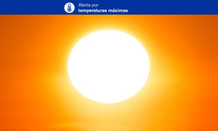
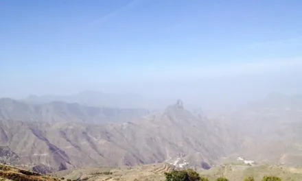
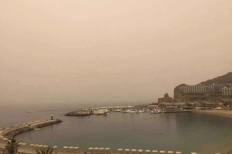
Temperatures on Gran Canaria, this Sunday, have risen suddenly as warm desert air has blown in a thick wash of Saharan dust from the African continent east of us, which has in turn met a storm front coming in off the north Atlantic covering the western canary islands archipelago and likely to bring thunder and lightening over the next couple of days, particularly to Tenerife. As the two fronts collide so we have dust warnings coming from the east and storm warnings to the west, with air humidity sitting at around 60% it’s likely to feel a little close and sticky over the next couple days and nights.
 To the north of Gran Canaria cloudy skies are expected throughout in the second half of Sunday, with intervals of cloud likely elsewhere. There is currently a low probability of isolated, occasional and scattered storm rains, with the heat expected to mainly affect medium and high altitude areas toward the centre of the island. Both minimum and maximum temperatures are seeing a moderate rise, more pronounced inland where it could reach 30-32ºC in the shade. With the warm winds however and high humidity interacting with Calima, you can expect it to feel more like 35º-36ºC even in the shade. North-northeast winds, with strong intervals on east and west slopes. Breezes are expected on the north and south coasts, however occasional strong gusts should not be discounted.

 The early hours of Monday morning are expected to begin the week with cloudy skies, intervals of low cloud, tending to increasing cloudiness as the day wears on. Probable storms have been predicted accompanied by showers, with a potential to be strong in some local areas, tending to die down in the afternoon. The Calima looks set to stay with us throughout the week with temperatures continuing to rise, especially in mid altitude and highland areas, remaining around 30-32ºC in the southeast and southern interior, though again the clash of dry Saharan air and a wet weather front could keep humidity up towards 60% with the potential for temperatures to feel a little warmer. Northeast winds are expected along the coasts, more intense to the southeast and northwest slopes. Breezes should persist along the south coast.

 As we head into Tuesday, a low probability of occasional showers persists on the western islands, calima likely to continue, especially in mid altitude and highland areas. In the eastern islands, the warm temperatures will continue without must change perhaps decreasing slightly as we head into mid week. Northeast winds turning northeast on Tuesday afternoon.
Things starting to clear up a little by Wednesday though some cloud still expected to the north of the islands with temperatures beginning to descend towards seasonal norms once more. Winds from the Northeast.

Some weak and scattered rain may return from the north on Thursday, tending toward cloudy intervals. Temperatures in the shade a little lower, stabilising around the upper 20s, with more blue skies and sunshine likely as we move towards Friday. Northeast winds with strong intervals on the southeast and northwest coasts.


Pre-alert declaration for potential storm weather.