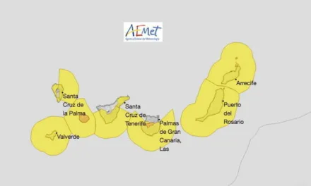
The head of the Spanish Meteorological Agency, AEMET, in the Canary Islands, Jesús Agüera, says that the storm “Theta” that passed north of the Canary Islands last weekend has produced easterly winds, bringing warm weather temperatures well above normal to the archipelago, “an anomalous meteorological phenomenon” expected to last until at least Thursday, when the warm weather will likely be replaced by the sudden arrival of cold air from the north.
Since the weekend many areas around the Canary Islands have reached maximum temperatures of more than 30ºC in the shade, such as the town of Tasarte, near the west coast of Gran Canaria, which this Monday topped 33ºC. By Thursday, “the arrival of the trade winds” will see daytime temperatures dropping back down to seasonal norms of between 20º & 23ºC in the shade. Of course it is always 5º – 10º or so warmer than that in direct sunlight.
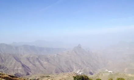
Tropical storm Theta passed north of us last weekend producing strong winds in some higher altitude areas of the western isles, and this has pulled much warmer air from the Sahara and the African continent. Agüera points out that “the passage of Theta disturbed the atmosphere, agitating air masses”, which has “induced African winds, which though very weak are quite warm”.
He predicts that temperatures will drop from Thursday when an “anticyclone sets in, which, conversely, will induce more humid weather and cooler northerly winds.” However, looking toward the end of the week, “it is still too early to confirm” he says.
Gran Canaria Outlook for the next few days:

Tuesday has seen some intervals of high cloud and light calima in the air. Temperatures remaining warm, many south and west facing zones likely to exceed 30ºC, in the shade . On the coasts, weak warm winds from the east, breezy on the north and west coasts. Inland and higher altitude areas will get the winds from the southeast, tending to decrease through the afternoon.


Clear skies on Wednesday with some intervals of high cloud. Warm temperatures continuing with few changes, though a slight decrease on the north facing slopes and inland areas. 30ºC likely to be exceeded inland on the south and west of the island. On the coasts, light winds from the east during the first half of the day, turning northerly from the afternoon. Inland and higher zones, light to moderate southeast winds, somewhat more intense in the peaks during the early hours. Breezy in the east and west.

On Thursday intervals of low cloud to the north, clearing after noon. Falling temperatures, especially inland at higher altitudes. Moderate north winds, more intense on the east-southeast and west coasts, turning to blow from the northeast from the afternoon. Breezes on the south and southwest coasts. Inland variable winds in the east and southeast summits.

By Friday more cloud is likely to the north of the island, with a tendency toward clear intervals in the afternoon. Elsewhere slight cloud or clear skies. Some weak calima possible. Temperatures changing little. Moderate northeast winds becoming less intense from noon. Easterly winds inland and at the summits.