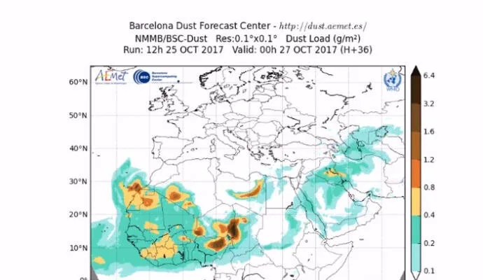
 This has been the warmest October on record for 30 years, and it looks like the end of October heat wave is not yet ready to leave the Canaries, with the next few days expected to remain hot and dusty. The prediction from the Spanish State Meteorological Agency (AEMET) indicates that the Saharan dust suspended in the air over the last few days will continue through to at least Friday, October 27, with the afternoon expected to be particularly intense.
The general forecast for the last Friday of October indicates that the skies will be cloudy and the heat will predominate on the southern and eastern slopes of the islands with winds on the east coasts and from the southeast inland.

Out at sea southeast or southerly force 3 to 5 winds, temporarily variable to between 2 or 3 mainly at night. There will be choppy seas or swell, with 2 meter waves to the northwest. Temperatures will remain high throughout the weekend, as winds continue to blow in off the desert, but expected to decrease a little as we head into next week
Slightly cloudy with some intervals of high clouds. Calima affecting mainly the south of the island and mainly in the afternoon. Temperatures high with few changes. Inland at at the summits, strong southeast winds decreasing in the afternoon, with gusts that could reach 60 km/h on western slopes.