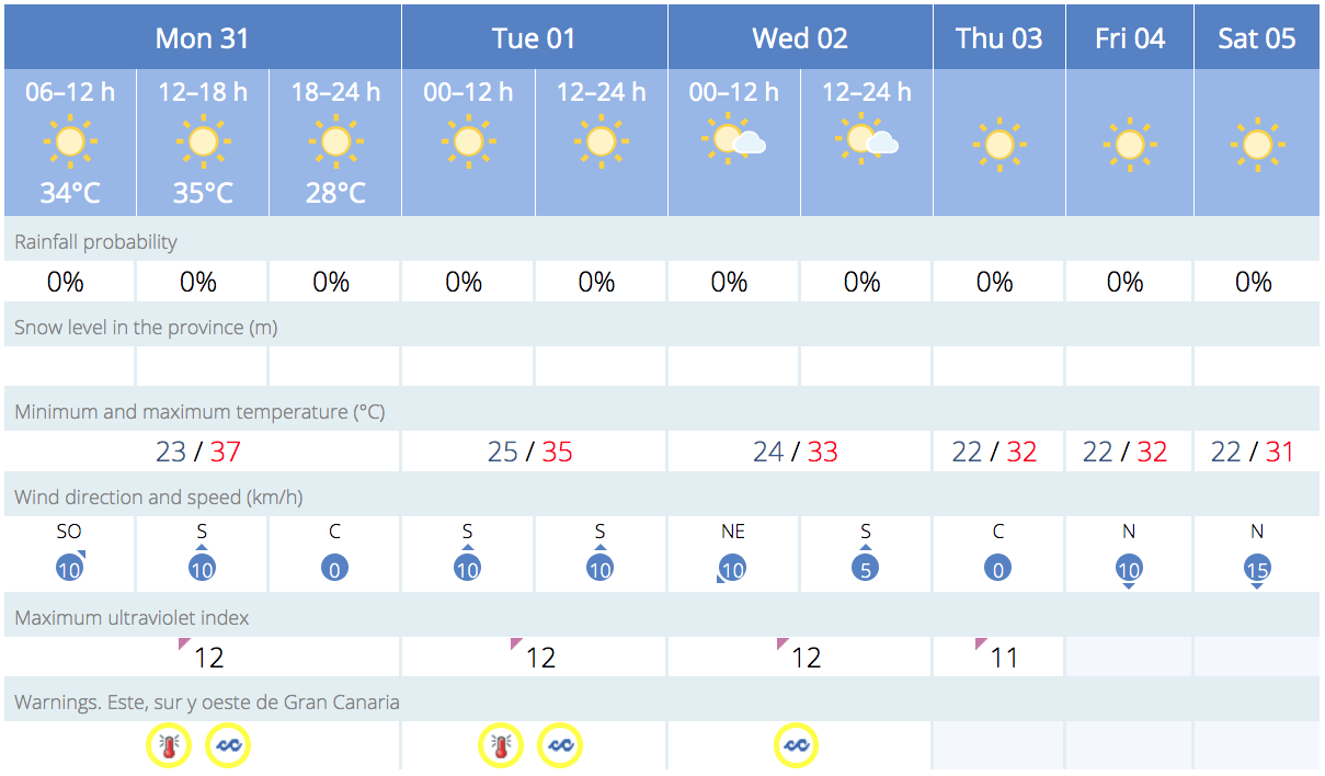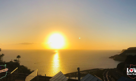
Good Morning Gran Canaria! This Monday, Calima is expected to bring some high altitude dust from the Sahara, and maximum daytime temperatures are expected reach 37ºC in the shade across the south of Gran Canaria and at the summits, according to Spanish State Meteorological Agency (AEMET).
|
----- Google provide a way for you to
|


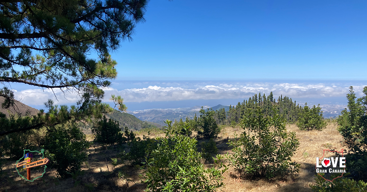
Generally clear, except for some intervals of low cloud along the northern coast during the early morning and some mid to high-level cloud during the middle of the day. Calima will be most noticeable at higher altitudes. Temperatures will rise on the southern slopes and higher areas, with nighttime minimums also expected to rise, and daytime maximum temperatures are likely to exceed 34º to 36 ºC on the south and at the summits and, occasionally, may reach or exceed 37 ºC in the shade. Northeasterly winds will bring intervals of strong gusts in lower altitude areas, intensifying at night with very strong gusts probable on the southeast and northwest slopes. On the summits, moderate northeast winds.

Expected minimum and maximum temperatures
Las Palmas de Gran Canaria: 22-27ºC
Puerto Rico de Gran Canaria 23-37ºC
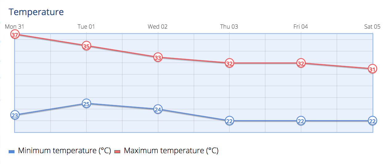
Tuesday should be generally clear, with some tendency for cloudy intervals in lower altitude areas of the north from midday onwards. Calima will continue at higher altitudes. Minimum nighttime temperatures will see little change, perhaps a slight increase, and maximum daytime temperatures will continue, dropping slightly, likely to exceed 34 to 36 ºC on the southern slopes of the island, and occasionally, could reach or exceed 37 ºC. Expect some warm nights inland at altitude away from the coasts. Northeast winds may be occasionally strong in lower areas, generally strong on northwest and southeast slopes, where there will probably be some very strong gusts, especially during the first half of the day. On the summits, moderate northeast winds.
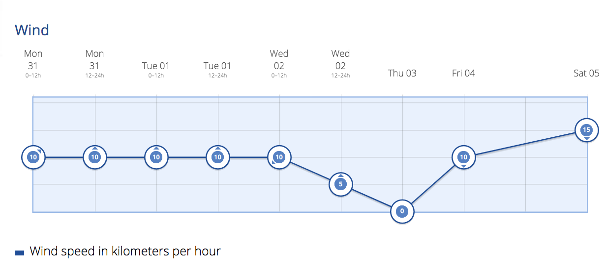
Wednesday, midweek, and there may still be intervals of cloud to the north, generally clear elsewhere, with some intervals of low cloud during the early morning and night. Calima will continue at higher altitudes, and temperatures will see little change, perhaps a slight decrease along the coasts; and more moderate inland and at height, with temperatures still possibly exceeding 32 to 34 ºC in inland areas on the south of Gran Canaria. During the first half of the day, moderate northeast winds with intervals of strong wind, more intense on northwest and southeast slopes, where there may be very strong gusts. By the afternoon, the winds will ease.
Heading in to Thursday there will be some cloudy skies to the north, clearing in the afternoon, and some weak and occasional rain during the early morning is possible. Elsewhere mostly clear skies. Light Calima may continue at high altitudes, tending to decrease. Temperatures with few changes, perhaps a slight decrease on the coasts; and in inland and higher areas. Moderate northeast winds, more intense on northwest and southeast slopes.
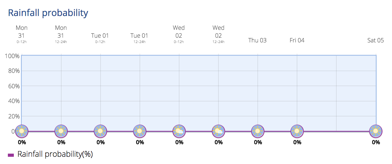
By next Weekend on the Canary Islands, the trade winds are expected to bring intervals of low cloud to the north with light rain probable. Temperatures, in the shade, will remain mostly unchanged, and the trade winds with intervals of low cloud will persist from the north, with occasional weak rain or drizzle. Mostly clear elsewhere. Temperatures tending to decrease a touch on Saturday and increase again for Sunday.