Tag: Rain
 |
Latest Gran Canaria News, Views & Sunshine
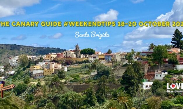
The Canary Guide #WeekendTips 18-20 October 2024
A wonderful October weekend ahead on Gran Canaria. Lovely warm autumn weather is predicted and there are some awesome public events, activities and festivities on offer.

The Canary Guide #WeekendTips October 4-6 2024
Hello October! A tremendous start to the last quarter of the year with a packed weekend ahead. There are Patron saints’ fiestas with pilgrimage offerings, religious processions and fireworks, an apple festival, a dance festival, multiple fairs and monthly markets, music festivals and much more to enjoy and explore on Gran Canaria.
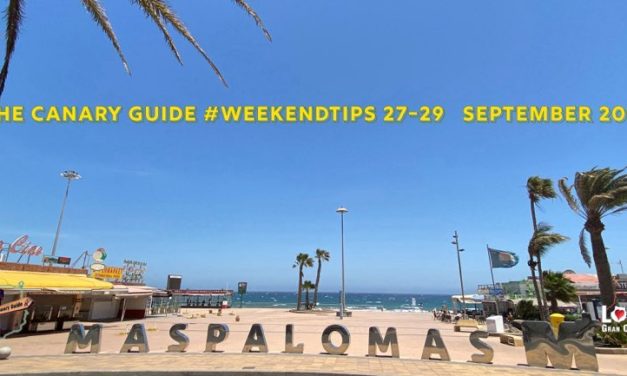
The Canary Guide #WeekendTips 27-29 September 2024
Welcome to The Canary Guide #WeekendTips 27-29 September – It is going to be a busy last weekend of September on Gran Canaria, with many different kinds of festivities and celebrations to choose from. There are patron saints’ festivities, a Pet Fair, markets, rally racing and of course, the last of the “End of Summer” festivities just to name a few worth highlighting.
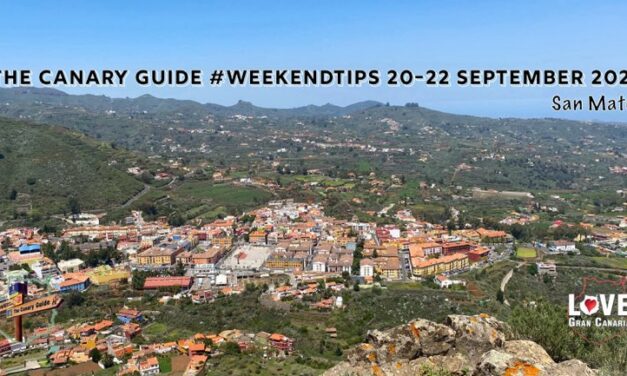
The Canary Guide #WeekendTips 20-22 September 2024
A full swing of traditional patron saints’ fiestas is on offer this weekend around Gran Canaria with pilgrimage offerings and popular events galore. It is such a special time to visit towns and villages whilst they are celebrating their festivities and are all decked out and decorated.
The Growing Importance of British Post-Brexit Tourism
British tourism has long been a vital part of the Canary Islands’ economy, but in the years following the UK’s exit from the European Union, the significance of British visitors has reached new heights.

- 1
- ...
- 2
- 3
- 4
- 5
- 6
- 7
- 8
- 9
- 10
- 11
- 12
- 13
- 14
- 15
- 16
- 17
- 18
- 19
- 20
- 21
- 22
- 23
- 24
- 25
- 26
- 27
- 28
- 29
- 30
- 31
- 32
- 33
- 34
- 35
- 36
- 37
- 38
- 39
- 40
- 41
- 42
- 43
- 44
- 45
- 46
- 47
- 48
- 49
- 50
- 51
- 52
- 53
- 54
- 55
- 56
- 57
- 58
- 59
- 60
- 61
- 62
- 63
- 64
- 65
- 66
- 67
- 68
- 69
- 70
- 71
- 72
- 73
- 74
- 75
- 76
- 77
- 78
- 79
- 80
- 81
- 82
- 83
- 84
- 85
- 86
- 87
- 88
- 89
- 90
- 91
- 92
- 93
- 94
- 95
- 96
- 97
- 98
- 99
- 100
- 101
- 102
- 103
- 104
- 105
- 106
- 107
- 108
- 109
- 110
- 111
- 112
- 113
- 114
- 115
- 116
- 117
- 118
- 119
- 120
- 121
- 122
- 123
- 124
- 125
- 126
- 127
- 128
- 129
- 130
- 131
- 132
- 133
- 134
- 135
- 136
- 137
- 138
- 139
- 140
- 141
- 142
- 143
- 144
- 145
- 146
- 147
- 148
- 149
- 150
- 151
- 152
- 153
- 154
- 155
- 156
- 157
- 158
- 159
- 160
- 161
- 162
- 163
- 164
- 165
- ...
- 166
|

German Tourist Dies Following Shark Attack More Than 500 km South Of Canary Islands
A tragic shark attack has claimed the life of a 30-year-old German woman, who was swimming off a catamaran more than 500 kilometers from the Canary Islands. The incident occurred on Monday, September 16, 2024, in the Atlantic Ocean, approximately 180 kilometers east of Dakhla, Western Sahara. Despite efforts to rescue her, the woman died before reaching a hospital in Las Palmas, Gran Canaria.
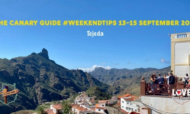
The Canary Guide #WeekendTips 13-15 September 2024
A busy September weekend ahead! Some traditional patron saints’ fiestas are just getting started while others are finishing up. Guía are celebrating their very traditional Las Marías festivities, there is a religious procession in the mountain town of Tejeda, a Wine and Tapas Night to enjoy in Playa de Mogán.
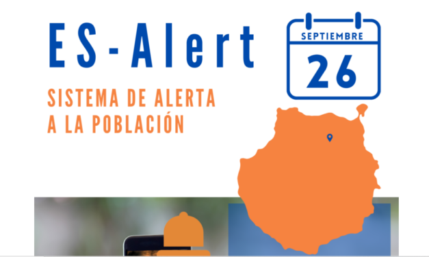
Gran Canaria Mass Emergency Warning Test: ES-Alert on September 26
The Canary Islands Government will conduct a test of the ES-Alert emergency warning system across Gran Canaria on Thursday, September 26. This system is part of Spain’s National Alert Network and is designed to send immediate SMS alerts to mobile phones in areas affected by imminent or ongoing emergencies. These alerts will provide crucial information on the safety measures that people should follow, allowing for accurate information and a quicker response to serious situations.
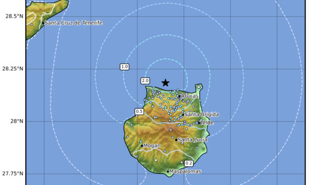
Gran Canaria Hit by A 3.8-Magnitude Tremor, One of The Largest in 60 Years
On Tuesday, September 10, 2024, a 3.8-magnitude earthquake shook Gran Canaria, marking one the strongest seismic events felt on the island in six decades. The quake, with its epicentre off the northern coastal municipality of Santa María de Guía, was felt across 14 of Gran Canaria’s 21 municipalities, according to the National Geographic Institute (IGN).
#GranCanariaWeather: Warm Temperatures, Strong Winds, and Cloudy Skies from the North This Week
Gran Canaria is set for a week of mixed weather, as ever with noticeable differences between the north and south of the island. The northern areas will see cloudy skies, particularly in the mornings and evenings, with a chance of light rain midweek. In contrast, the southern and inland regions will enjoy clearer, sunnier skies with rising temperatures.

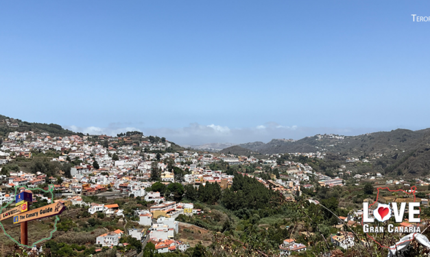
The Canary Guide #WeekendTips 6-9 September 2024 & El Charco
It’s that time of the year again, when the two most popular traditional annual celebrations on Gran Canaria take place back to back. Teror, the pretty little merchant town is celebrating the main harvest Romería pilgrimage for the island, an offering in honour of the patron saint of Gran Canaria, Our Lady of the Pine with carts carrying summer produce, representing all the municipalities on the island and the main Cabildo de Gran Canaria.
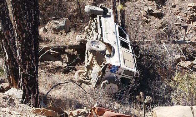
Tourist Safari Excursion Rolls Into Ravine Injuring Two
A tourist safari excursion vehicle, containing five occupants, overturned falling down a fifteen-metre slope, on the road between Pinar de Pilancones and the Chira dam.
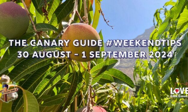
The Canary Guide #WeekendTips 30 August – 1 September 2024
Oh Hello! September is here and what a crazy weekend it will be. There are “End of Summer” festivals galore, concerts, spectacles on the streets, patron saint festivities, romería-pilgrimages, fireworks and even a mango and summer avocado fair. So many things to choose from but definitely, there is something for everyone.
- 1
- ...
- 2
- 3
- 4
- 5
- 6
- 7
- 8
- 9
- 10
- 11
- 12
- 13
- 14
- 15
- 16
- 17
- 18
- 19
- 20
- 21
- 22
- 23
- 24
- 25
- 26
- 27
- 28
- 29
- 30
- 31
- 32
- 33
- 34
- 35
- 36
- 37
- 38
- 39
- 40
- 41
- 42
- 43
- 44
- 45
- 46
- 47
- 48
- 49
- 50
- 51
- 52
- 53
- 54
- 55
- 56
- 57
- 58
- 59
- 60
- 61
- 62
- 63
- 64
- 65
- 66
- 67
- 68
- 69
- 70
- 71
- 72
- 73
- 74
- 75
- 76
- 77
- 78
- 79
- 80
- 81
- 82
- 83
- 84
- 85
- 86
- 87
- 88
- 89
- 90
- 91
- 92
- 93
- 94
- 95
- 96
- 97
- 98
- 99
- 100
- 101
- 102
- 103
- 104
- 105
- 106
- 107
- 108
- 109
- 110
- 111
- 112
- 113
- 114
- 115
- 116
- 117
- 118
- 119
- 120
- 121
- 122
- 123
- 124
- 125
- 126
- 127
- 128
- 129
- 130
- 131
- 132
- 133
- 134
- 135
- 136
- 137
- 138
- 139
- 140
- 141
- 142
- 143
- 144
- 145
- 146
- 147
- 148
- 149
- 150
- 151
- 152
- 153
- 154
- 155
- 156
- 157
- 158
- 159
- 160
- 161
- 162
- 163
- 164
- 165
- 166
- 167
- 168
- 169
- 170
- 171
- 172
- 173
- 174
- 175
- 176
- 177
- 178
- 179
- 180
- 181
- 182
- 183
- 184
- 185
- 186
- 187
- 188
- 189
- 190
- 191
- 192
- 193
- 194
- 195
- 196
- 197
- 198
- 199
- 200
- 201
- 202
- 203
- 204
- 205
- 206
- 207
- 208
- 209
- 210
- 211
- 212
- 213
- 214
- 215
- 216
- 217
- 218
- 219
- ...
- 220