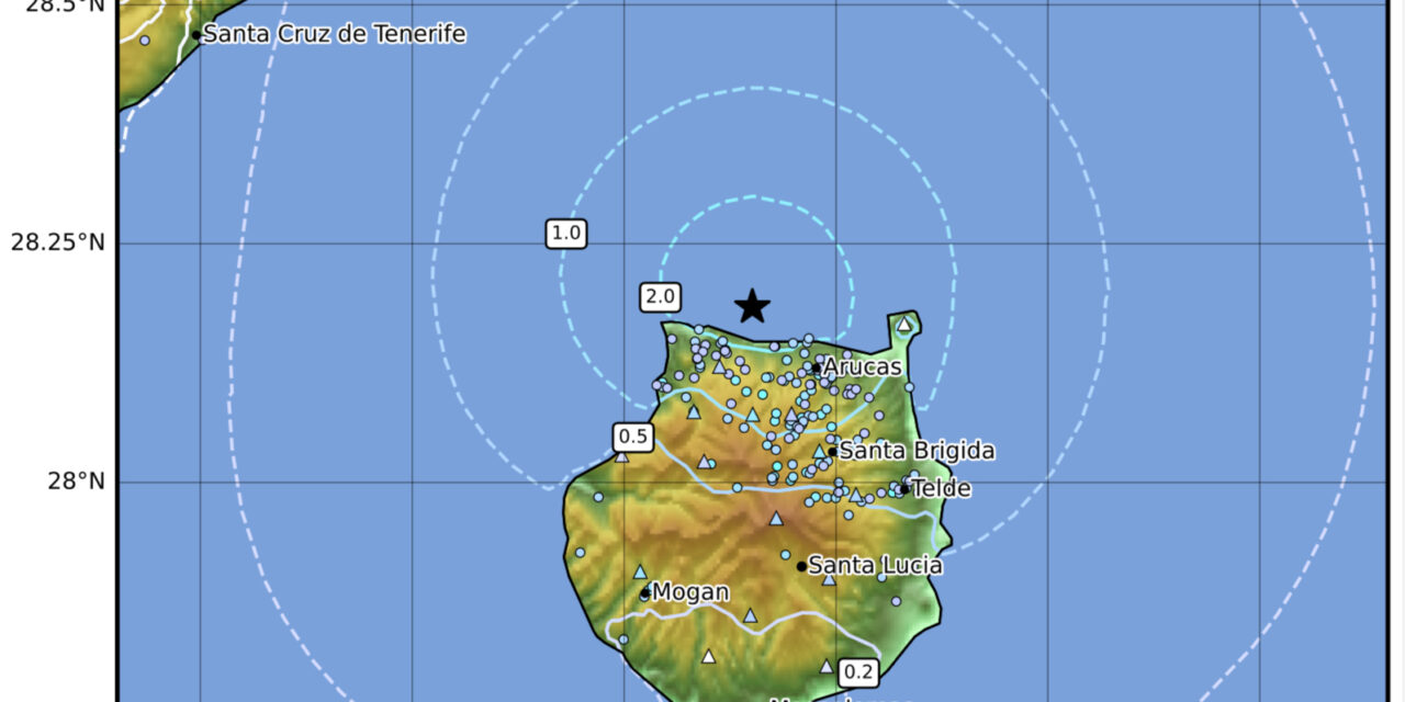
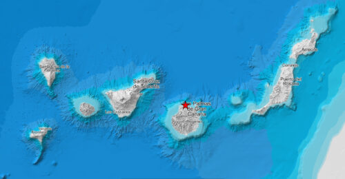
On Tuesday, September 10, 2024, a 3.8-magnitude earthquake shook Gran Canaria, marking one the strongest seismic events felt on the island in six decades. The quake, with its epicentre off the northern coastal municipality of Santa María de Guía, was felt across 14 of Gran Canaria’s 21 municipalities, according to the National Geographic Institute (IGN).
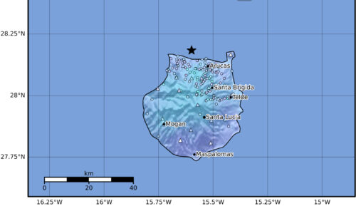
The earthquake struck at 19:20, with the epicenter located at 28.18°N latitude and 15.6°W longitude, roughly 20 kilometers beneath the surface of the ocean. Initially reported as a 4.1-magnitude tremor near Gáldar, it was later downgraded to 3.8, with its epicenter confirmed near Santa María de Guía. The shaking lasted no more than two seconds but was enough to cause a wave of concern across the northern and central parts of the island.
The IGN clarified that the tremor was typical for an event of this intensity, with residents in several municipalities feeling the shaking both indoors and outdoors. One local from Santa Cristina reported, “The bed shook, and the wardrobe creaked. It was quite a shock.” Moya, located near the epicenter, recorded a level IV event on the European Macroseismic Scale, the highest intensity tremor of the day, with some residents hearing a rumbling noise similar to thunder.
 Areas Affected On Gran Canaria
The quake was felt most intensely in northern towns like Agaete, Firgas, Arucas, Teror, and Moya, as well as central areas such as Vega de San Mateo, Valleseco, and Valsequillo. Residents of these towns reported feeling a noticeable tremor, categorized at intensity levels III-IV, characterized by rattling dishes, creaking windows, and swaying light fixtures.
In other regions, including Gáldar, Ingenio, Telde, and Mogán, the quake was felt more faintly, with some residents not noticing it at all. One woman from Guía said, “I didn’t feel a thing, and when I heard the news, I thought it was a joke.” The earthquake’s impact was also less pronounced in parts of Las Palmas de Gran Canaria, such as Los Giles and Los Hoyos.
Emergency Response and Public Reaction
Shortly after the earthquake, the Canary Islands Emergency and Security Coordination Center (Cecoes 112) received a flurry of calls from concerned citizens, particularly from those living in the northern municipalities of Moya, Guía, Arucas, Teror, and Valsequillo. Despite the panic, no incidents or damage were reported.
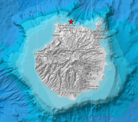 According to the IGN, the intensity IV rating indicates a moderate earthquake, typically felt more indoors than outdoors. The level of shaking is described as mild, causing objects like dishes and windows to rattle, but posing no structural threat. The IGN reassured the public that the quake’s effects were consistent with previous moderate seismic activity on the island.
Historical Context
While earthquakes are not common on Gran Canaria, this tremor was the strongest since eight years ago when another 3.8-magnitude earthquake struck the island, with an epicentre then in Vega de San Mateo. That event was also felt strongly in the northern town of Agaete. The island, though not as seismically active as other parts of the Canary archipelago, does occasionally experience tremors due to its location near several fault lines.
As of now, no significant aftershocks have been recorded, but the IGN has not ruled out the possibility of further seismic activity. Residents are advised to remain aware of their surroundings and follow guidance from local authorities.
In the meantime, life on the island continues as usual, with the memory of this brief but powerful quake likely to linger among those who felt it firsthand. Gran Canaria’s geological dynamics, will likely result in other noticeable seismic events in the future, though they are unlikely to ever cause any significant damage and will remain rare and unusual enough to excite conversation and occasional headlines

