Parts of Gran Canaria experienced significant rainfall this weekend due to the passing of Storm Bernard, leading to disruptions primarily on the island’s roadways. The mountain town of Teror received the highest rainfall, accumulating 41 litres per square meter, followed by Valleseco and the capital Las Palmas de Gran Canaria, all on the north of the island.
|
----- Google provide a way for you to
|


Traffic Disruptions
Heavy rain in Las Palmas led to multiple road incidents and traffic delays. Authorities alerted motorists to drive cautiously due to rocks washed onto some roads, such as GC-300 Hoya Andrea – Tamaraceite. A section of the Maritime Highway was also closed for traffic due to a sinkhole, requiring immediate intervention from the traffic and mobility unit agents.
Rainfall Levels and Incidents
Teror topped the list of areas with heavy rainfall, recording over 41 liters per square meter, marking it the rainiest day so far for this autumn in the northern midlands. Valleseco also had significant rainfall, with more than 36 litres per square meter. The Las Palmas City Council reported 51 minor incidents due to the rain, mainly related to drainage and street lighting issues, although none were of major concern.
Forecast
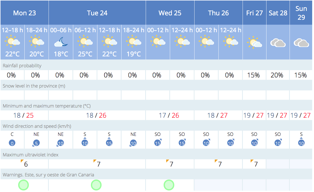
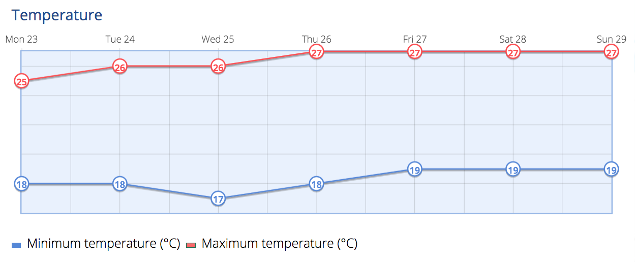
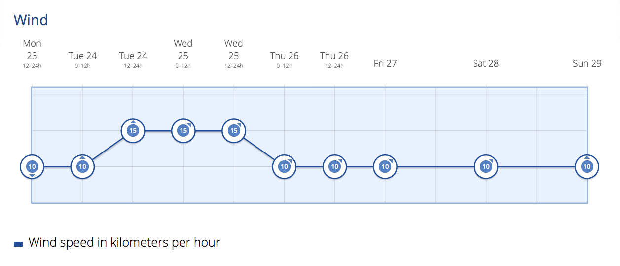
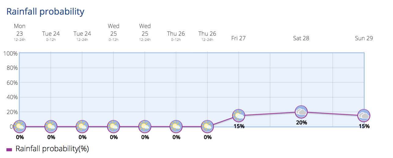
The Spanish State Meteorological Agency (Aemet) predicts cloudy skies with light to moderate rain for Monday mainly to the north of the island. Isolated thunderstorms expected around Lanzarote. Winds will shift from northwest to northeast throughout the day. The temperatures are forecast to remain steady or slightly decrease. We are looking at night time lows of around 18ºC and during the day time 25º-27ºC in the shade is expected across the south of the island, a few degrees lower to the north or at higher altitudes.

Tiempo previsto en Canarias desde 23-10-2023 hasta 29-10-2023. Info siempre actualizada en https://t.co/pAtP17oqOG pic.twitter.com/n9ooU8NxQT
— AEMET_Canarias (@AEMET_Canarias) October 23, 2023
For Tuesday, rains are expected to subside. Light, occasional rain may occur in the morning in the north, and in the afternoon in the southern interior areas, though the south coast should stay dry. The weather for Wednesday and Thursday will be mostly cloudy, with some light rain in the northern mountainous regions, again drier and warmer across the southern resorts.
Extended Outlook
The instability is expected to continue from Thursday onwards, with a new episode of rainfall forecast, affecting mainly Tenerife, La Gomera, La Palma, and El Hierro, but Gran Canaria will also experience some significant wet weather, mainly to the north of the island. The rainy pattern is set to last at least until Saturday, marking an autumnal end to the clear skies and high temperatures the archipelago has been experiencing since early October.
Residents and travellers on Gran Canaria are advised to exercise caution while driving and be prepared for unsettled weather conditions throughout the week, including rain and moderate winds. Keep an eye out for updates as another bout of rain is predicted to start this Thursday.