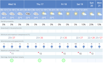
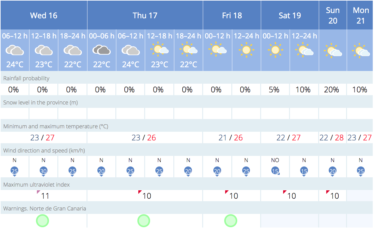
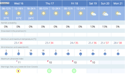
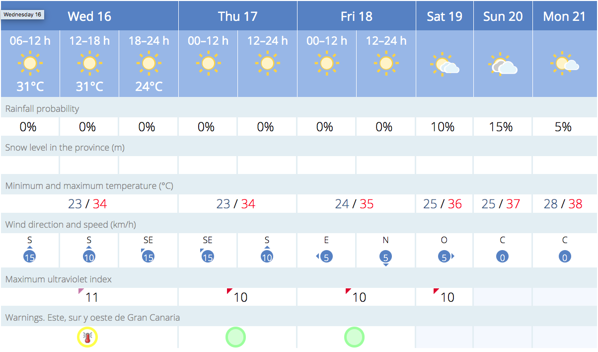
Cloudy intervals in low lying areas to the north, this Wednesday, mainly during the first half of the day and again as evening approaches.
High altitude Calima haze, generally light, according to Spanish state meteorological agency, AEMET.
|
----- Google provide a way for you to
|

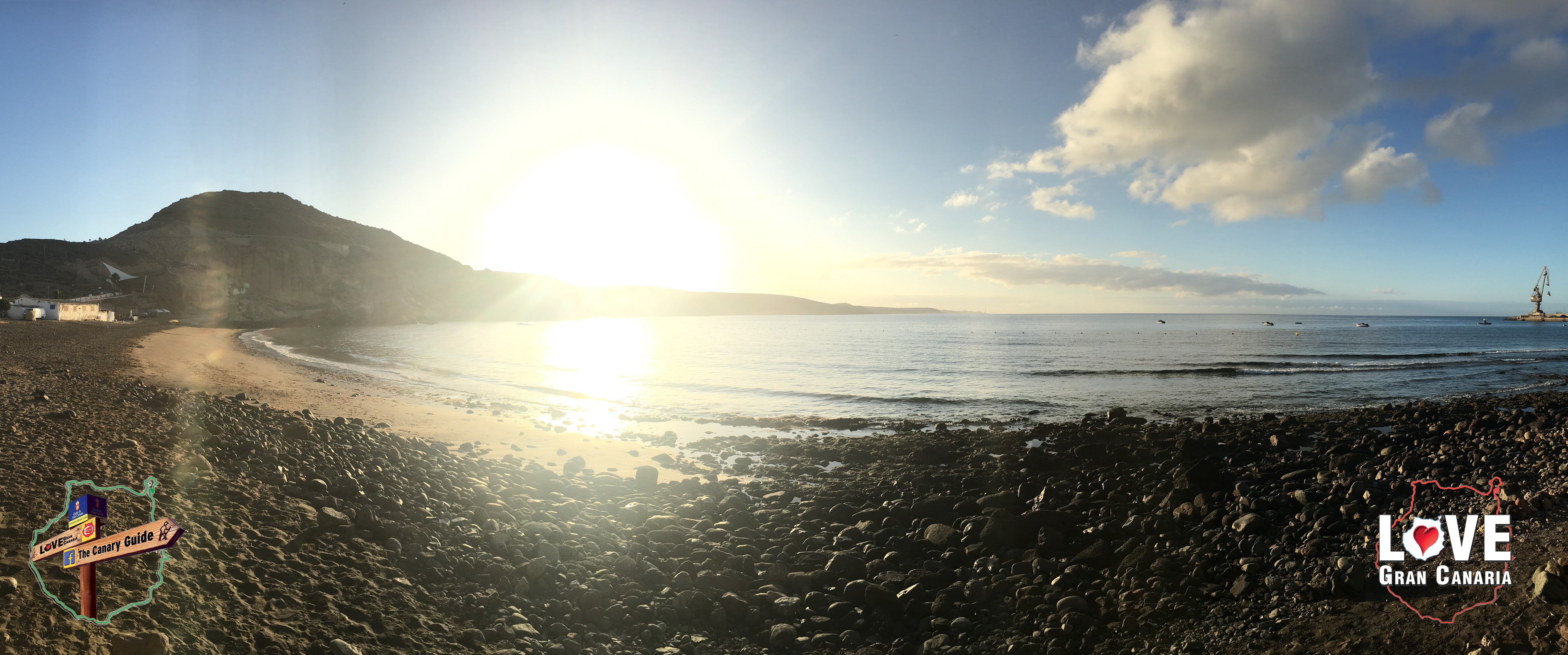
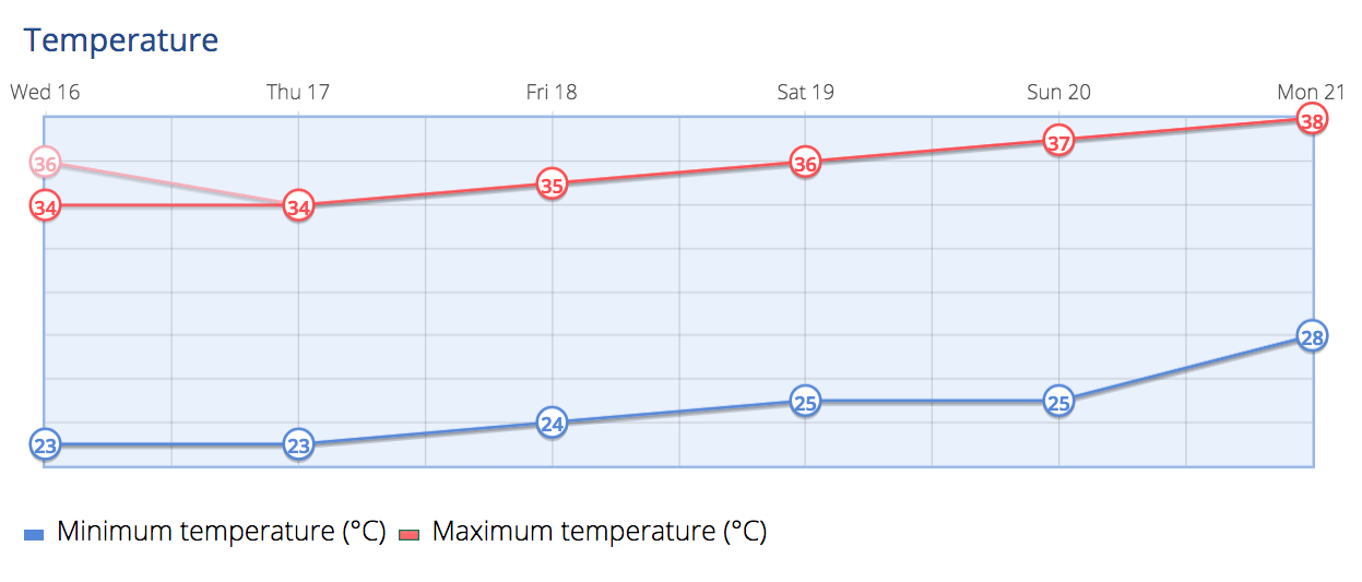
Some relief from a week of heatwave. Temperatures decreasing slightly, more pronounced on the southern coast. It may exceed 34 ºC in the shade, inland, on the south and west and so there is a yellow advisory warning from the State Meteorological Agency on the southern half of Gran Canaria
Northeast winds, with strong intervals on the southeast and northwest slopes, as well as on the western tip, where there is a low probability of some occasional very strong gusts, mainly at dawn. At the summits, light winds with a westerly component. Breezes all across the southwest coasts.
The AEMET forecast consolidates the drop in maximum temperatures for Thursday which, in principle, if there are no last-minute changes, will be the first day after eight consecutive days, without warnings for significant weather phenomena.

Thursday will be slightly cloudy to the north or clear skies elsewhere. The presence of a slight Calima haze at height will continue, especially affecting the easternmost islands. The temperatures will continue with few changes or a slight decrease, maxing out at around 32º to 34º C, in the shade, at some inland points on the south and west of Gran Canaria.
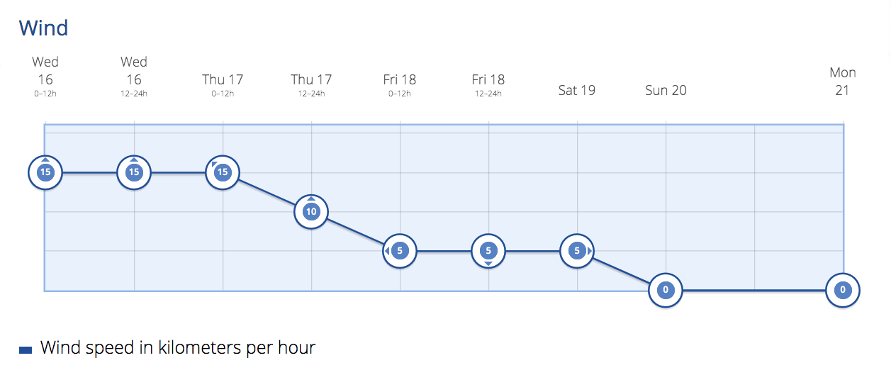
As for the wind, it is expected to blow moderately from the northeast, with strong intervals on the southeast and northwest slopes, while at the summits, it will be a variable light wind.
Thursday may just be a small interruption to the summer swelter, according to some predictions a slight increase in temperatures is again expected for Friday, which will become more pronounced on the easternmost islands, which could exceed 32º to 34ºC, in the shade, along with the southern and west inland areas of Gran Canaria
Some cloudy intervals are expected on Friday, in lower areas of the western isles at dawn, and with Calima at height, carried by a moderate wind from the northeast, with higher speeds in the areas most exposed to the trade winds, where there is a low probability of an occasional very strong gust in the later hours of the day, while at the summits, variable light winds will blow, with an easterly component predominating in the afternoon.
As we head into the weekend rising temperatures are expected to return, heading upwards from around 34ºC on the south and west oriented inland areas at mid-altitude, where it could easily exceed those values. By the start of next week we are expecting temperatures in the shade upwards of 36ºC, as ever much hotter in direct sunlight.
-
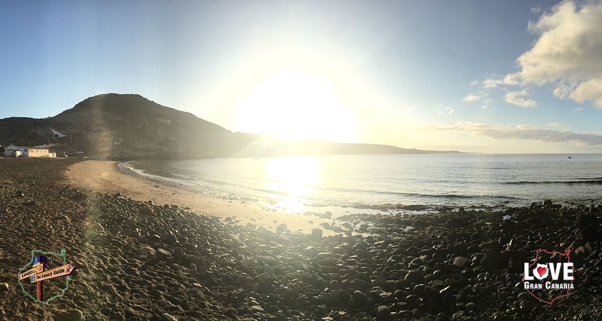
- #GranCanariaWeather Las Palmas de Gran Canaria
-
- #GranCanariaWeather Puerto Rico de Gran Canaria
Seven days of heat wave across the Canary Islands has resulted in the same number of deaths: three due to heat stroke and four drowned, the last two during the day on Tuesday, one on the coast of Los Gigantes and one at Adeje, on Tenerife. Some of the deaths occurred while continuing with outdoor activities during the hottest hours of the day, as well as on a coast also under warnings from the State Meteorological Agency due to coastal phenomena, with waves of up to two meters high, and there have been several bathers seen trying to escape the drag of the waves, both on the island of Gran Canaria, and on Tenerife, ignoring warnings about the situation as they sought relief in the waters. There have also been several reports of micro-algae blooms along some of the coasts, with water temperatures unusually sustained at around 25ºC