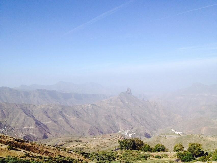
The Canary Islands have had a yellow advisory for Calima declared until midnight on Wednesday. The Spanish State Meteorological Agency (AEMET) forecast dust suspended in the air would affect visibility, and sure enough by Tuesday afternoon visibility had been reduced to around 3 kilometers. The mass of Saharan sand is gradually moving from east to west, and had blanketed the entire archipelago by the end of the day.
It doesn’t end there. What is being termed as a “weather stew” is now expected after humidity looks likely to bring rain to the north of the islands and by the weekend we can expect a strange mixture of sun, rain, and in places even hail, along with the arrival of a new storm front predicted by AEMET.
A further yellow advisory (denoting risk) due to dust in the air causing haze is expected to mainly affect the islands of the eastern province, Gran Canaria, Lanzarote and Fuerteventura , as well as Tenerife.
The prevailing trade winds, from the north east, had subsided by Tuesday afternoon, ushering in the calima haze with maximum temperatures expected to rise this Wednesday throughout the Archipelago, particularly in inland areas and in the south where thermometers could easily top 30ºC.
On the coasts the temperatures are expected to be more moderate and by Good Friday we will be in for a transition to the possibility a storm arriving that is expected bring a new cold front to the islands during the Easter Weekend, say AEMET.
Yellow advisories are expected due to coastal phenomena on the east and west coasts of Gran Canaria with northeasterly winds as strong as force 7 with strong gusts at intervals that are expected to cause rough seas along the island’s coast.