 The forecasters at the Miami-based US National Weather Service had anticipated that Hermine would be down graded, having only ever modeled a less than 5% chance of strong winds reaching The Canary Islands. However, although the winds were not as strong as some local commentators had suggested in their reports, the rains look set to continue with real intensity across the Archipelago for at least the next 12 to 24 hours. On Saturday night the president of the Canary Islands, Ángel Víctor Torres, also referred to the liklihood that Hermine would be downgraded during a press conference following the emergency coordination meeting for adverse atmospheric phenomenon together with the deputy director of the General Directorate of Security and Emergencies, Marta Moreno, and the delegate in the Canary Islands of the AEMET, David Suárez.
The stormy weather is behaving as had been predicted by AEMET and the authorities, which is “good news”, since the weather system’s nucleus begins to move west towards the ocean and not towards the archipelago, it is estimated that by Monday afternoon the islands will no longer be affected by what is now being termed as a “remnant low”.
 However, Torres stressed that the cyclonic wet weather system will pass at its closest to the Canary Islands between 11:00 p.m. this Sunday and 11:00 a.m. on Monday morning.
“These are the hours in which the most rain will predictably fall,” he pointed out, adding that on Saturday it rained more in the upper parts of the islands.
The president has also pointed out the forecast from this Sunday is that the rains will intensify and be more powerful on all the islands.
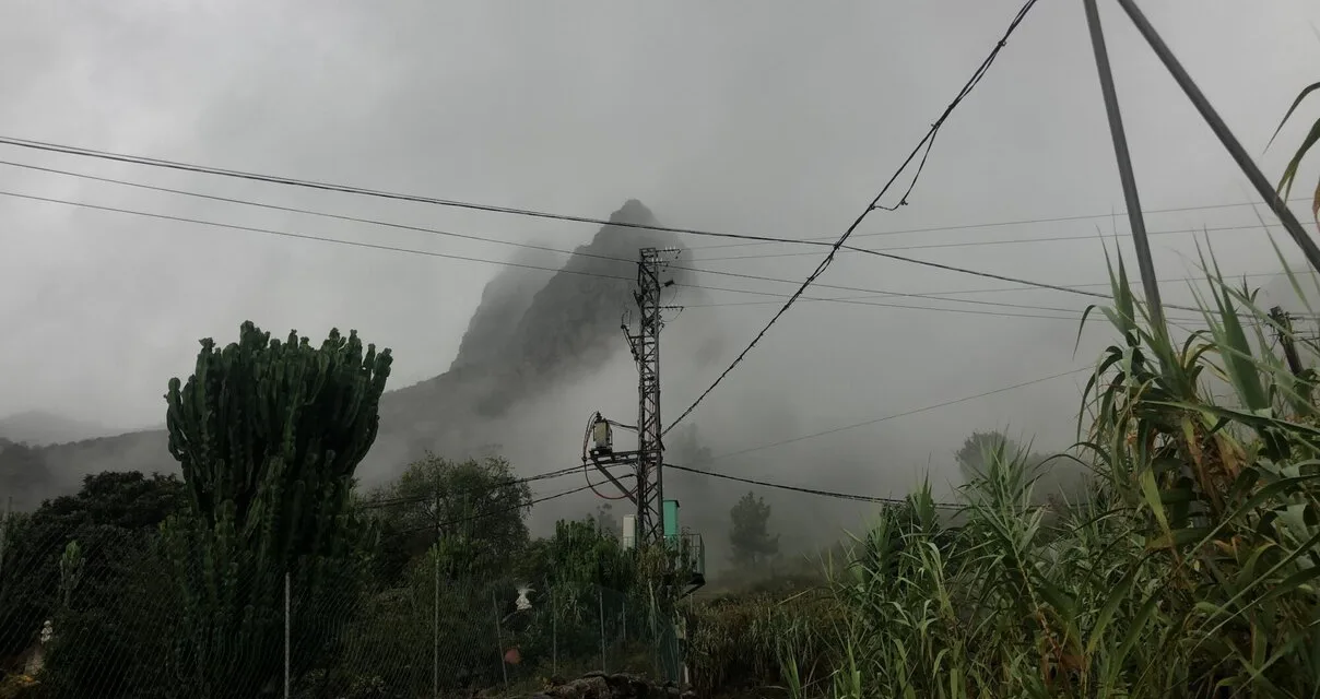
The Cabildos across the islands are warning of rockfalls and other obstacles caused by the rain blocking roads and presenting unusual hazards, and on the westernmost island of La Palma residents have been warned that heavy rainfall could cause ash and lava flows from last year’s volcanic eruption to shift, or even cause massive landslides.
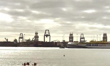
 As for the airports, throughout the day on Saturday there have been a dozen or so flight cancellations and diversions, although all airport facilities continue to operate and the initial estimate is that they will continue to do so this Sunday. The inter-island regional airline Binter has announced this Sunday morning that several Binter flights to/from the airports of Tenerife North, La Palma, El Hierro and La Gomera have been cancelled until at least 13:00. Binter recommend that you check the status of your flight before heading to the airport.
Alerts are still in place, and unnecessary road journeys are being actively discouraged.
Mapa de lluvias registradas hoy domingo hasta el momento: pic.twitter.com/HAenksRsEM
— AEMET_Canarias (@AEMET_Canarias) September 25, 2022

 Hermine’s structure overnight has deteriorated further. While
occasional intermittent bursts of deep convection are still
occurring to the north of the elongated surface circulation, this
convection lacks organization. The system no longer meets the
definition of a tropical cyclone and, therefore, is being declared
a remnant low and this will be the last NHC advisory on Hermine.
Strong southwesterly shear greater than 40 kt and a high
statically stable surrounding Saharan air mass should prevent the
regeneration of organized convection during the next several days.
The global models and the statistical SHIPS intensity guidance
agree that the remnant low will open up into a trough of low
pressure Tuesday, and the official forecast follows suit.
 …HERMINE BECOMES A POST-TROPICAL REMNANT LOW…
…HEAVY RAINS EXPECTED TO CONTINUE ACROSS THE CANARY ISLANDS
THROUGH MONDAY…
SUMMARY OF 800 AM CVT…0900 UTC…INFORMATION
———————————————-
LOCATION…23.6N 20.2W
ABOUT 580 MI…935 KM NNE OF THE CABO VERDE ISLANDS
MAXIMUM SUSTAINED WINDS…30 MPH…45 KM/H
PRESENT MOVEMENT…N OR 10 DEGREES AT 7 MPH…11 KM/H
MINIMUM CENTRAL PRESSURE…1008 MB…29.77 INCHES
WATCHES AND WARNINGS
——————–
There are no coastal watches or warnings in effect.
DISCUSSION AND OUTLOOK
———————-
At 800 AM CVT (0900 UTC), the center of Post-Tropical Cyclone
Hermine was located near latitude 23.6 North, longitude 20.2 West.
The post-tropical cyclone is moving toward the north near 7 mph (11
km/h) and this motion is expected to continue through Sunday
followed by a slow turn toward the northwest early Monday and a
turn to the west-northwest Monday evening.
Maximum sustained winds have decreased to near 30 mph (45 km/h)
with higher gusts. Hermine is expected to dissipate in a couple of
days.
The estimated minimum central pressure is 1008 mb (29.77 inches).
HAZARDS AFFECTING LAND
———————-
RAINFALL: Hermine is expected to produce 3 to 6 (75 to 150 mm)
inches of rainfall with localized higher amounts up to 10 inches
(250 mm) across the Canary Islands through Monday. This rainfall may
cause some flash flooding in areas of higher terrain.