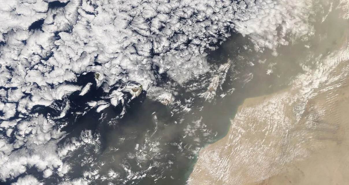
Calima has returned to the Canary Islands this Thursday and looks set to continue until at least Saturday, affecting all the islands, particularly in the easternmost province, the mass of Saharan dust clearly visible on the latest NASA satellite imagery.
|
----- Google provide a way for you to
|


Strong winds from the north from storm Celia left rain and snow, strong waves and a cold snap that closed roads and left snowfalls at the summits of Gran Canaria and on Mount Teide. The powerful weather system led some modellers to predict Saharan dust being sucked out over the Atlantic, from the North African desert, with the first episodes being reported from the morning hours on the easternmost islands.
 The dense Calima is expected to dissipate over the western islands and Gran Canaria, but but is expected to return with similar intensity from noon on Friday, and likely to be with us until Saturday.
In mainland Spain southern regions have experienced similarly intense Saharan dusts, turning the skies red for some, but this too is expected to decrease, leaving the mainland by Saturday.
The Archipelago registered the lowest temperature in Spain at least once this week.
The weather this Thursday in the Canary Islands
The Canary Islands are set to expect some chance of weak rains, especially to the north of the islands, and strong winds across all the islands, especially in the west, according to today’s forecast from the Spanish State Meteorological Agency (AEMET).
At sea, winds of force 5 or 6 from the north. Strong swell, locally in some areas, as well as swells, from the north or northwest, of up to 3 or 4 meters. Occasional rain with some potential for heavier downpours to the north.