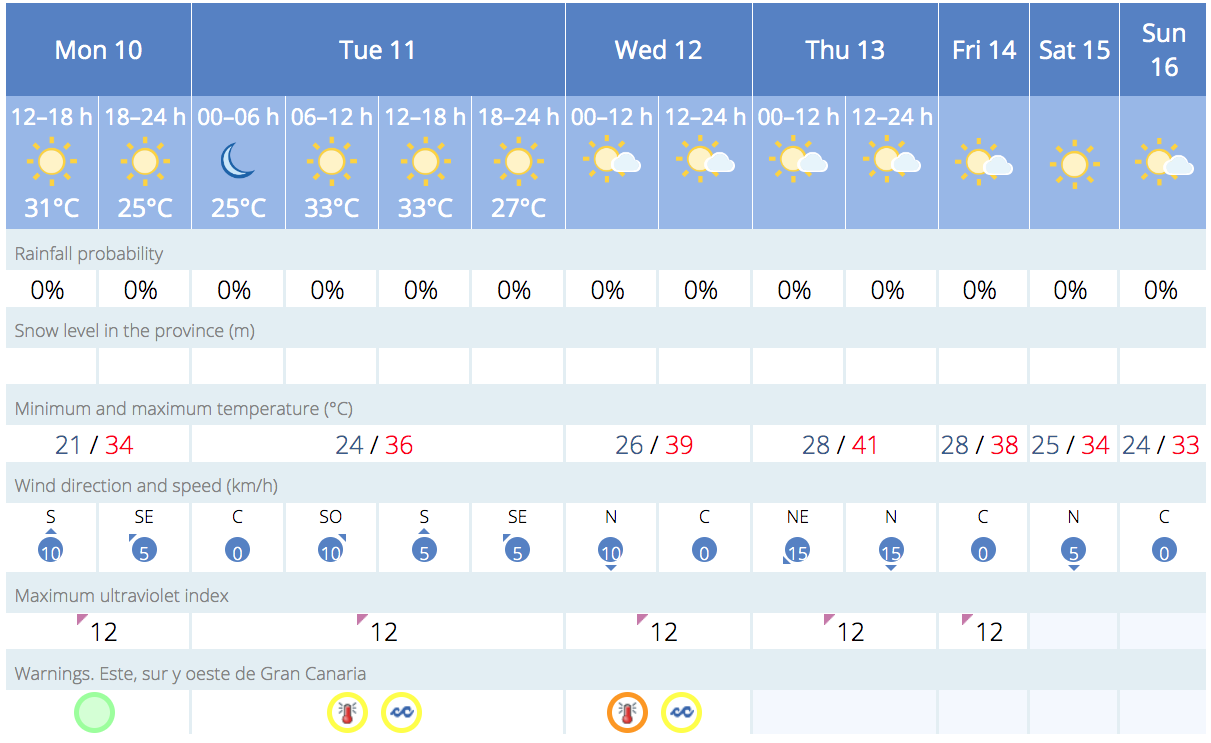
A hot, dry Saharan air mass is currently producing a major heatwave across southern and central Spain, with red advisory warnings due to temperatures topping 44ºC, and is expected to also affect the archipelago starting from Monday, gradually raising temperatures here up towards 42ºC in the shade in some places. High temperatures will continue throughout the week, with Wednesday and Thursday as the probable peak days when a significant calima intrusion is also expected, especially in inland mountainous areas. However, the episode may not officially constitute a heatwave, as a significant temperature decrease is probable across the archipelago from Friday or Saturday, returning to typical values for this time of the year.
|
----- Google provide a way for you to
|


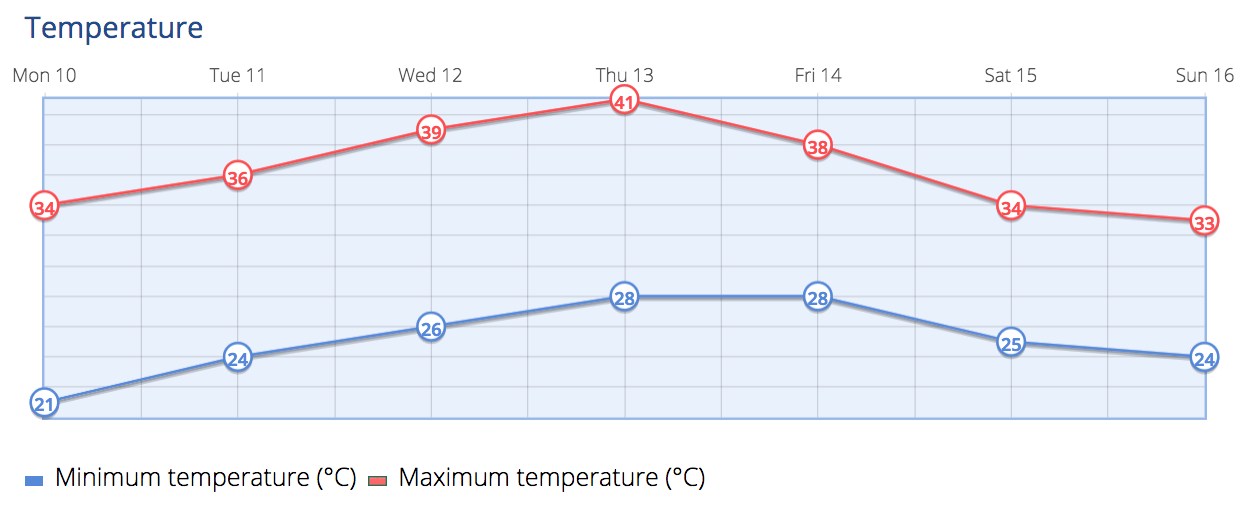
By Tuesday, on northern coasts, cloudy intervals, with a little cloudiness in the afternoon. Elsewhere, slightly cloudy or clear, with some intervals of medium and high cloud possilbe. Calima will start to affect the midlands and higher altitude areas, especially during the afternoon. Temperatures on the north coasts will see few changes, while for the rest of the island, temperatures look set to moderately rise, which could well be noticeable in the inland and higher areas. 36 ºC, and even occasionally 37 ºC, in the shade looks likely at the summits and the west, south and southeast midlands, while 30 to 32 ºC is probable elsewhere. Moderate northeast winds will blow strong on the southeast and northwest slopes, where very strong gusts are not ruled out, especially during the afternoon. Breezes should predominate on southwest coasts.

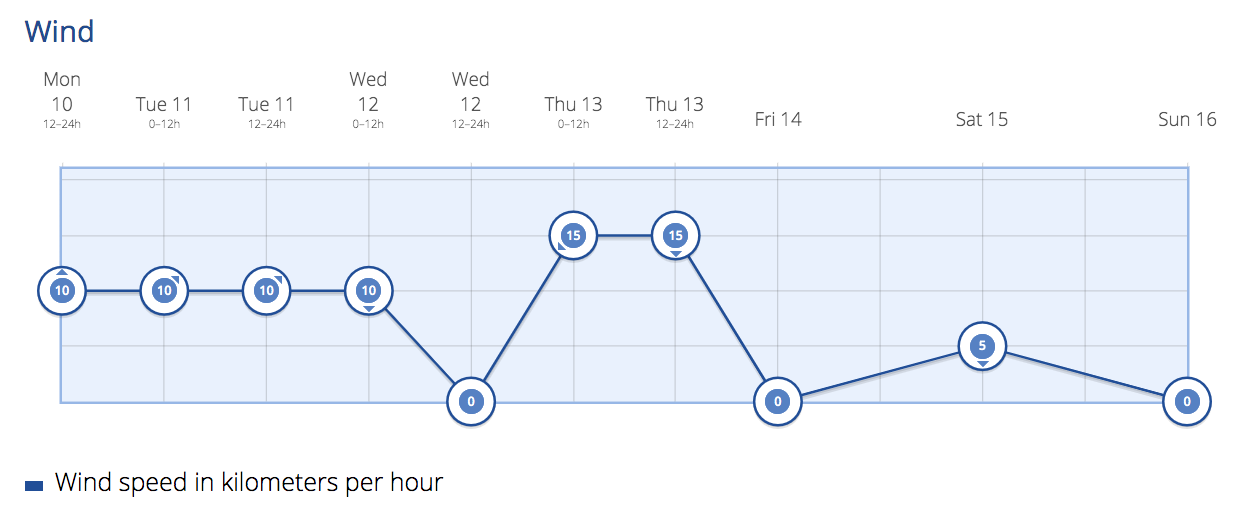
 On to Wednesday, and we have yellow and even orange warnings across Gran Canaria, with generally clear skies, though some morning intervals of cloud are possible in low-lying northern areas, tending towards intervals of medium and high cloud during the afternoon. Calima is expected across the eastern islands, which will mainly affect the midlands and highlands, and then extend to the rest of the islands. Temperatures will see slight to moderate rises, more pronounced inland and on southern slopes, where the maximum temperatures will be significantly high. Night time temperatures will see little change though the air may become stifling . Moderate winds from the northeast, will blow strong on the southeast and northwest slopes with the probability of locally very strong gusts. Breezes on the southwestern coasts.
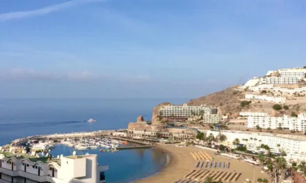
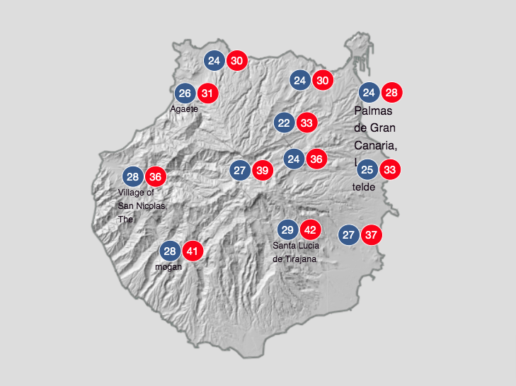
For Thursday, more of the same with temperatures continuing to rise a little further, with peak temperatures for the week ranging between 24º-28ºC on the north of Gran Canaria, while the southern tourist zones look to swelter a little with night time temperatures as high as 28ºC, hitting up to 42ºC in the shade, during the daytime, much hotter in direct sunlight.
As we head into the weekend temperatures are expected to drop back down towards seasonal averages for this time of year, with cooling winds blowing in from the northeast, plenty of blue skies and sunshine, and perhaps a touch of cloud across the north of the island.
|
----- Google provide a way for you to
|