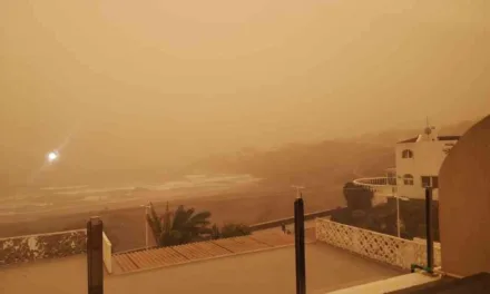
A storm, expected to arrive over mainland Spain on Wednesday, is thought to be carrying some part of the emissions, including ash from the volcano, La Soufrière, erupting on the Caribbean island of St Vincent, according to a prediction by Meteored. AEMET, the Spanish State Meteorological Agency, has clarified today that the storm is not expected to have any great effects on the Canary Islands, as it will arrive already “broken” and at most will bring some rain to the westernmost islands, and perhaps Gran Canaria.
|
----- Google provide a way for you to
|
 Concern over sulphur dioxide emissions from the volcano were first raised on Sunday when it became clear that westerly airflows were driving a large plume of the gas across the Atlantic Ocean. However experts have made clear that SO2 usually travels in the atmosphere at at an altitude of between 3km and 5km above the surface, and so is unlikely to pose any risk to The Canary Islands. Added to that the North Atlantic convection currents over recent days which have helped ensure that the main gas plume has remained far south of the archipelago, though now it is expected to curl north, over the Sahara, towards the Mediterranean and mainland Europe.
 In peninsular Spain, however, the wind flows are expected to move a storm from west to east across the Atlantic and could well also be carrying part of the ash and SO2 (sulphur dioxide) emitted from the volcano. AEMET has announced through social networks that it is monitoring the sulphur cloud expelled by the Caribbean volcano from the Canary Islands. The trajectory of the polar jet, that is described as acting like a conveyor belt for North Atlantic squalls, looks set to remain “very wavy”, so has the potential to cause new storms from which these “extremely unusual” particles could potentially fall, though most likely along the Galcian coasts.
An expert over at eltiempo.com, Samuel Biener, has said that these storm episodes are normal at this time of the year but said he was “surprised how they are interacting with subtropical air masses to increase the temperatures and the intensity of the rains”.
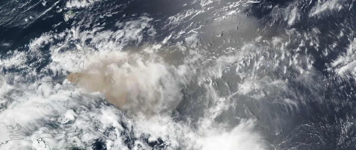
Sulphur Dioxide plume trajectory and forecast from Caribbean heading across the AtlanticSulphur Dioxide plume trajectory and forecast from Caribbean Island of #StVincent #LaSoufriere #volcanic #eruption heading across the Atlantic towards #Africa and #CanaryIslands
Posted by TheCanary.TV on Tuesday, April 13, 2021

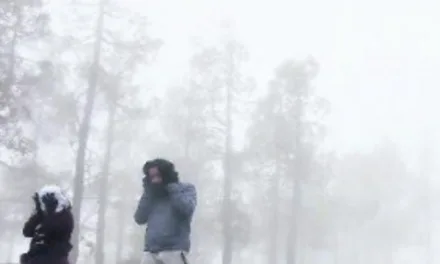
By Wednesday, a cold air mass is expected to arrive from the Atlantic ocean, causing a drop in temperatures and intense, irregular showers on the western and southern half of the Peninsula. This storm will likely also reach the Canary Islands, where particularly intense storms are expected on Tenerife, La Palma and Gran Canaria.
Meteorologist Francisco Martín predicts that SO2 and ash from the volcano, La Soufrière, on the Caribbean island, San Vicente, will arrive with this storm, following the eruption on April 9, and at least 3 subsequent eruptions, a large amount of ash and SO2 has been injected into the troposphere and is already crossing the Atlantic.
Martín points out that over the next few hours, if they have not already done so, these emissions could reach the skies over Canary Islands and then the south of the peninsula, although they will be travelling at altitudes of a few thousand metres, so, in principle, they should not represent any danger to the population.
On Thursday the storm looks set to meet with a new storm over North Africa that will be located over the Straits, with the potential for intense rainfall over southern Spain, especially to the extreme southeast. This storm is expected to be accompanied by a strong east wind on the Mediterranean side.
St. Vincent’s La Soufrière Volcano earlier today from GOES East
#LaSoufrière #StVincent #GOESEastPosted by TheCanary.TV on Sunday, April 11, 2021