Over the next few days Gran Canaria weather is expected to be influenced by a front associated with a low-pressure system formed in northern Portugal. According to the State Meteorological Agency (AEMET), this will bring rain to the islands over the weekend. The northern areas of Gran Canaria, Tenerife, La Palma, Fuerteventura, and Lanzarote are expected to be most affected.
|
----- Google provide a way for you to
|


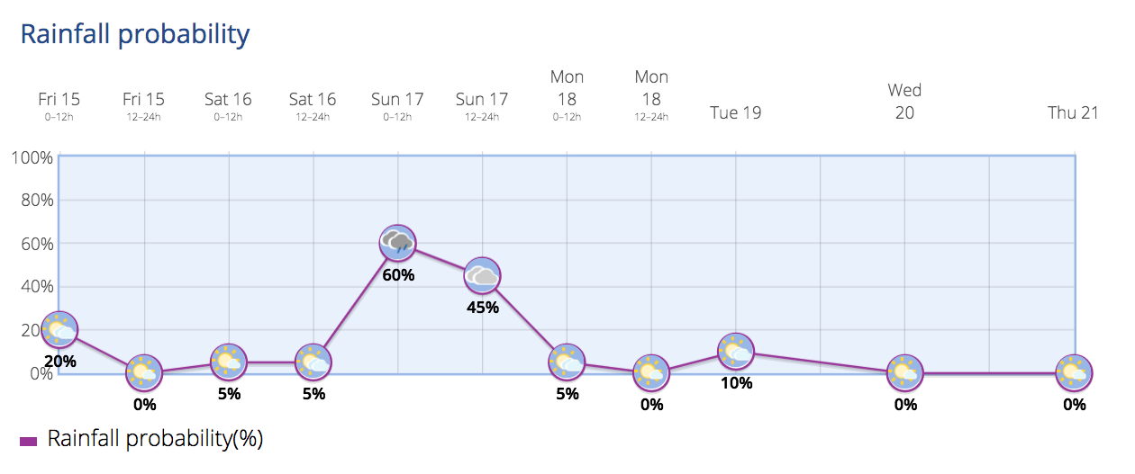
Saturday will see partly cloudy conditions in the north, with more clouds during the early morning and a low probability of light rain. In other zones, it will be mostly clear, except for occasional high-level clouds and some cloud development in inland areas facing south during midday. By late afternoon, it will become cloudy in the north with widespread light rain, possibly locally moderate. Temperatures will experience little change. Winds will be light from the north, turning to the northeast and increasing to moderate in the evening.
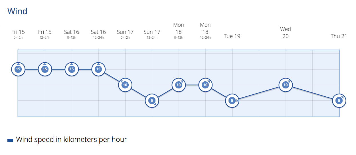
Moving on to Sunday, during the early morning, the mountainous northern areas of the islands will experience overcast skies with widespread, locally moderate, light rain. In other regions, there will be partly cloudy intervals with a chance of light rain. By dawn, it will become partly cloudy in general, although in the afternoon, weak rain is still possible in the interior of Tenerife and Gran Canaria. Minimum temperatures will remain steady or experience a slight increase, while maximum temperatures will decrease in north-facing slopes of the mountainous areas, with little change elsewhere. Minimum temperatures will remain steady except in Tenerife, where there will be slight decreases. Winds will be moderate from the northeast, with occasional strong gusts on northeast and southeast slopes. On mountain peaks, winds will be light and variable, except in the high peaks of Tenerife, where they will be moderate from the southwest.
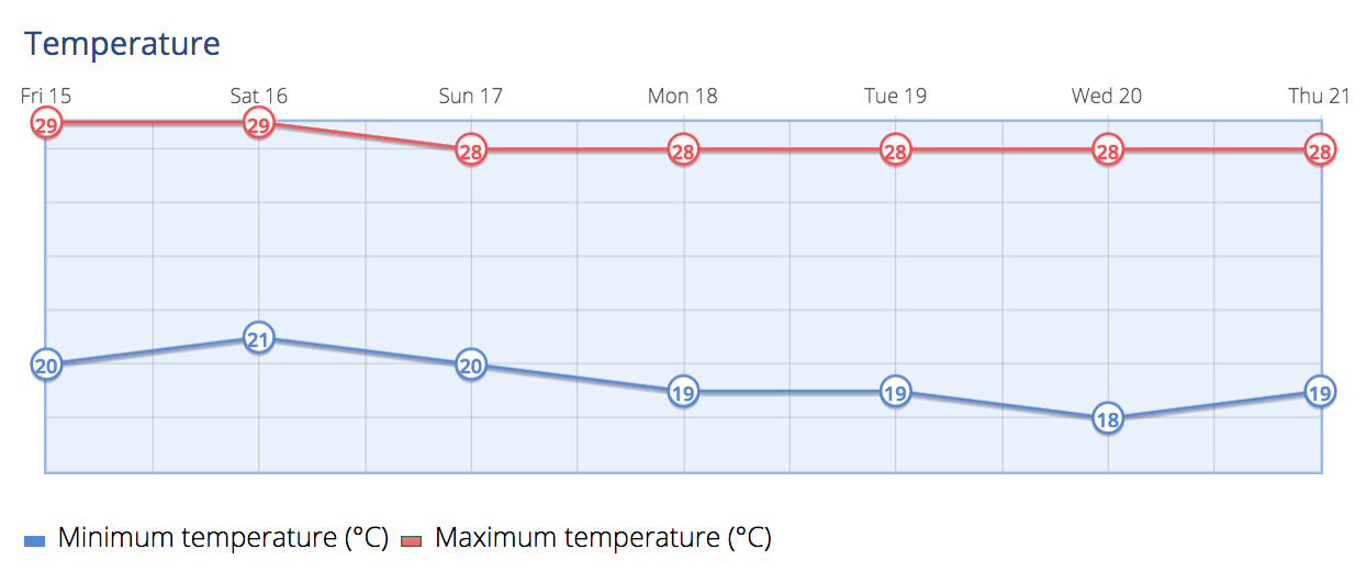
Looking ahead to next week, the northern mountainous areas of the islands will have partly cloudy intervals with a low probability of light rain in the early hours, followed by clearing skies in midday. In other regions, it will be mostly clear with the presence of high-level clouds. Maximum temperatures will experience slight decreases in north-facing slopes of the mountainous areas, and minimum temperatures will have a slight increase in inland areas, with little change elsewhere. Winds will be moderate from the northeast, with intervals of strong gusts. On mountain peaks, winds will be light and variable, except in the high peaks of Tenerife, where they will be moderate from the southwest.