The Government of the Canary Islands, through the Directorate General of Security and Emergencies, has declared a rain alert for La Palma, El Hierro, La Gomera, Tenerife, and Gran Canaria starting from 8:00 a.m. tomorrow, Wednesday, June 7th.
|
----- Google provide a way for you to
|

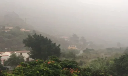
Tomorrow, Wednesday, widespread and persistent precipitation is expected, which may locally be heavy or very heavy. In the western islands, there is a probability of reaching and surpassing 30 mm of rainfall per hour, with an accumulation of 60 mm over twelve hours.
In La Palma, La Gomera, and El Hierro, the rain will affect the southern and western slopes, while in Tenerife, the northern and western slopes are more likely to be impacted. In Gran Canaria, there is a probability of reaching and surpassing 15 mm of rainfall per hour, mainly affecting the southern and western slopes, with a lower likelihood compared to the western islands.
The population is urged to follow the self-protection advice provided by the Directorate General of Security and Emergencies.
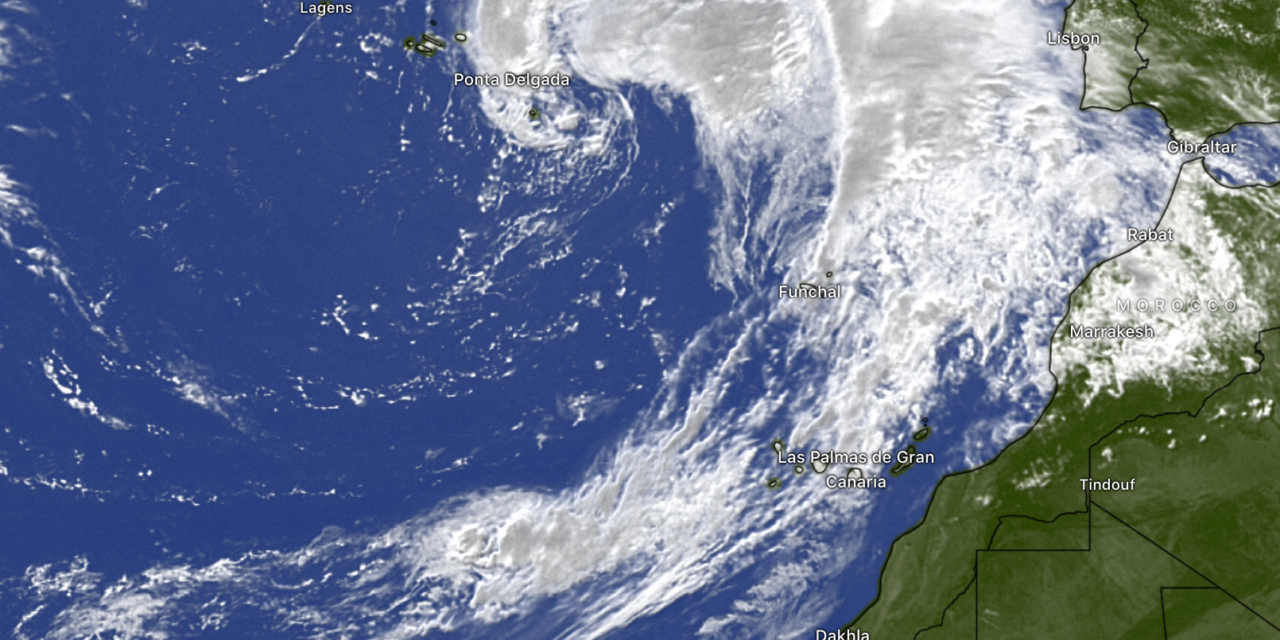
Storm Óscar formed southwest of the Azores, prompting the State Meteorological Agency to issue orange and yellow warnings for five islands on Tuesday and Wednesday.
La Palma
Orange warnings throughout Tuesday for the peaks and the west of the island due to gusts of wind reaching speeds of up to 90 kilometers per hour. Yellow warnings have also been issued for Tuesday due to rainfall, with an accumulated precipitation of 60 liters per square meter over 12 hours, and coastal phenomena due to strong gusts of wind.
Tenerife
The AEMET (State Meteorological Agency) has activated orange warnings for the north of the island, where gusts of wind reaching speeds of 90 kilometers per hour are expected. The western extremity and peaks may also be affected. There are yellow warnings for rainfall, with an accumulation of 15 liters per square meter in one hour, as well as gusts of wind reaching up to 70 kilometers per hour and coastal phenomena.

La Gomera
Yellow warnings have been issued for rainfall, with an accumulated precipitation of 60 liters per square meter over 12 hours. Within one hour, there could be 15 liters per square meter. There are also yellow warnings for gusts of wind reaching speeds of up to 70 kilometers per hour.
El Hierro
Yellow warnings for rainfall are in place across the entire island on Tuesday and Wednesday, with an accumulated precipitation of 15 liters per square meter in one hour and 60 liters per square meter over 12 hours.
Gran Canaria
Throughout Tuesday, there are yellow warnings for gusts of wind reaching speeds of up to 70 kilometers per hour and for rainfall with an accumulated precipitation of 15 liters per square meter in one hour. On Wednesday, there are also yellow warnings for rainfall, but with an accumulated precipitation of 60 liters per square meter over 12 hours.
An unusual weather event
Storm Oscar is considered unusual due to several factors that differentiate it from typical weather patterns. According to meteorologists, this storm stands out for its anomalous characteristics.
One notable aspect is the current weather conditions in the Canary Islands. Normally, the region should be influenced by the Azores anticyclone, which brings high pressure, stability, and prevailing trade winds to the eastern part of the archipelago. However, the presence of a cluster of storms, including Storm Oscar, is disrupting this pattern. This unusual situation involves a transition from a stable anticyclonic condition to a low-pressure system, resulting in cyclone formation. The cyclone’s intensification will lead to strong winds and precipitation in the Canary Islands.
The cyclone’s formation in June at a latitude of 28 degrees north of the equator is also atypical. Typically, cyclones form in colder months and at middle latitudes around 45 degrees north. The occurrence of cyclone development at this time and location adds to the storm’s uniqueness.
Additionally, Storm Oscar is associated with an atmospheric river—a moisture-laden conveyor belt—that carries humidity from the Caribbean to the Canary Islands. This atmospheric river, driven by strong winds at lower levels, is not commonly observed in June. It contributes to the presence of intense rainfall, creating a potentially adverse situation.
The combination of these factors, including the deepening cyclone, strong associated winds, and the presence of an exceptionally intense atmospheric river, makes Storm Oscar a historically unusual and potentially impactful storm. Meteorologists note that it is rare for such a high-impact storm to receive an official name.
The warm temperatures recorded in the waters of the Atlantic to the west of the Canary Islands also contribute to the anomaly. The water temperatures are currently two to three degrees above normal for this time of year.
The extraordinary nature of this storm has attracted the attention of the National Hurricane Center (NHC) in the United States, which has begun monitoring it due to the possibility of it acquiring tropical storm characteristics. However, the NHC estimates a low 10% chance of the storm developing into a cyclone.
Despite the uncertainties, the Spanish Meteorological Agency (AEMET) has issued appropriate warnings, and regional authorities have declared alert status in the potentially affected areas. It is now crucial for the population to act sensibly and respond appropriately to this adverse weather event. The expert emphasizes that predicting weather in the Canary Islands remains a challenge, but advancements in numerical models and satellite observations have greatly aided in this task.