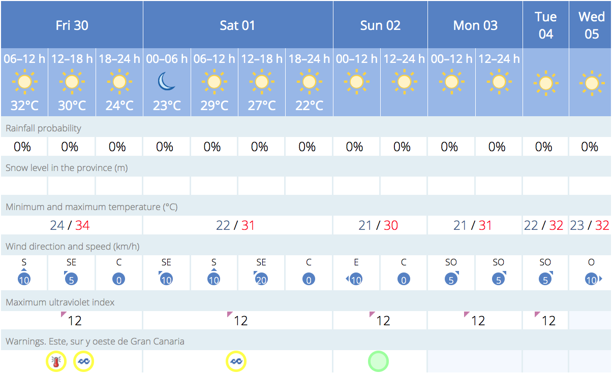
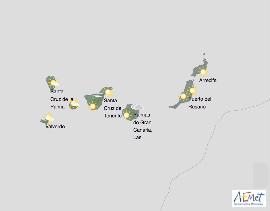
Clear skies are expected across the Canary Islands this Friday, although there will be some cloud in low-lying areas of the eastern islands, along with a decrease in temperatures, following a week of heat wave where thermometers touched 40ºC in the shade, we will see particularly maximum daytime temperatures start to return to seasonal norms, according to the forecasts from the Spanish State Meteorological Agency (AEMET). Temperatures of around 31º-34ºC in the shade are expected on the south of Gran Canaria, hotter in direct sunlight.
|
----- Google provide a way for you to
|


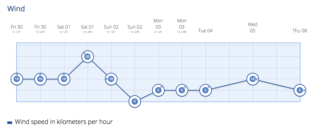
Northeast winds of force 4 or 5 are expected out at sea, increasing to force 6 in some areas during the afternoon, along with moderate waves becoming rough and a northerly swell with waves of 1 to 2 meters.
 Wind Pre-Alert
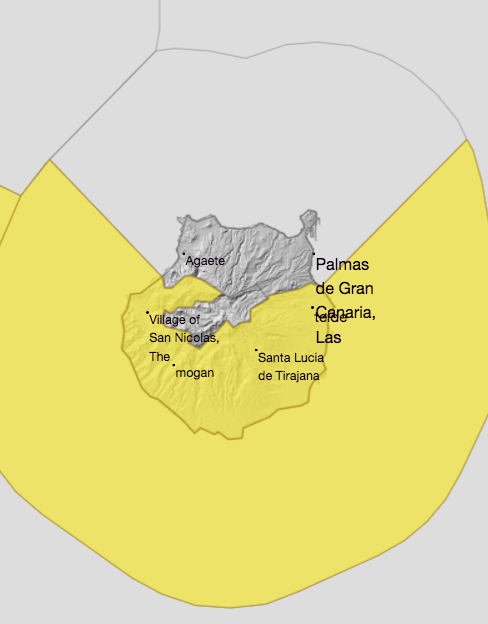
The General Directorate of Security and Emergencies of the Government of the Canary Islands has declared a pre-alert for wind in La Gomera, Fuerteventura, and Lanzarote, as well as in the metropolitan area of Tenerife and the southern slope of Gran Canaria.
The pre-alert, in effect from 7:00 a.m. on Friday, has been declared due to concerns over strong winds forecast with maximum gusts reaching 75 kilometers per hour.
It is expected that the wind will blow with particular strength at the summits and northeastern and eastern slopes of La Gomera, the southern slope of the metropolitan area of Santa Cruz de Tenerife, the western and southeastern exposed slopes of Gran Canaria, inland areas and the southern slope of the Jandía Peninsula on Fuerteventura, and the southern half of Lanzarote.
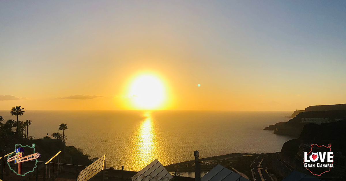
Gran Canaria Weather
Clear skies this Friday as we head into the weekend, with some cloudy skies in low-lying areas of the north. Light calima will remain at higher altitudes. Temperatures generally decreasing, with a notable drop in maximum daytime temperatures in inland areas.
Temperatures could exceed 34°C in the midlands of the south. North winds with intervals of strong winds in the western and eastern extremes, where occasional very strong gusts are possible, especially during the second half of the day.
Sea breezes predominating on the south and southwest coasts.

Las Palmas de Gran Canaria: 21°C – 24°C
Maspalomas/Puerto Rico de Gran Canaria: 31º – 34ºC
 The heat continued to affect the Canary Islands during Thursday, with a noticeable decrease this Friday. According to AEMET, temperatures exceeded 37º C on several islands including Gran Canaria. In particular, Fuerteventura and Gran Canaria were under orange heat warnings, while the rest of the islands were under a yellow warning. Calima haze has continued to affect a large part of the archipelago.
Temperatures of around 34º C are expected in the intermediate zones of the west, south, and southeast. Calima will start to disappear on the western islands but will persist on the eastern ones. In general, skies will be mostly clear or sunny, with morning intervals of clouds on the northern coasts.
Pre-alert in Las Palmas, except on the south of Gran Canaria
The General Directorate of Security and Emergencies of the Government of the Canary Islands has updated the alert situation due to the risk of high temperatures, changing it to a pre-alert in the province of Las Palmas, except on the south of Gran Canaria.
Based on the forecasts from the State Meteorological Agency (Aemet), the Government of the Canary Islands has decided to maintain alerts in the municipalities of Artenara, La Aldea de San Nicolás, Mogán, San Bartolomé de Tirajana, Santa Lucía de Tirajana, Agüimes, Ingenio, Telde, and Valsequillo de Gran Canaria.
These are the areas where temperatures of 37º C or higher could still be reached and exceeded in the midlands and inland areas of Gran Canaria, while on the north of the island, temperatures could reach 34ºC, in the shade, mainly affecting the summits.
The weekend
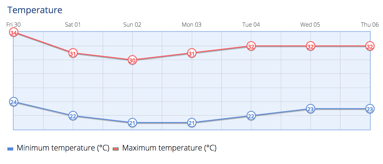
During the weekend, temperatures will experience a moderate decrease, especially in inland areas. Maximum temperatures will drop below 30ºC, although there will be a slight increase on Gran Canaria, where temperatures could reach 32ºC in the intermediate zones of the south. There will be a light presence of calima, dissipating throughout the day.
Regarding the forecast for the weekend, Saturday is expected to have predominantly cloudy skies in the northern areas of the islands, with a low probability of weak and occasional rainfall in the intermediate areas of the northern mountainous regions. Temperatures will experience a slight to moderate decrease, especially in inland areas, although temperatures of 30ºC could be reached on Gran Canaria.
For Sunday, more frequent intervals of low cloud are expected to the north, with the possibility of weak rainfall. Temperatures, in general, will increase, approaching 30ºC on Gran Canaria, Lanzarote, and Fuerteventura.
Canadian Smoke & Saharan Calima
Smoke from the hundred or so fires that have devastated the forests of Canada reportedly reached the Canary Islands last Wednesday, noticed on Lanzarote and Fuerteventura, where the aerosols generated by the burning combined with the calima currently affecting the archipelago.
In statements to Spanish news agency EFE, the territorial delegate of AEMET in the Canary Islands, David Suárez, explained that these aerosols have been carried by meteorological conditions and atmospheric circulation, first passing through the Iberian Peninsula, especially Galicia, Madrid, and Portugal, and now moving towards the Canary Islands.
“As it moves, it dissipates, so it’s logical that a lower concentration reaches the Canary Islands than Galicia,” said the AEMET delegate.