Its a perfect Gran Canaria springtime weekend ahead with light calima sands blowing in from the Sahara, temperatures in the shade of 31ºC, light breezes and blue skies. Remember too the clocks spring forward by an hour this weekend.
|
----- Google provide a way for you to
|


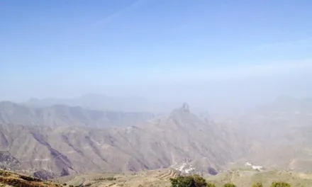
Calima is present, more significant in inland and higher altitude areas. Temperatures look set to rise throughout the day, with maximum temperatures locally noticeable inland on the southern and western halves of the island. Northeast winds with intervals of strong and occasionally very strong gusts on the northwest and southeast slopes, especially towards the end of the day. On mountain tops, southeast winds.

Temperatures in the shade:
North – Las Palmas de Gran Canaria: 17º – 23º
South – Puerto Rico de Gran Canaria: 16º – 31º

On Thursday, intervals of medium and high cloud from the beginning of the day will tend to clear or in some places remain partly cloudy. Intervals of low cloud are also expected during first and last hours of the day along northern coastlines, as well as in interior areas of the west during the afternoon. Calima haze will be present, more significant in inland and high areas, and will tend to decrease during the afternoon. Minimum temperatures will rise slightly to moderately, especially in inland areas. Maximum temperatures will remain high with few changes. Northeast winds, with intervals of strong and occasionally very strong gusts on the northwest and southeast slopes, especially in first and last hours of the day. On mountain tops will receive east winds.

By Friday, skies will be clear or partly cloudy, with intervals of low cloud on northern coastlines during the first hours of the day. There will be a slight Calima haze at high altitude. Temperatures will remain unchanged or rise slightly, especially the night time minimum temperatures in inland areas. Northeast winds with intervals of strong gusts on the northwest and southeast slopes, without ruling out occasionally very strong gusts at the beginning of the day. Breezes along southwestern coasts. In inland and mountainous areas, east winds.
On Saturday, there will be predominance of clear or partly cloudy skies. Slight haze at high altitude at the beginning, tending to disappear. Temperatures will rise slightly. Northeast winds, stronger on the northwest and southeast slopes of the island. Breezes on southwestern coasts.
As the weekend comes to a close AEMET are expecting partly cloudy or clear skies on Sunday morning, with some intervals of low clouds in northern coastal areas at the beginning of the day, and intervals of high cloud that will be spreading from west to east across the archipelago from the morning. Light calima at high altitudes from noon. Temperatures with little change. Northeast winds, with strong intervals on the northwest and southeast slopes of the island. Sea breezes all along the southwest coasts.