Well it looks like predictions of an extended autumn heat wave have receded in The Canary Islands as weather forecasts across the archipelago turn towards a more seasonal outlook, with temperatures starting to drop following the balmy weather over the weekend. All Saints’ Day has started with cloudy intervals at lower altitudes, but continues with a probability of Calima haze and maximum daytime temperatures in the shade of up to 27ºC, and dropping to 20ºC at night, according to Spanish State Meteorological Agency AEMET.
|
----- Google provide a way for you to
|

The downward trend for the thermometers will continue as the week wears on returning to normal seasonal values for November in the Canary Islands, while the Spanish mainland is affected by storm Claudio, which will leave rains across much of the Iberian peninsula during the first days of November. By Thursday, night time minimums will be around 18ºC across the archipelago with day time maximums reaching up to around 25º or 26ºC in the shade, moving away from the more summer-like temperatures experienced over this past few days.
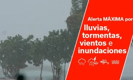
This Friday there may be some light showers across the archipelago, according to AEMET, especially on Gran Canaria, Tenerife and La Palma, though they are still only predicting a 20%-30% probability in the south, rising to more than 50% likelihood to the north and in the capital. Saturday will possibly see more rainfall: with forecasts predicting rain both in the province of Santa Cruz de Tenerife and also on the island of Gran Canaria.
For Sunday, there may again be light showers at some point in the archipelago, although in principle it will be very light. Temperatures on the south expected to stay in the upper 20s daytime, in the shade, but dropping by up to ten degrees at night. Both daytime and night time temperatures, as ever, a few degrees cooler in the capital and across the north of the island.

This Tuesday, Todos Santos, lower altitude areas of the north have started with intervals of cloud from the early hours, set to clear during the day, only to return again this evening. Elsewhere slightly cloudy or clear, with intervals of high cloud. Light Calima haze expected to continue, affecting midland and highland areas, especially on the southern slopes, tending to subside as we move through the day. Temperatures will see few changes this Tuesday, with a slight rise in the minimum night time temperatures and a slight decrease in the day time maximums. Moderate northeast winds, more intense in the southeast and northwest. Breezes on the north and southwest coasts. At the summits, light winds, predominantly from the south.

Wednesday looks set to begin with a little cloud tending to clear skies, with intervals of high cloud starting in the afternoon. In lower altitude areas of the north, cloudy intervals are expected in the early and later hours. Slight Calima haze is not ruled out during the first half of the day, affecting mid-altitude and higher areas. Temperatures will see few changes, except for a slight decrease in the day time maximums for the southern half of the island. Light to moderate winds from the northeast, more intense in the extreme northwest and on the southeast coast. Breezes across the southwest coasts of Mogán.
To the north of the island, cloudy intervals are expected on Thursday. Elsewhere, slightly cloudy or clear in general, with some cloudy intervals on the easternmost islands during the earlier and later hours of the day. Temperatures will see few changes or decrease slightly, especially day time maximums and in inland areas, expected to reach around 28ºC in the shade to the south and 25 or 26º to the north. Loose to moderate northeast winds, with breezes along the coasts.


Friday, on the north of the island will begin with cloudy intervals and a low probability of weak and occasional rains. Elsewhere slightly cloudy or clear, with cloudy intervals in the earlier and later hours possible. Temperatures will see few changes or daytime maximums may continue to decrease just a touch, to around 26º on the southern coasts and perhaps a couple of degrees cooler to the north. Moderate northeast wind, more intense on the northwest and southeast slopes of the most mountainous islands.
As we move into the weekend on the Canary Islands, cloudy intervals are expected on the north of the island, with a real possibility of some weak precipitation, and perhaps a little cloud to the south, though showers seem less likely.


The Canary Guide
|
|
----- Google provide a way for you to
|
|
Advertise your business to English Speakers on Gran Canaria
We have a range of exciting advertising opportunities starting from as little as 2€ a day online, with a monthly audience averaging more than 150,000 individuals visiting our site regularly.
Give us a call on 928 987 988 or email [email protected] for more information