AENA has confirmed, despite the large amount of Saharan dust currently in the environment, no incidents have been caused and flights have continued to operate across the Islands over recent days.
|
----- Google provide a way for you to
|


Rains and storms are predicted for the Western Province, so Spanish State Meteorological Agency (AEMET) have activated a yellow advisory on Wednesday for rains across the islands of El Hierro, La Palma , La Gomera and Tenerife, with accumulated rainfall of up to 15 litres per square metre each hour expected to come into force from from Tuesday 9:00 p.m. on El Hierro followed by the other three islands from 00:00 until 18:00.

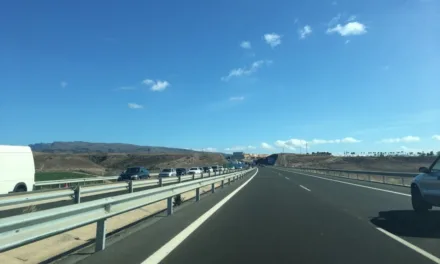
Wednesday on Gran Canaria will see medium and high cloud, with some possibility of rains, generally weak, though a potential for heavier showers in some places. Calima dust will continue through the day, temperatures seeing few changes, daytime highs of 26ºC in the shade and night time minimums in the mid teens, a little chillier inland. Variable winds from the north and east more intense on the northwest and southeast slopes.

 Much of the same for Thursday on Gran Canaria with some weak rains likely across the island during the morning, clearing up generally as we head into the afternoon. Things continue to clear as we get to the end of the week, with blue skies set to return by the weekend, despite an occasional cloud wandering at altitude.
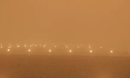
A new severe #Saharan #dust storm episode has engulfed the skies over the Canary islands🇪🇸 & Madeira🇵🇹
➡️@AEMET_Esp issued an🟨alert
➡️Health authorities have advised the population not to stay outdoors for long periods⬇️#Sentinel3 🇪🇺🛰️image of 30 Jan.#Calima pic.twitter.com/HBVNX0IQO5
— 🇪🇺 DG DEFIS #StrongerTogether (@defis_eu) February 1, 2022