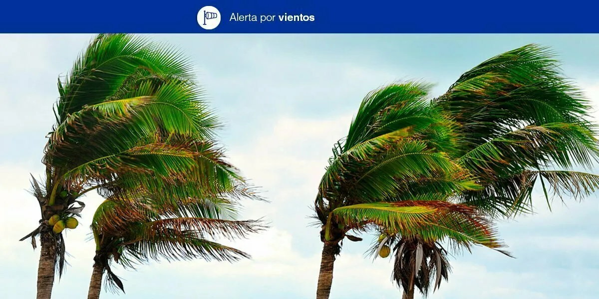
 The Government of the Canary Islands, through the General Directorate of Safety and Emergencies, have declared a Wind Alert from January 4, the winds alert and rain forecast take into account the information provided by the Spanish State Meteorological Agency (AEMET) and other available sources. Moderate southwest and west winds – strong and gusty. Variable average speed 30 – 60 km/h. Maximum gusts in prediction of 70-110 km/h, with the greatest winds and gusts expected in the midwest and southeast, the highlands, the peaks, and locally leeward.
The population is urged to be aware, take appropriate precautions and follow the advice of the General Directorate of Security and Emergencies.
|
----- Google provide a way for you to
|
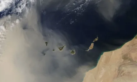
Prevailing wind directions flip this week with wet weather and overcast skies bringing stormy weather from the south-west, with a winter winds alert and rain seeing the brunt of the Atlantic squall hitting usually more sunny areas like Mogan, while Las Palmas is to be a little more shielded from the worst of it, on the other side of the mountain, in the lee of the island. Cloud bringing rain and heavy showers could see gusts of wind of 70 kilometers per hour on the summits this Monday and up to 100km/h later in the week across the Canary Islands.
Force 3 or 4 southwesterly winds out at sea, could gain strength to the west and south, with force 5 expected by the end of the day possibly stronger at times, rolling west to sw. Very strong gusts of wind to set the trend for the rest of this first week of 2021. Swell, increasing to strong swell from the west by the end of day. On the southeast coasts force 2 or 3 with swell from the north west bringing waves of 1 to 3m to the west and northwest. Rain and downpours, even the occasional thunderstorm, temporarily, locally heavy.
Overcast skies should begin to clear a little by end of Monday. Showers, most likely in the southwest where they could be locally heavy this afternoon. Minimum temperatures unchanged or slightly rising in the southwest and maximum temperatures slightly rising. Moderate southerly winds will tend towards the west, strong at intervals in the afternoon inland and in high altitude areas, with a probability of very strong gusts at the summits that could reach up to 70 km/h.
MINIMUM AND MAXIMUM EXPECTED TEMPERATURES (° C): 13 – 26


Tuesday
Cloudy and overcast on the southwest, elsewhere some cloud, with intervals of high cloud. A chance of light rains in the southwest, which could be persistent in places during the afternoon. Temperatures rising a little to an above average 18-24C. On the coasts, winds from the southwest, a little more intense on the northwest and southeast facing slopes with a predominance of breezes along the northeast coasts. At the peaks, strong west winds with gusts of 70 km/h during the early morning, decreasing to moderate winds as we head towards afternoon.
Wednesday
Cloudy and overcast. To the southwest, persistent moderate showers in general, with a probability of occasionally strong downpours and even storms. Elsewhere occasional and scattered light showers. Minimum temperatures continuing to rise above 18C with maximum temperatures of up to 26C. Moderate to strong southwesterly winds, more intense on northwest and eastern slopes, where gusts could reach 80 km/h. Gusts at the summits could exceed 90 km/h, and may extend to northern inland areas.

Thursday
Cloudy with moderate and persistent showers in the southwest and a chance of occasionally strong and stormy downpours. Temperatures will change little with lows of 20C and highs of 25C, though may slightly decrease toward end of day. Strong to very strong southwesterly winds are expected with gusts that may exceed 80 km/h on the coasts and hit 100 km/h on the summits.
Friday
As we head into the weekend there is a little more uncertainty though by Friday the winds alert and rain should have significantly dissipated. The most probable forecast currently places a powerful storm to the southwest of the Spanish Peninsula, with southerly winds raising temperatures, and gathering rains to its south, while extending rainfall north toward the mainland, where it is likely to meet cold air, making snowfall very likely. However if the thermal rise does not occur, snowfall could come much further south. The Canary Islands should see a little less of the stormy weather by then, with less intense rainfall and wind turning northwest and then subsiding. Temperatures will begin to fall once again throughout the archipelago.

Weekend
With rain meeting cold air from the peninsula it is likely that snow will continue to form in relatively high areas of the mainland. Temperatures will tend to continue dropping throughout the archipelago. As the southerly and westerly winds die down, so some stability should return however the winds are then expected from their predominant northerly direction bringing a distinct possibility of snow from the north, above 1600m, and significant frosts may occur across the peaks of our mountain areas. Whether the snow finds us down here or not rains are expected across the north of The Canary Islands with north winds turning northeast and temperatures returning to something closer to seasonal norms.