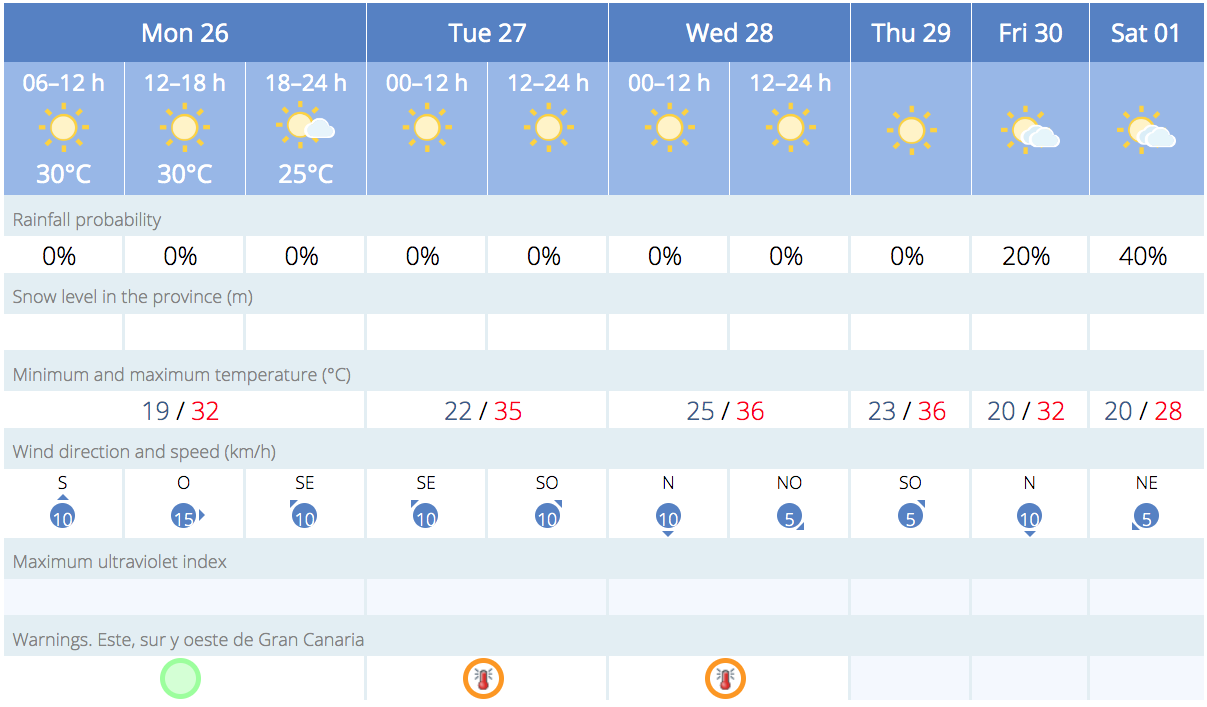
The Spanish State Meteorological Agency (AEMET) has issued an orange alert for temperatures of up to 37ºC, in the shade, in the inland areas of the east, south, and west of Gran Canaria for this Tuesday, minimum night time temperatures are not expected to drop below 25ºC. The north of the island and the summits will maintain a yellow alert, which also extends to four other islands.
|
----- Google provide a way for you to
|


The Orange “important risk” advisory warning is limited to the southern, eastern, and western areas of Gran Canaria this Tuesday.
Weather forecast for Monday:
The Canary Islands can expect clear skies on Monday, with maximum temperatures gradually rising and a possibility of calima (dust/sand haze) in the inland and higher altitude areas, according to AEMET.
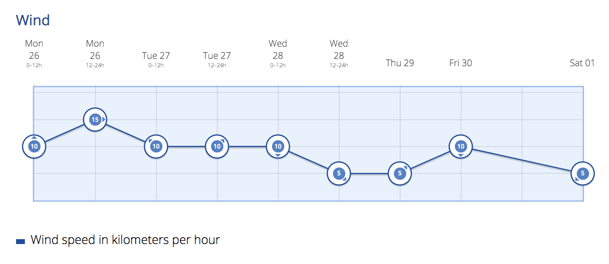
At sea, northeast winds are forecasted at force 3 to 5, decreasing to 3 or 4 in some areas. There will be rough to very rough seas, becoming slight to moderate as the day progresses, with northerly or northeasterly swells of 1 to 2 meters. However, as ever, in the lee of the island, the touristed southwest, coastal waters will likely be calmer.

On Gran Canaria this week:
Generally clear to mostly clear skies. Some cloudy intervals in the lower altitude areas of the north below 500 meters, mainly during early and late hours. Clouds may also appear on the southern coasts at the beginning of the day. Calima will be more significant in the inland and high areas. Minimum temperatures will slightly rise, and maximum temperatures will have a moderate increase, particularly notable in the interior areas where temperatures may reach 32-34ºC, but climbing as the week progresses. Light north winds with sea breezes in the coastal areas, while moderate southeast winds are expected in the higher zones. By the end of the week there is a possibility of some greyer weather, though most likely on the north of the island, the south is expected to stay hot and sunny.
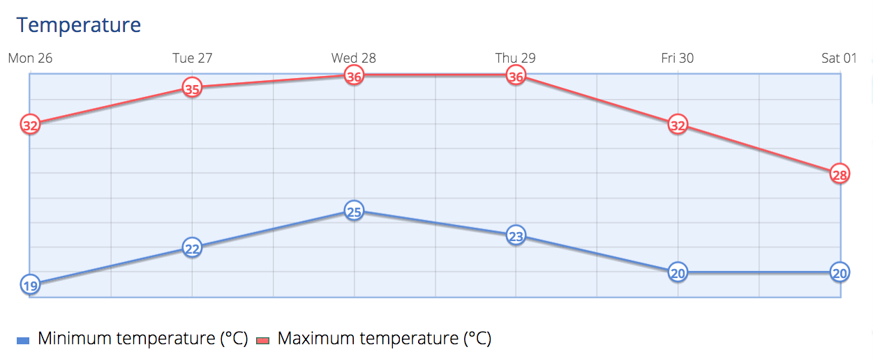
Temperatures heading towards 40º
The expected night time temperatures in the capital will be around 23ºC, rising during the day to around 29ºC, in the shade. On the south coast, evening temperatures will be in the low to mid 20s, and reaching up towards 36º or more daytime, much hotter in direct sunlight. Top temperatures of 37º+ are expected on southern slopes.
On Monday, it will be generally clear or mostly clear, with cloudy intervals in the low areas of the north. Calima will affect the eastern islands and Tenerife, with a significant impact on the inland and higher areas. Minimum temperatures will slightly rise, and maximum temperatures will increase in general, reaching 34 degrees Celsius in the interior of Lanzarote and Fuerteventura, and 32 degrees Celsius in the inland areas of Gran Canaria and Tenerife. Light north winds are expected, while moderate to strong winds from the southeast, with very strong gusts in the central areas of Tenerife that may exceed 90 km/h.
On Tuesday, there will be a maximum temperature alert. Temperatures will reach 34-36ºC in the shade, in interior areas of the eastern islands, Tenerife, and La Gomera, and may reach 37ºC in Gran Canaria. Strong gusts are likely in the central peaks of Tenerife during the early hours.
Midweek will be generally clear or mostly clear, with cloudy intervals on the northern coasts. During the early hours, there will be intervals of mid-level clouds in the eastern islands. Calima will mainly affect the inland and high areas. Temperatures will remain unchanged or slightly decrease on Lanzarote and Fuerteventura, while on the other islands, minimum temperatures will slightly rise, and maximum temperatures will remain unchanged or slightly increase. Temperatures will reach 34-36ºC in the interior of all the islands, exceeding 37ºC on Gran Canaria, likely much hotter in direct sunlight.
By Thursday, there are likely to be cloudy intervals. Generally clear or mostly clear in most areas. Significant calima is expected at higher altitudes, mainly affecting the western islands. Temperatures will have a slight to moderate decrease, with maximum temperatures potentially becoming notably lower. Local temperatures in the shade of 34ºC may be reached in the southern inland areas of Gran Canaria and Tenerife. Northeast winds will blow, with strong winds in the summits and northwest and southeast slopes.
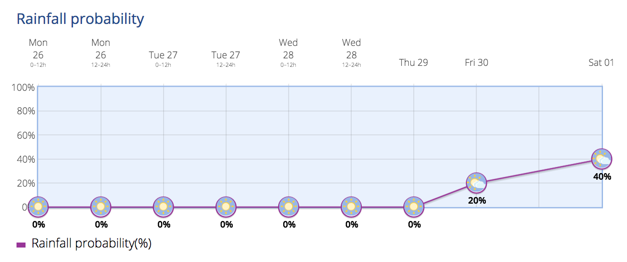
As we head into the weekend, after the passage of a front expected the day before, a moist northwest Atlantic flow is expected, resulting in cloudy skies. Trade winds will dominate the Canary Islands, with strong intervals. There will be cloudy intervals, more abundant in the north, with a low probability of light rain, and temperatures decreasing.