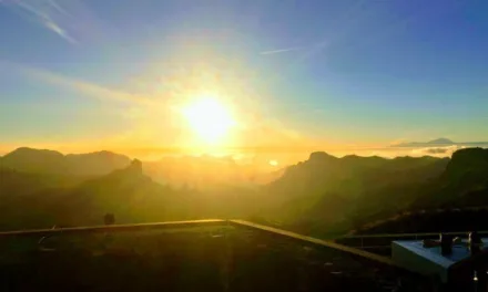
Well if you thought its been a little chilly or wet over recent days and weeks on Gran Canaria, you’re in for a further blast from the north, as it looks like a polar vortex is, this Wednesday night and Thursday morning, pulling in some decidedly wintery wet weather, with a potential for very strong winds, rough seas and even a good chance of some snow possible on Gran Canaria and on neighbouring Teide.
|
----- Google provide a way for you to
|

The Spanish State Meteorological Agency (AEMET) has forecasted continuing heavy rains for Thursday, in areas of the north and easternmost parts of the Canary Islands, with the possibility of locally heavy downpours.
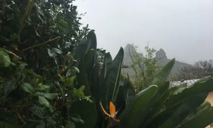
Snow is also expected in the most mountainous regions of Tenerife, Gran Canaria and La Palma, although the latter is less likely to be affected. Temperatures are expected to remain somewhat chillier than they have been over the last couple of weeks, although could fall in inland areas and at altitude, with strong northerly winds expected over the next 24-48 hours. There’ll even be a touch more calima to top it all off.

The forecast suggests that very strong gusts of wind are likely to occur locally, around the summits and on western and eastern slopes, and some occurring in the highest parts of the islands. The intensity of the winds should decrease from east to west across the archipelago.
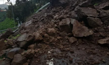
 The Canary Islands’ General Directorate for Security and Emergencies issued a pre-alert for storms this Wednesday on Gran Canaria, Fuerteventura and Lanzarote. The government has indicated that there is a probability of locally strong thunderstorms, accompanied by heavy rains, very strong gusts of wind, and even hailstones of over one centimetre in diameter, with a significant amount of lightning.
Out at sea, the forecasts suggest that there will be northerly to northeasterly winds, at gale force 4 or 5, locally reaching up to force 7, that should ease to variable winds of between 1 & 3, with rough to very rough seas, subsiding to moderate as the day progresses.
Northwest swells are expected to create waves of between 2 to 3 metres and occasionally larger.
On Gran Canaria, intervals of heavy cloud are expected, with predominately cloudy skies throughout Thursday afternoon.
Rain is certainly expected to the north, with some possibility of more frequent and locally heavy rainfalls during the early morning and evening, even reaching the normally sunny southern coasts.

There is also a low chance of occasional showers in inland areas of the south during the afternoon, and a probability of isolated thunderstorms.
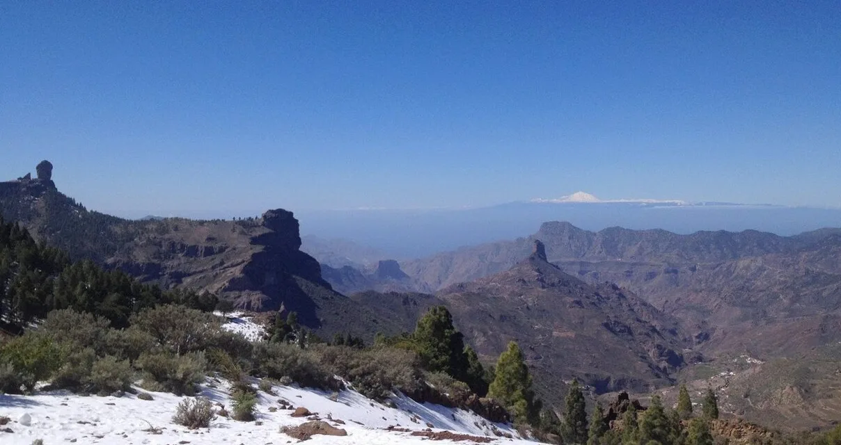
The predicted snow line is expected to drop to around 1,700 metres during the early morning, meaning that some of the rain expected may fall as snow on the mountaintops.


CC2.0 Los Pechos Juan Rodriguez Sosa El Coleccionista de Instantes
Temperatures are expected to remain unchanged or fall slightly, with the most significant declines likely to be on the southern slopes of the island.
Winds from the north are expected to gust strongly, particularly at the western and southeastern extremes, with a low possibility of locally very strong gusts at the summits. These will decrease slightly during the central hours of the day, and will be dominated by the prevailing northeast winds during the afternoon.
With predicted minimums for Las Palmas de Gran Canaria of around 14ºC and and maximum temperatures of around 19º, most Canarians will be grabbing their jumpers and wet weather gear. While on the touristed south coasts, day time highs of around 19ºC will give way to night time lows of around 10ºC, decidedly chilly for the area.

However it is at the summits, in the picturesque mountain towns like Tejeda, that lows are expected to drop to at least 4ºC, perhaps even as low as 2ºC, only mitigated slightly by day time highs of no more than 11ºC, with wind chill and rainfall, potentially sleet, being a real subtropical possibility.
Everything looks set to warm up again and dry out a little by the weekend.

-

- Mogán Forecast

-

- Mogán Temperatures

-

- Mogán Wind

-

- Mogán Rainfall probability