The Spanish State Meteorological Agency (AEMET) has declared a yellow advisory warning for this Tuesday, due to gusts of very strong winds from the southeast, which could exceed 70 kilometres per hour, in the west of the easternmost islands and on the summits and western slopes and north of Gran Canaria, Tenerife and La Gomera.
|
----- Google provide a way for you to
|


According to the AEMET forecast, the skies will clear, with occasional cloud, and intervals of high clouds; more Calima will follow, more intense on the easternmost islands, and temperatures will rise a little on all the islands.
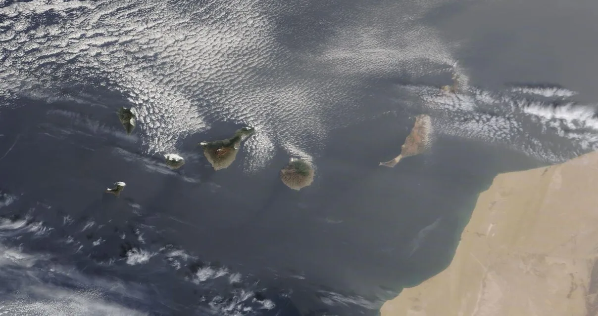
The Calima could significantly reduce visibility on Lanzarote and Fuerteventura.
As for the state of the sea, a northeast wind of force 5 or 6 is expected, could reach force 7 on the southeast and northwest coasts, the sea will be churning with a strong swell, decreasing a little through the day on the west and southwest coasts, settling to a variable strength 2 to 4 with swell.
On the coasts of Lanzarote and Fuerteventura, the winds will be from the northeast reaching force 3 or 4 and in places 5, strong swell is expected.
Across the islands, a swell of 2 meters, could reach to 3, on the western isles.

 Tuesday on Gran Canaria will begin slightly cloudy or clear with intervals of high cloud. Calima, and potential for reduced visibility.
Minimum night time temperatures will climb, a little, towards the top of the teens, more noticeably on the north and southwest slopes. Maximum temperatures rising along the north coasts, and staying warm elsewhere during the day at around 27ºC in the shade, perhaps a little warmer to the south. Northeast winds will shift to the southeast from the early hours and intensify. Very strong gusts, likely to exceed 70 km/h on summits and west and north slopes, are probable mainly during the middle of the day. Fading during the afternoon and evening.
Wednesday starts with some cloud in the sky, and Calima. Minimum temperatures rising slightly. Moderate to strong southeast winds, with high probability of very strong gusts of 70 km/h on summits and on the west and north slopes, subsiding by the end of the day.
Thursday: Medium to high clouds. Calima likely in the eastern islands, possibly affecting the rest of the archipelago a little more lightly. Temperatures dropping a little on the eastern islands, with little change in the western province. Moderate southeast winds, with strong intervals will be felt on the eastern islands during the first half of the day.
Friday: A little cloud is expected. The last of the Calima on the eastern islands. Temperatures cooling off a little. Loose variable winds, more from the north by end of day.

A little wet weather is possible along the east of Gran Canaria on Saturday but should brighten up again as we head through the weekend.
FORECAST MINIMUM AND MAXIMUM TEMPERATURES:
Las Palmas de Gran Canaria, 19 – 27ºC
Puerto Rico de Gran Canaria 17 – 28ºC