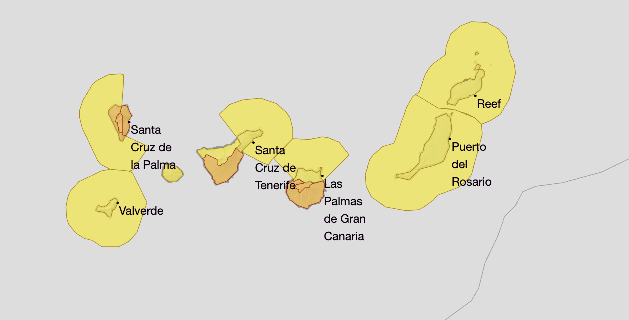
The Canary Islands are bracing for the arrival of Storm Claudia, a powerful Atlantic front that is already prompting the Spanish State Meteorological Agency (AEMET) to escalate warnings to orange advisories in key regions. Over the next 48 hours, the storm is forecast to bring very heavy, persistent rain, violent thunderstorms, and winds exceeding 80 km/h—posing significant risks of flash floods, local inundations, and infrastructure damage, especially in the western isles and southern Gran Canaria.
Emergency services have now declared a full alert across the Canary Islands in response to the arrival of Storm Claudia, activating the region’s Adverse Weather Emergency Plan (PEMA). Authorities warn of heightened risks due to very heavy rains, persistent thunderstorms, and wind gusts exceeding 80 km/h, particularly from Wednesday afternoon through Thursday. Residents and visitors are urged to remain vigilant in high-risk areas and closely follow official instructions, as the forecast may be updated while the situation develops. Flooding, road disruptions, and coastal disturbances are likely, especially on western and southern slopes as well as exposed beaches and promenades.
|
----- Google provide a way for you to
|
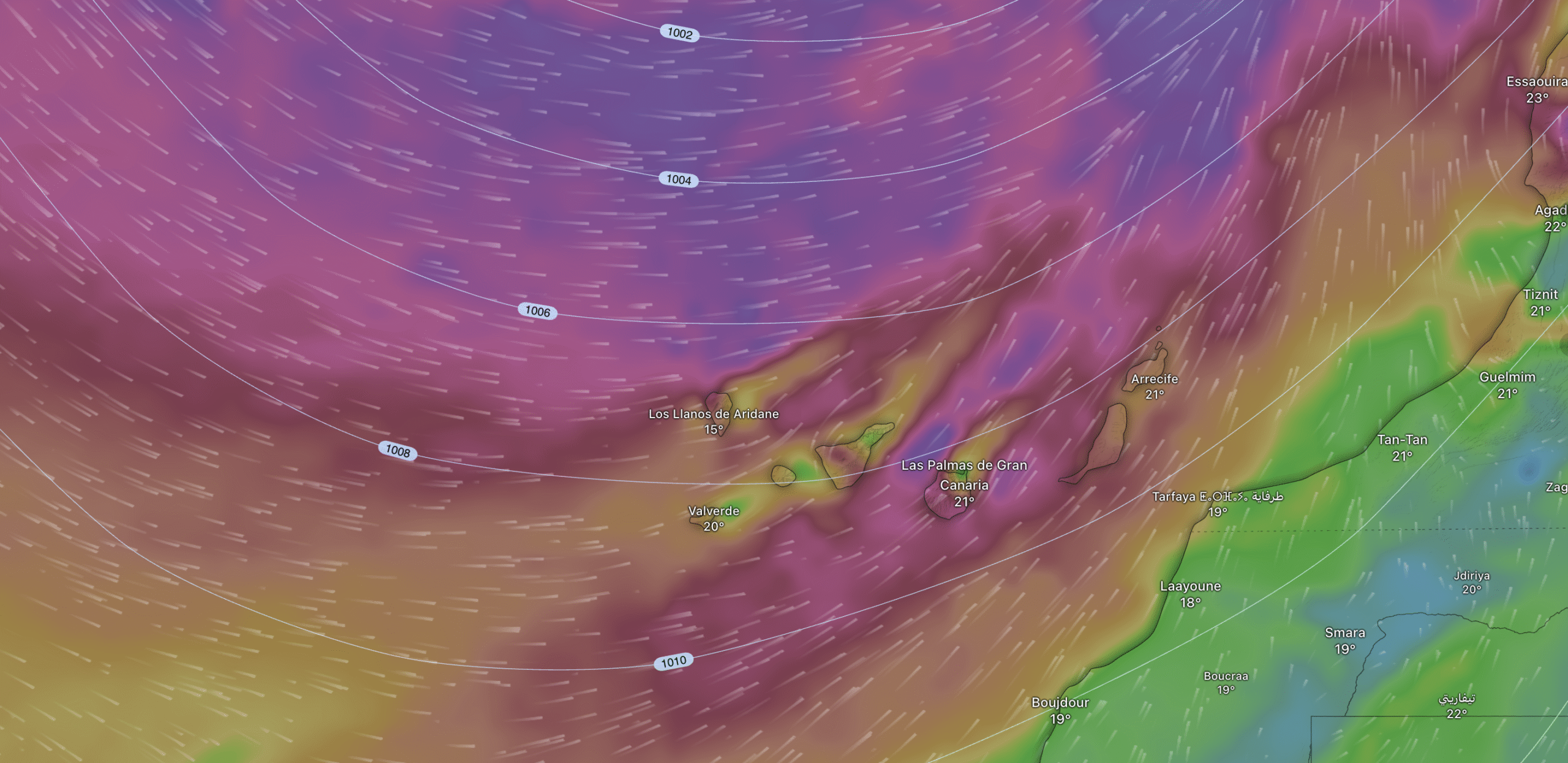
Storm Claudia is a deep Atlantic low situated northwest of the Iberian Peninsula, expected to remain stationary. Its frontal systems will reach the Canaries from Wednesday to Thursday.
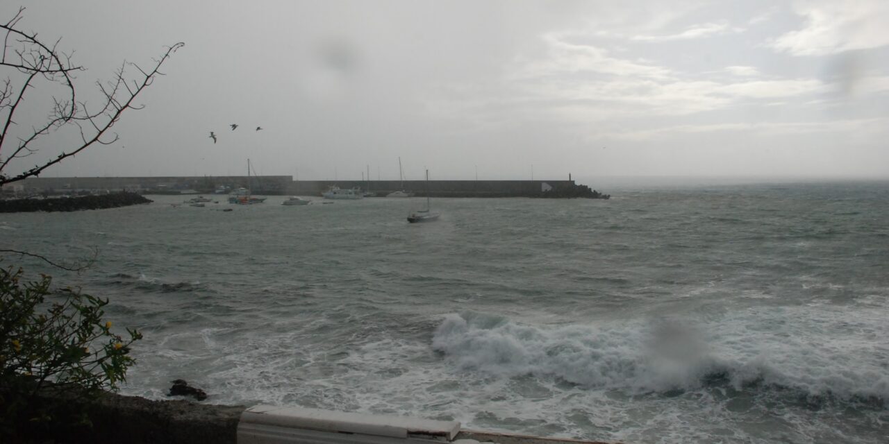
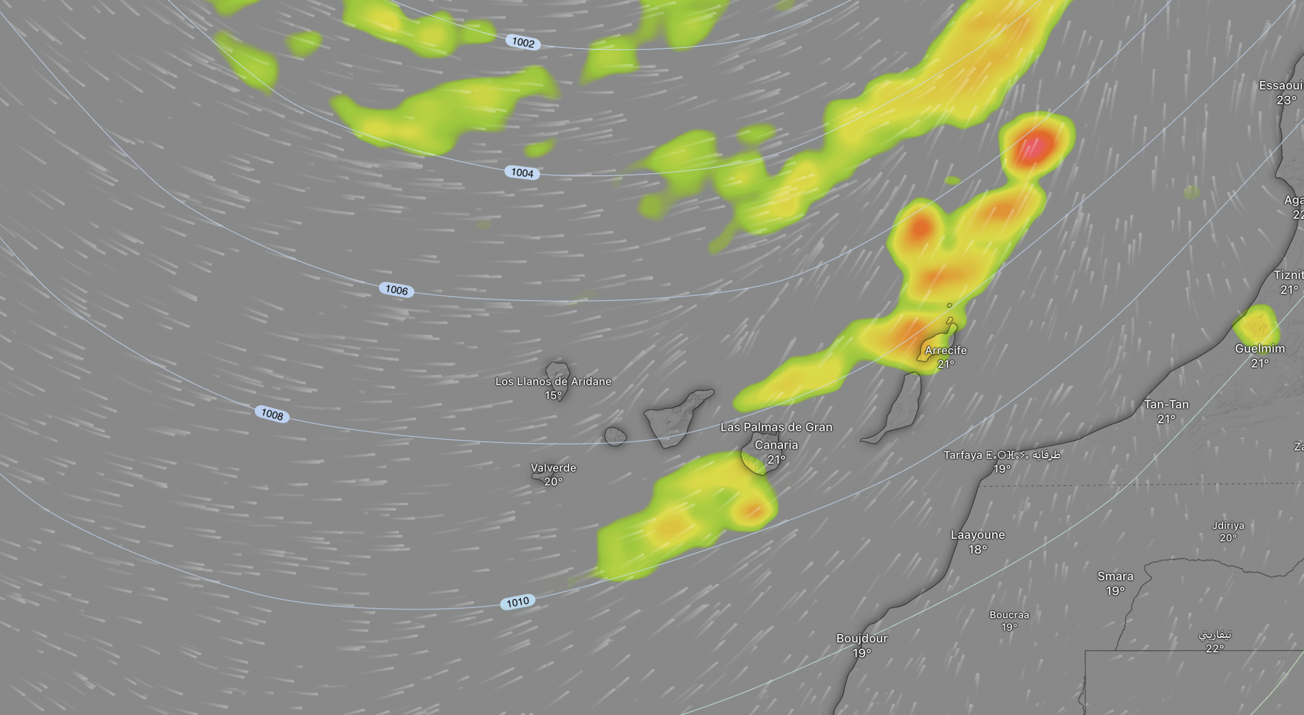
AEMET’s latest special report confirms that the weather will deteriorate rapidly from Wednesday. The first frontal systems associated with Claudia will strike La Palma and the rest of the western islands, where rainfall could top 100 litres per square meter in just twelve hours. Showers and thunderstorms will sweep from west to east, intensifying on southwest-facing slopes and in mountainous areas, with wind gusts expected to bring down branches, trees, and precarious structures. Coastal disturbances and storm surges are anticipated along exposed shores, threatening ports and beach promenades.
Very heavy, persistent rain and thunderstorms are forecast for the western islands, especially on southwest-facing slopes. Risks include flash floods in ravines and local flooding.

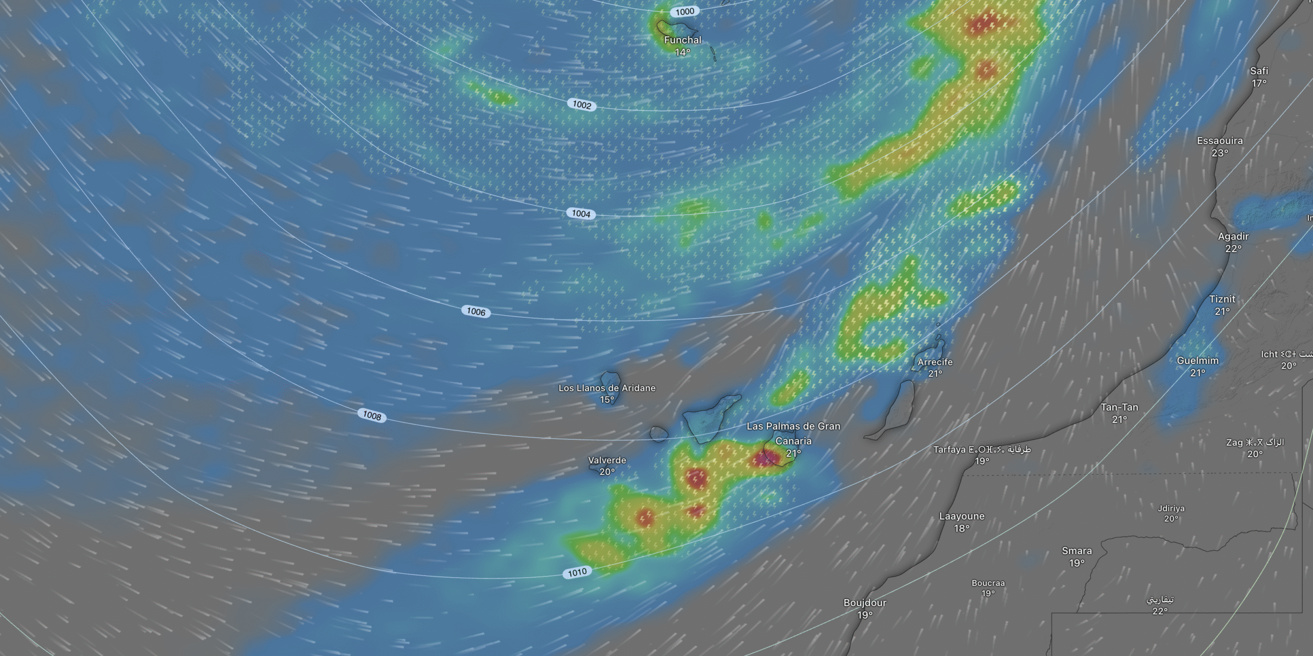
Wednesday will see the worst effects initially on La Palma, with torrential downpours expanding later to Tenerife and eventually to central and eastern islands. Gran Canaria’s south faces orange alerts for severe rainfall and storms, particularly from midnight through Thursday morning. Aemet has extended yellow warnings to Lanzarote and across other islands, forecasting episodes of damaging winds and sudden deluges, especially around ravines and low-lying areas.
Strong southwesterly winds will accompany the rain, with potential gusts capable of bringing down branches, trees, and unstable building elements. This may also provoke coastal disturbances, potentially affecting ports and promenades.
By Thursday, the front is expected to sweep eastward, bringing widespread instability but easing somewhat by evening as winds shift and moderate. Authorities urge residents to remain vigilant, especially in high-risk locations like El Paso and Garafía (La Palma), and southern slopes of Gran Canaria, where the risk of flooding and road disruption is highest. Similar weather impacts are projected for exposed regions on the Spanish mainland later in the week.
Wednesday: Instability increases in northwestern Canaries, especially affecting La Palma, which may see very heavy showers and thunderstorms, then extending to other western islands. The strongest winds will be from midday, notably in mountainous and mid-altitude zones.
Thursday: The frontal system sweeps east across the archipelago, bringing strong and very strong stormy showers to central islands early, then moderate but occasionally strong rainfall to eastern islands as the day advances. Winds will shift westerly and are expected to ease by evening.
Aemet warns that forecasts may be updated as conditions evolve, and all residents and visitors are advised to follow official instructions and prepare for potentially hazardous weather through Thursday.
Gran Canaria: Orange alerts are activated for southern areas due to high rainfall and risk of storms, specifically from Thursday midnight until noon.