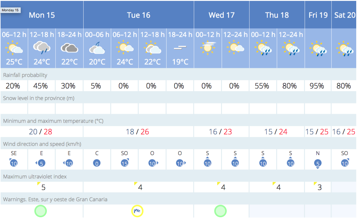
The Spanish State Meteorological Agency (AEMET) has issued a yellow warning for Gran Canaria, Tenerife, La Gomera, and El Hierro, escalating to an orange warning for the entire island of La Palma and the north of Tenerife. These warnings are due to a weather phenomenon causing strong winds, reaching up to 90 kilometers per hour, particularly affecting La Palma and the high areas of Tenerife with gusts possibly exceeding 100 kilometers per hour. Gran Canaria will experience winds of up to 70 kilometers per hour, primarily affecting the peaks and northwest and eastern slopes of the island. The alerts will begin in the early hours of the morning in the eastern province islands and from 06:00 hours in Gran Canaria.
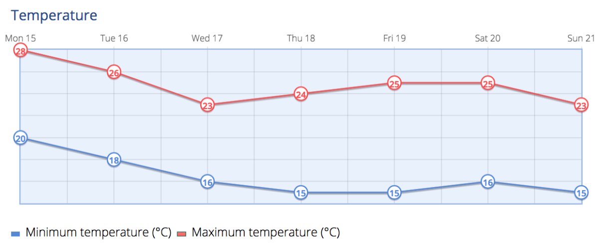
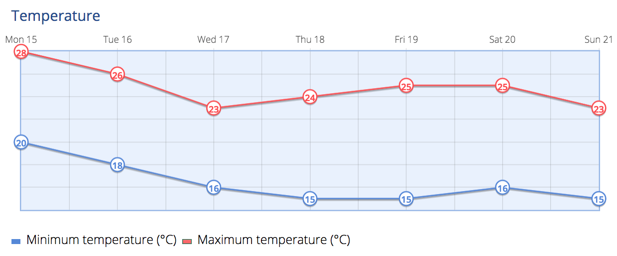
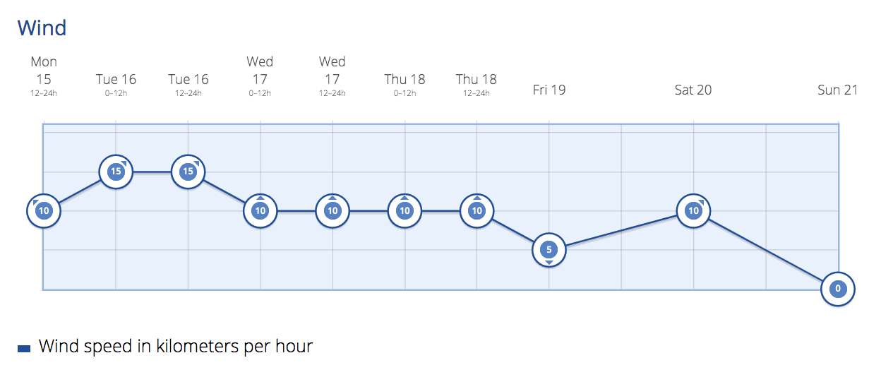
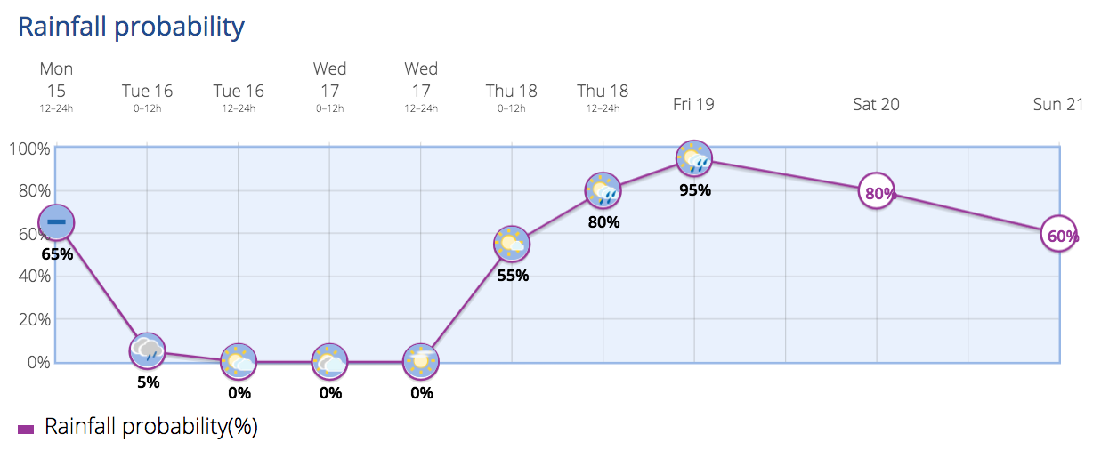
Partly cloudy skies with intervals of high clouds, transitioning to intervals of medium and high clouds start the week this Monday. There is a low chance of light, occasional, and scattered rain. Light calima is expected, which should diminish later. Temperatures will remain stable, with slight to moderate increases on the northern slopes, especially in maximum temperatures. Winds will be light to moderate from the south, occasionally strong on the peaks towards the end of the day.
Tuesday Expect intervals of medium and high clouds, becoming cloudier in the west and south from noon, and partly cloudy with intervals of high clouds elsewhere. There’s a chance of occasional light precipitation, especially in the southwest. Temperatures will see a slight to moderate decrease inland and in the west, with little change in other areas. Winds will be light to moderate from the south, turning southwest from noon. Strong southwestern winds are expected in the midlands and peaks, turning west by the end, with very strong gusts possible in the morning and afternoon, particularly affecting the northwest and eastern slopes.

Wednesday The forecast calls for cloudy intervals, becoming overcast in the afternoon on the eastern and northeastern slopes of the mountainous islands. Occasional light precipitation is expected, especially on the western slopes in the first half of the day and on the eastern and northeastern slopes in the afternoon, where showers cannot be ruled out. Temperatures will see a slight to moderate decrease. Winds will be light to moderate from the west, with strong intervals on the peaks, especially overnight.
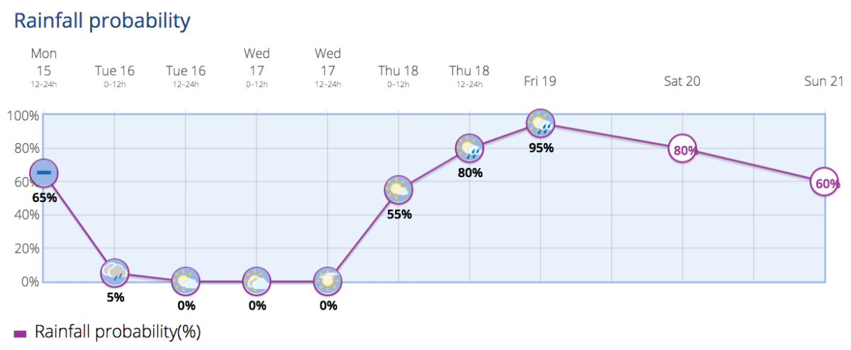
Thursday Expect cloudy intervals overnight, becoming overcast from the morning from west to east across the archipelago, with generally moderate precipitation, which could be strong or frequent, especially in the west and south of the western islands. Temperatures will continue to moderately decrease. Winds will be light to moderate from the southwest, increasing in intensity in the midlands and high areas, and moderate to strong on the peaks.
Friday and the Weekend Unstable weather is expected with likely cloudy skies and rain, more abundant in the north of the islands, and less likely in the south. The forecast suggests cloudy skies with possible light precipitation in the north of the archipelago and cloudy intervals in the south.