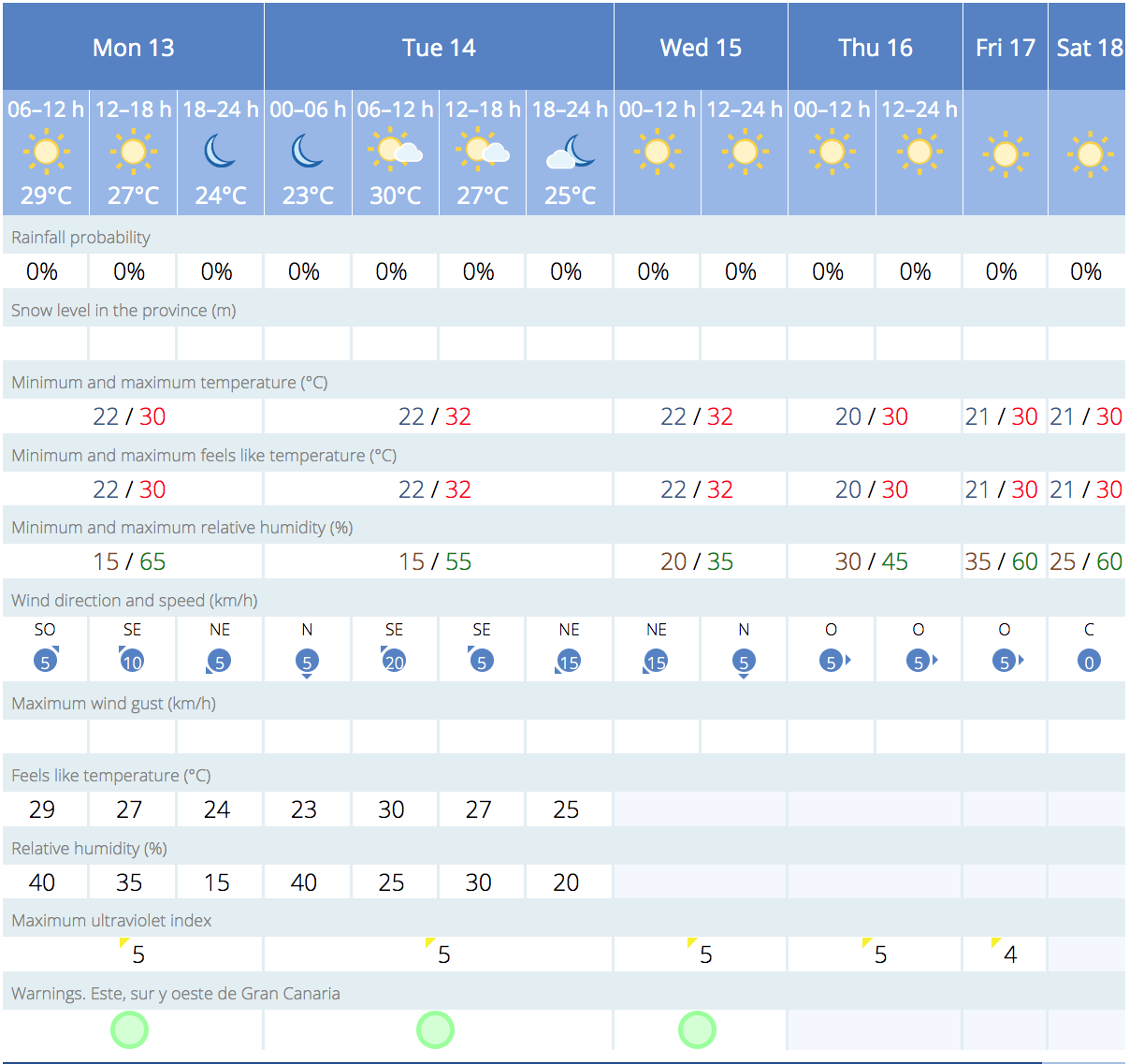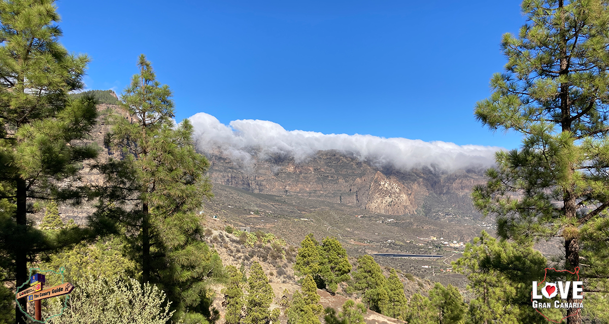
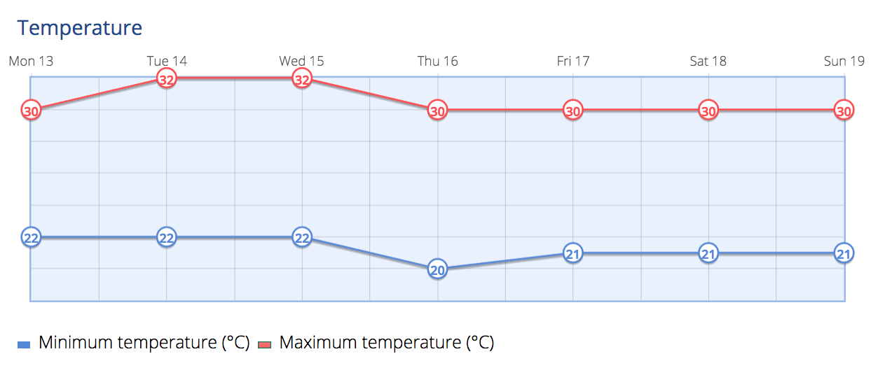
This week on Gran Canaria a return of warmer temperatures and clear skies, according to the latest forecast from the Spanish State Meteorological Agency, AEMET. This third week of November will bring a notable rise in temperatures, particularly for the southern regions and in the capital, Las Palmas.
|
----- Google provide a way for you to
|

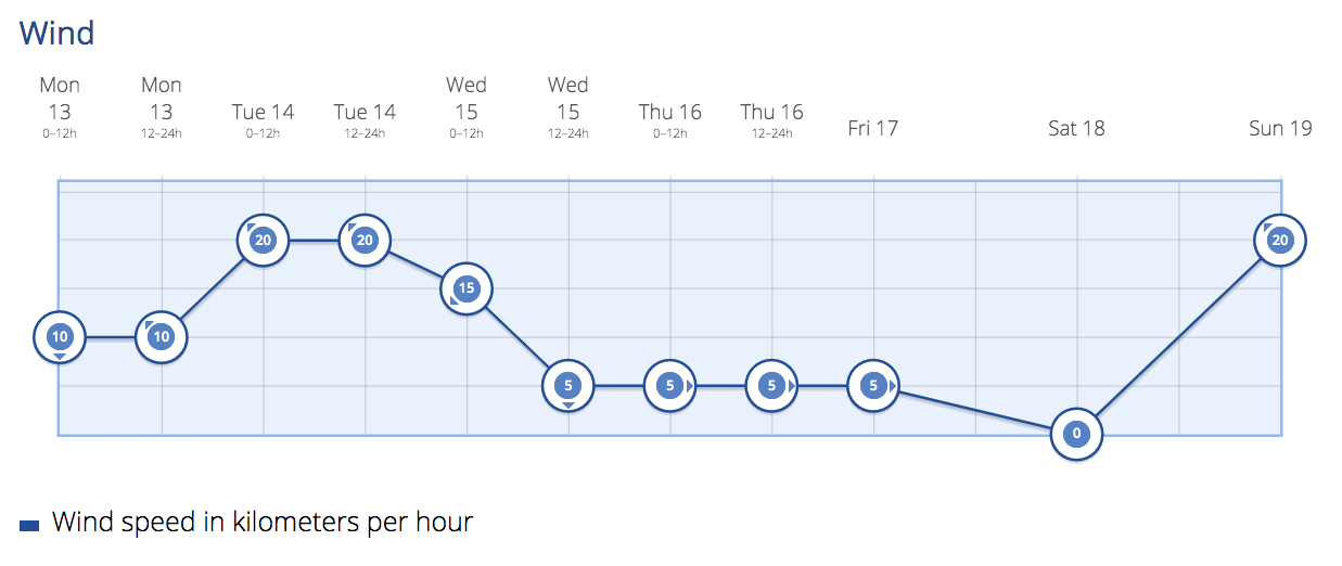
Expect a further temperature increases on Tuesday, with highs potentially reaching 32ºC, in the shade. Skies remaining mostly clear, with occasional high clouds and morning low clouds on the northern parts of the island. A light calima and east/northeast winds are expected to persist.

Similar conditions continue into Wednesday, with a gradual reduction in calima by the afternoon. Local temperatures may soar to 32ºC, in the shade, especially in the midlands and on the southern and western coasts.
South
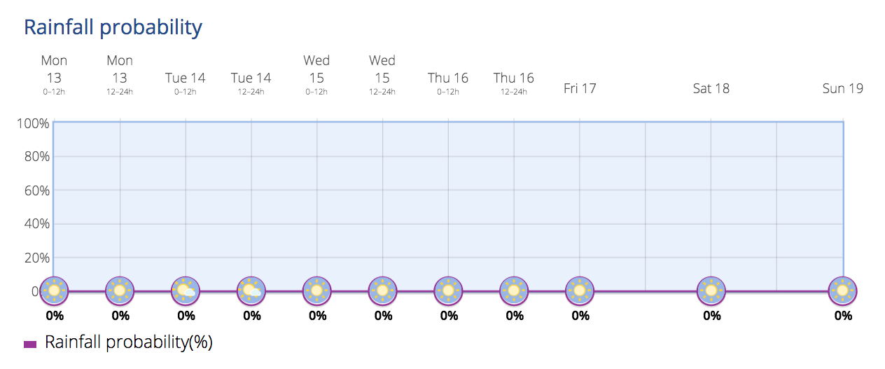
The touristed south of the island is expected to be mostly clear with some high clouds at times. Maximum temperatures should reach 29ºC in the shade, but will feel more like 31ºC due to 57% humidity. As ever temperatures in direct sunlight can be much higher. Gentle winds are anticipated, starting from the north at 4 km/h this morning and increasing to a southwest breeze of around 7 km/h by the afternoon. No rain is expected all week, and humidity levels will remain moderate at around 57%.
North
The weather up on the rugged north coastline and in the capital, Las Palmas de Gran Canaria, is expected to be cloudy throughout the day, with high cloud expected by the afternoon. Maximum temperatures forecast at around 24ºC, with minimums of 20ºC. Humidity levels will range from 59% to 86%, influencing the perceived temperature, which will feel cooler. No rain is expected at all this week, with a 0% chance of rain predicted. North winds at a maximum speed of around 27 km/h are forecast, strongest in the early morning and gradually decreasing throughout the day.
Seasonal Averages
The forecasted temperatures for the week ahead indicate a notable departure from expected seasonal averages. Traditionally, this period sees milder temperatures, but the week ahead will bring a temporary return to warmer conditions, in what many are expecting to be the warmest autumn, and perhaps year, in more than 60 years of records. Residents are advised to be prepared for the unseasonably high temperatures, especially on the south of the island.
As Gran Canaria experiences this brief spell of warmer weather, it’s wise for residents to stay informed about the evolving conditions and take necessary precautions, while most tourists will be treated to temperatures more usual in the early summer and late spring. The Spanish State Meteorological Agency AEMET continue to monitor weather patterns.