Gran Canaria, Canary Islands — After an unprecedented heatwave since the beginning of October, the Canary Islands are now poised for a dramatic shift in weather conditions. According to the Spanish State Meteorological Agency (AEMET), with a rain front set to move across the archipelago, accompanied by a substantial drop in temperatures.
⚠️ Temporal atlántico con precipitaciones y vientos
intensos. 🌧 🌬
Durante la próxima semana, la llegada de borrascas atlánticas dará lugar a lluvias, sobre todo en la mitad occidental peninsular, y vientos fuertes.
Actualizamos nota informativa.
👉 https://t.co/uk2kxCwxBx pic.twitter.com/XHz2HR0CmZ— AEMET (@AEMET_Esp) October 15, 2023
Rainfall to Begin Over La Palma
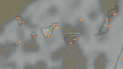
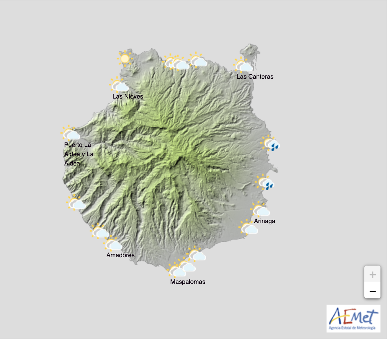
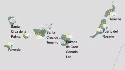
La Palma will be the first island to experience the onset of this rainy weather. The Atlantic front is expected to bring significant rainfall to La Palma island early on the morning of Friday, October 20. Following this, the rain will sweep from west to east, affecting particularly the northern and western parts of Gran Canaria, Tenerife, La Gomera, Fuerteventura, and Lanzarote.
National Weather Context
It’s worth noting that this changing weather will also have broader implications for mainland Spain. AEMET predicts an “unpleasant atmosphere” characterised by intense rain and strong winds across the Iberian peninsula.
Unprecedented Heatwave
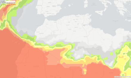
Prior to this significant change, the first two weeks of October 2023 has been recorded as the warmest for this time of the year since 1961, surpassing even the figures from 2017. Notably, the Canary Islands were especially affected by this anomalous heat.
Until October 9, 2023, this has been the warmest year on record, closely followed by 2022. The heatwave has been part of a wider trend of warming, with 183 records for warm days set in the past decade, compared to just 7 for cold days.
This shift to cooler, wetter weather is not just a relief for the Canary Islands but also significant for Spain as a whole, as an intense low-pressure system is expected to affect the Iberian Peninsula, bringing considerable rainfall.
Gran Canaria Weather Forecast: Changeable Conditions Persist into Next Week
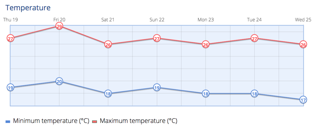
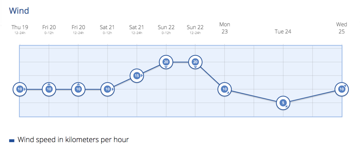
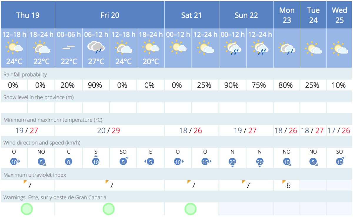
 Thursday: Partly cloudy skies, with clearer conditions in the south and west this afternoon. Temperatures largely remaining stable or showing slight declines, with minor increases along the eastern coasts. Light northwesterly winds picking up to moderate levels.
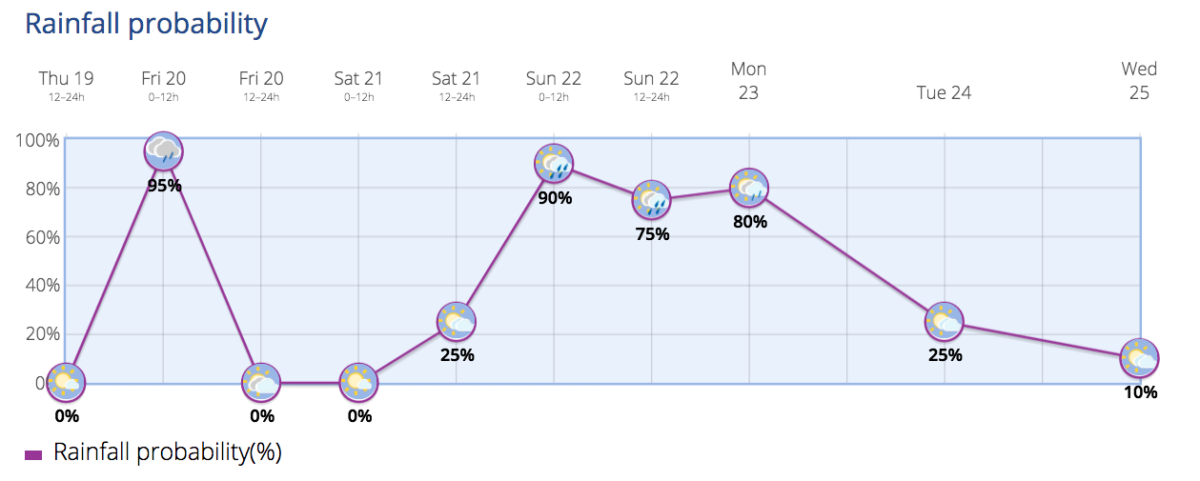
- Friday: Cloudy skies are forecast, accompanied by morning and early afternoon rain. In southern inland areas, rain is likely in the afternoon. Minimum temperatures are expected to remain the same or slightly rise in coastal areas, while maximum temperatures, especially at higher altitudes and on northern slopes, will show a slight decline. Moderate northerly winds will shift to the northwest in elevated regions.
- Saturday: Expect intermittent clouds and light rain, with conditions turning cloudier and rains becoming locally moderate by late afternoon in the southeastern highlands. Temperatures will be in slight decline, particularly in interior zones. Light winds from the west are expected.
- Sunday: General cloud cover will persist with occasional showers. Minimum temperatures are expected to stay the same or slightly rise, and maximum temperatures will either remain stable or decline slightly. Moderate northwesterly winds are anticipated.
Outlook for Next Week
- Early Next Week: There’s a likelihood of precipitation, especially in the islands with higher terrain, with moderate northerly winds. Temperatures are expected to increase, and a light trade wind pattern could be re-established.
- Long Range: Potential for rain continues in the larger islands, as temperatures gradually rise. Moderate trade winds are probable.
Overall Summary
This fluctuating weather pattern offers a mix of rain, variable temperatures, and shifting winds, affecting particularly the islands with higher elevations. Those in Gran Canaria and other Canary Islands should be prepared for these changes and stay updated on the latest forecasts, especially if planning any outdoor activities.
Based on forecasts and data from AEMET.


