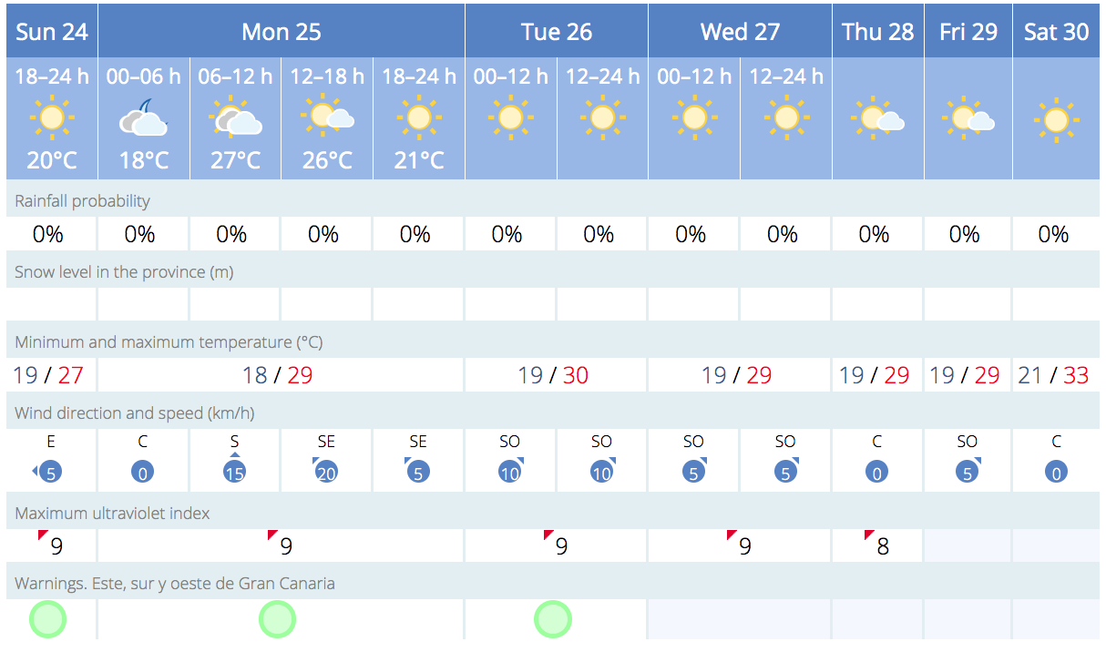
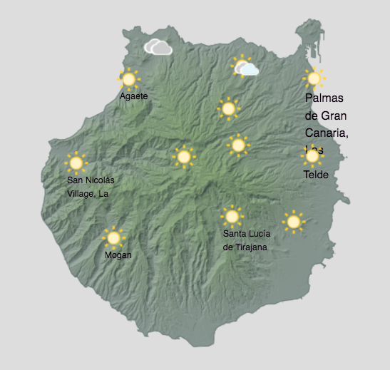
As Gran Canaria ushers in the first week of Autumn, a bit of a mixed bag in terms of weather, generally warm across the island in the mid to upper 20s, and characterised by some varying levels of cloudiness and steady temperatures.
|
----- Google provide a way for you to
|

This Week’s Temperature Outlook
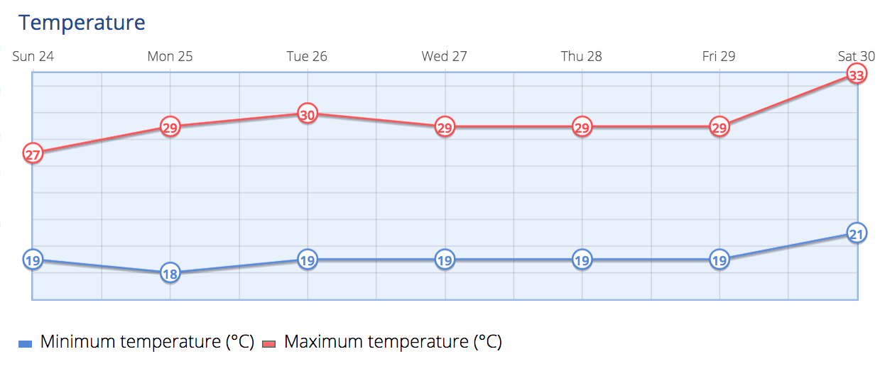
 Daytime temperatures are expected to hover around 28º to 29ºC in the shade on the south, although it will be considerably hotter when exposed to direct sunlight, rising into the mid 30s by next weekend. Nighttime conditions should remain relatively cooler, with thermometers showing around 18º or 19ºC, perhaps a couple of degrees lower on the rugged north coasts.
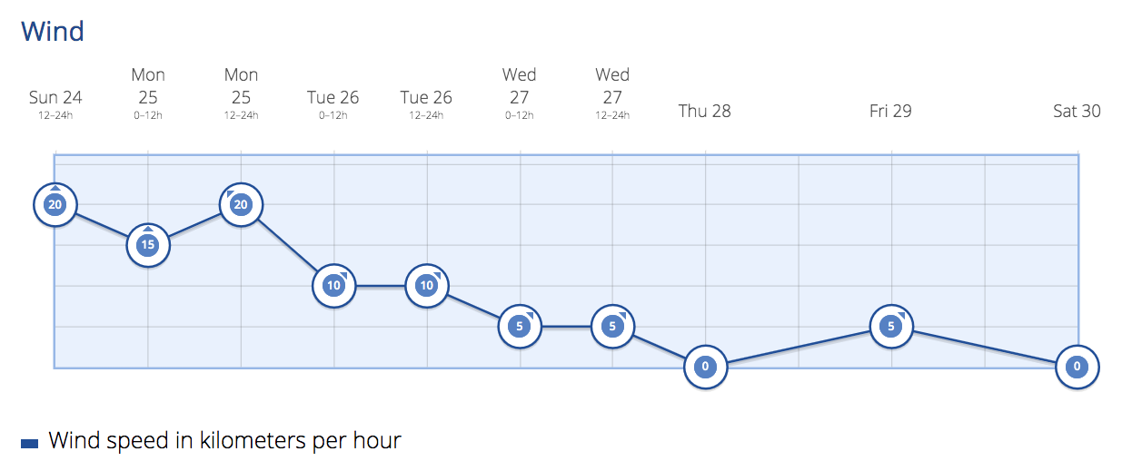
Monday saw some cloudy intervals, particularly in the afternoon, though skies were largely clear, light cloud cover and occasional high clouds did make an appearance. Winds blew moderately from the northeast and picked up in intensity towards the southeastern and extreme western areas in the latter half of the day. Summit areas experienced weaker winds, predominantly coming from the north, and southwest coasts were breezy.
Tuesday

Tuesday’s forecast largely mirrors Monday, with cloudy skies in the north during the morning hours making way for clearer skies by midday. The rest of the island should expect minimal cloudiness. Winds will continue to blow moderately from the northeast and may become stronger along the southeastern slope and extreme west. On the summits, winds will be variable in direction.
Wednesday
By Wednesday, occasional high clouds are expected across the island. No significant changes in temperature are forecast, though a slight decrease in the midlands is possible. Moderate winds will continue, especially along the northwest and southeast slopes, intensifying more likely during the afternoon.
Thursday
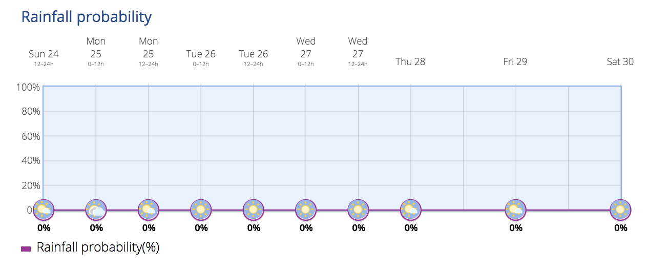
Thursday will start off with fewer clouds, although high cloudiness may develop in the second half of the day. A low probability of light and sporadic rain is forecast for the northern parts of the island. Winds will maintain a moderate pace from the northeast, with occasional strong gusts more likely during the afternoon on the northwest and southeast slopes.
Friday and Weekend Preview
Friday will bring cloudy intervals to the north and perhaps some isolated rainfall in mountainous regions. The southern parts of the island will see less cloud cover. As the weekend approaches, temperatures are expected to rise once more.
Whether you’re planning outdoor activities or just going about your daily routine, keep an umbrella and sunglasses handy to adapt to the changing conditions.