According to Spanish Language Daily, La Provincia, a DANA (isolated high-level cold front) is expected to reach peninsular Spain this Friday, September 1st, bringing rain and a noticeable drop in temperatures over the weekend. Maximum day time temperatures in many northern and inland regions of the country will not exceed 25ºC due to atmospheric instability. The arrival of this DANA marks the beginning of meteorological autumn, say meteorologists.
|
----- Google provide a way for you to
|

Meteorologists have outlined two possible scenarios. Firstly, the front could move down the western part of the mainland, covering an area from the Atlantic coast of Portugal to the Spanish border, possibly reaching the Gulf of Cádiz before stalling, the heaviest rainfall would occur in the Mediterranean and inland areas of the iberian peninsula, with bands of rain advancing from south to north or from southeast to northeast. The current forecast leans towards this scenario, anticipating heavy rain from late Sunday to early Monday across the mainland.
Canary Islands Mostly Unaffected
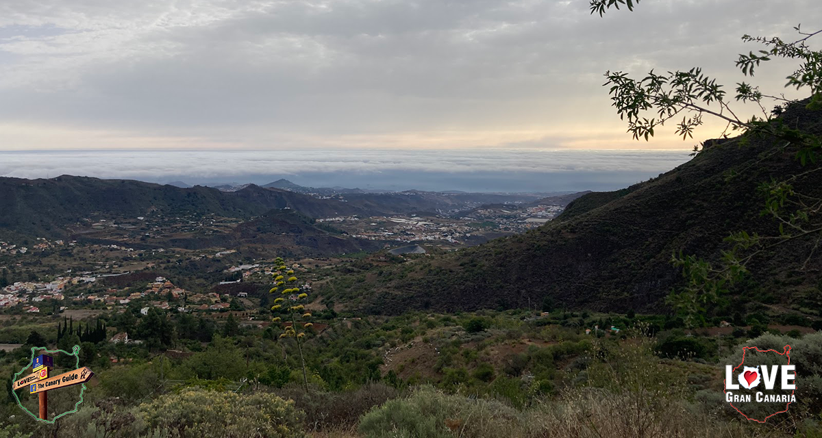
Here on the Canary Islands, while this DANA might not directly impact the archipelago, we won’t be entirely spared from rainfall. The Spanish State Meteorological Agency (AEMET) predicts a cloudy Saturday across the northern, mountainous parts of the island, with rain possible, especially in the early hours of Sunday and into Monday, September 4th.

This is an “El Niño” year, so weather patterns can be a little different from what is usually expected for the time of year. Climate events can appear to be amplified. Meterologists are expecting a warmer than usual Autumn, which could well lead to increased rainfall. Whichever way you look at it, all the warning signs are that Summer is about to start giving way to Autumn, with temperatures beginning to drop and more rainfall, though here on the islands the majority of our wet weather is usually expected around November, and even then it hardly compares with mainland Europe, but when it rains it can get heavy quickly.
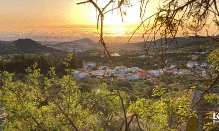
For now we still have a few good weeks of summer sunshine to go before our main sub-tropical winter season begins. While the sunny south of Gran Canaria will continue with bright blue skies, and hot beach days, the encroaching autumn then winter weather will bring with it the potential for rains too and the occasional north wind.
The AEMET Outlook For The Weekend Ahead
Thursday will be a little cloudy to the north with intervals of medium and high clouds, in the early and late hours of the day. Little change in temperatures, with daytime highs of up to 30ºC in the shade, cooler on the north of the island, and the nights dropping a little to around 19º or 20ºC. Moderate northeast wind occasionally strong on southeast and northwest slopes. Breezes on southwest coasts and variable light on summits.
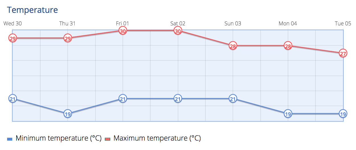
Cloudy skies on Friday, in the north there will be low cloud during the first half of the day and into the later hours. Temperatures with few changes in general, except for slight increases in minimum temperatures in inland areas. Moderate northeast wind, with strong intervals on southeast and northwest slopes; breezes all along the southwest coasts. On summits, weak variable winds from the north to northeast.
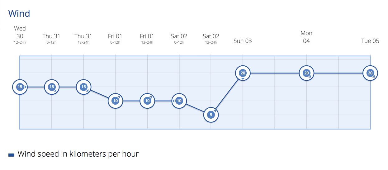
By Saturday there is likely to be more cloud around, with low cloud to the north. Temperatures unchanged or decreasing slightly. Northeasterly winds with strong intervals on the southeast and northwest slopes and a predominance of breezes along the southwest coasts. On the summits, the winds will blow from the northwest.
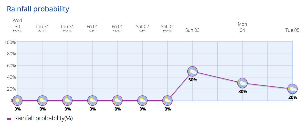
Into Sunday and cloudy skies on northern slopes with the added presence of high clouds at the beginning of the day. There is a probability of generally weak rains on the north side of the island, and though less likely, there could be occasional showers in some other areas. Temperatures in slight decline. Moderate winds from the north, with strong intervals on the summits and western and eastern slopes.
There could be some wet weather to start the week, next week, though it is still only 50/50 as to whether any of that will reach the south of the island, and across the archipelago, of course, we will get nothing like they are likely to see in mainland Spain and further north from which the “snowbirds” escape by flying down to see us for their winter sun.