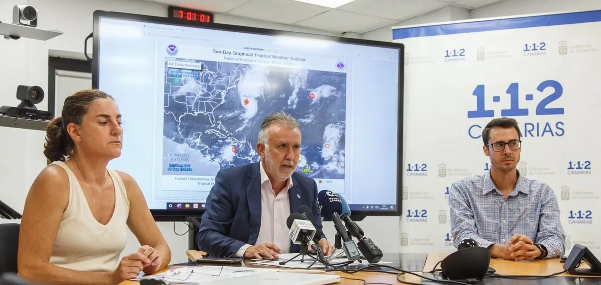
The president of the Canary Islands, Ángel Víctor Torres, this afternoon appealed for “prudence” and called for “self-protection and maximum precautions” during the weekend, in the face of what, he pointed out, “may be the most important rains in recent years ”. Torres announced that all activities are suspended from tonight and until the change from maximum alert. At this time, the forecasts highlight that the core of the cyclone will not touch the islands, but the meteorological phenomenon will leave significant rainfall in the Archipelago.
The Government of the Canary Islands has suspended school classes this coming Monday throughout the Canary Islands, as well as recommending the suspension of all activities and sporting events from the afternoon of Saturday, September 24, due to the imminent arrival of tropical cyclone Ten on the islands, that was subsequently upgraded to Tropical Storm Hermine.
Regional President Ángel Víctor Torres explained at a press conference, although the “core” of the cyclone is not expected to directly impact the archipelago, it will bring intense rains (probably the most intense in the last decade) and strong gusts of generalised wind, with serious effects in the islands of La Gomera , El Hierro, La Palma, Tenerife and Gran Canaria.
Torres appeared on Friday afternoon before the media to announce the measures adopted by the Government in the face of the imminent arrival of the meteorological phenomenon, after a meeting held with the island Cabildos in which he decreed a maximum alert for heavy rainfall, wind and floods from Friday night until Monday.
Together with emergency technicians, the president warned that “something unknown” is coming , so “you have to be prepared” for various situations. He recalled that tropical storm Delta affected the Canary Islands in 2005, which was more marked by strong winds more than by rains, as is expected to be the case with Storm Hermine, intense rains that could affect airports, although disruption to maritime transport is not foreseen.

Candles, lanterns and a radio
The highest intensity of the cyclone is expected for Sunday, which is expected to be “a complicated day”, as indicated by emergency technicians. Among the recommendations issued, they have alerted the population to have candles, flashlights and a battery powered radio on hand in the event of a power outage.
Likewise, they have recalled the importance of not making trips that are not strictly necessary, especially avoiding travelling or crossing where water is flowing, to avoid unnecessary tragedies. In this type of situation “Firefighters are here to bail out water and not to rescue people” he recalled.
Deputy director of Civil Protection, Marta Moreno, recalled the importance of putting self-protection recommendations into practice and asked people “not to rely on us.” Moreno insisted that Sunday will be a complicated day, with heavy rains and possible flooding, and that it is necessary to anticipate and take civil protection measures on Saturday. In that sense, she pointed out the importance of keeping roofs and gutters clean, removing from balconies and facades any object that could fall.