The July summer heat is expected to continue for another few days here in The Canary Islands with the ECMWF European weather forecasting models predicting a day of intense heat this Tuesday that looks set to affect all the islands. Temperatures on Monday were already stifling, especially on Gran Canaria, and the south of Tenerife and Fuerteventura, and this Tuesday the thermometers will continue to rise in many places throughout the archipelago.
The General Directorate of Security and Emergencies have updated their alert for maximum temperatures on Gran Canaria and extended it to Tenerife, La Gomera and El Hierro as well, effective as of 10:00 a.m. on Tuesday, July 26.
According to Spanish State Meteorological Agency, AEMET, the heatwave affecting the archipelago will continue, and on the islands where the alert has been declared, maximum temperatures are expected to reach and even exceed 38ºC in the shade, as ever much hotter in direct sunlight.

It will be hotter in the interior, inland areas and higher altitude areas of the southern half of the islands, and could intensely affect some sectors on the southeast coast of Gran Canaria.
AEMET have modified their advisory warnings for adverse phenomena on the Canary Islands for this Tuesday, July 26. There will be an orange warning for maximum temperatures, expected to reach up to around 38ºC in the shade, focused primarily on highland and inland areas and on the southeast coast of Gran Canaria. This threshold may be exceeded in some places. There is also an orange warning for temperatures of around 37ºC on La Gomera, El Hierro and the south, east, west and metropolitan areas of Tenerife.
The north of Gran Canaria maintains a yellow advisory warning, with maximums of 34ºC. The south coast could hit 40ºC
One of the hottest places in Spain
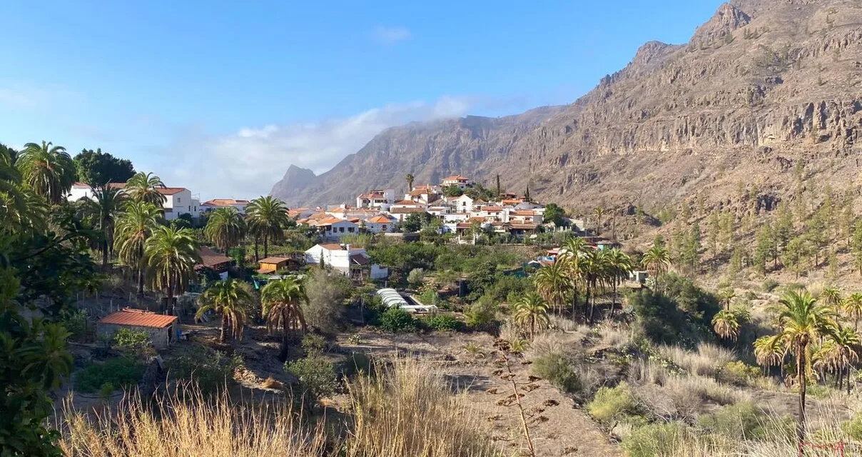
Thermometers on Gran Canaria reached 45ºC on Monday in Tasarte, during the afternoon, on the west of the island, recording the fourth highest temperature in all Spain, surpassed only by three Murcian municipalities, on the mainland, where the mercury added a few tenths more. This trend may be repeated today, according to AEMET forecasts with an orange alert for high temperatures across a large part of the island.
 Other parts of Gran Canaria’s south-facing midlands also saw temperatures exceeding 40º Celsius in several cases, including in Agüimes, where they reached 43.2ºC, and in San Bartolomé de Tirajana reaching 41.7. In Telde, the temperatures were similar, as they were in Tejeda, in the central heartlands of the summit areas. The capital, saw cooler temperatures due to the usual summer Panza de Burro (Belly of the Donkey, mottled cloud cover), registering temperatures of around 30ºC this Monday, also seeing some Calima haze.
The situation this Tuesday puts all the islands at some risk due to high temperatures, as well as adverse coastal phenomena. Gran Canaria will once again see the worst of the temperatures with an Orange Advisory Warning (serious risk), with the potential to exceed 38ºC inland, in high areas and on the southeast coasts, while across the rest of the island, a yellow advisory is in place, with temperatures expected to reach 36ºC in the shade.

Forecast temperatures for Tuesday METEORED

AEMET forecasts the skies will start slightly cloudy this Tuesday on the north, elsewhere clear, although there will be a little cloud travelling down the east coast during the first half of the day. The Calima will continue, especially at high altitudes, with minimum night time temperatures looking to continue practically the same as yesterdays.
Maximum temperatures are expected to rise, and the winds will be from the northeast, with greater intensity on the northwest and southeast slopes of the island. Its intensity will increase throughout the day, until the afternoon, when there could be some very strong gusts. The summits of the island will see easterly winds, while the west coasts should enjoy fairly light breezes.
Slightly cloudy or clear skies, except for some medium and high cloudiness during the first half of the day. Slight haze in height. Minimum temperatures in slight to moderate rise, especially in inland areas of the southern half, where they may locally exceed 30 ºC. Highs with few changes or slightly rising, reaching 32 – 34 ºC in a general way, except on the northern coasts. In large inland areas and on the southeast coast temperatures may exceed 35 – 37 ºC, and in the midlands of the south and west 40 ºC will be reached locally. Northeast winds, with strong intervals on the northwest and southeast slopes, especially during the early morning and at the end of the day, when there could be very strong gusts. On summits, easterly component wind occasionally more intense. Breezes off the southwest coast.

Wednesday will start with cloudy skies in the north once again, tending to cloudy intervals during the central hours. Elsewhere some cloudy intervals are possible, clearing up by noon. There is a low probability of some occasional drizzle on the north of the islands by the end of the day. Temperatures should start to fall, notably in inland areas. Northeast winds with strong intervals, especially during the early morning in areas exposed to the trade winds, where occasional gusts are expected that could exceed 70 km/h.
To the north cloudy skies with some likelihood of occasional drizzle early Thursday morning, tending toward cloudy intervals for the afternoon. Elsewhere across the island, slight cloud or generally clear from the start of the day, some cloudy intervals a possible during the first half of the day. Light Calima may still be hanging over the eastern islands during the afternoon. Temperatures will be slightly lower and see few changes through the day. Northeast winds, with some strong intervals expected, especially in areas exposed to the trade winds, where occasional gusts could exceed 70 km/h.

As we move towards the weekend the Canary Islands there will see some cloudy intervals on the north of the islands, some weak and scattered rain is possible, while slightly cloudy skies across the rest of the archipelago look likely.