Increasing temperatures and high altitude cloud have predominated this Saturday in the Canary Islands archipelago, supplemented to the east by a light Calima blanketing the islands in dust from the Sahara, travelling at altitude, but causing maximum temperatures to rise still further and expected to spread to all the islands as the weekend wears on.
|
----- Google provide a way for you to
|


At sea, northeasterly moderate winds, of force 4 or 5 (11-21kts or 20-38km/h), increasing to stronger, force 6 (22-27kts or 39-49km/h), further offshore, have met the coastlines with occasional gusts to the northwest and southeast as the afternoon has progressed. An increasingly strong offshore swell has arrived all along the northwest and southeast as we have moved through the afternoon.
On the northeast coast, and in the capital Las Palmas de Gran Canaria, light winds have varied between force 1 to 3 (between 2 & 9 kts or 3 to 16km/h), bringing some swell with it too. On the west coast, variable light winds of force 1 to 3, with frequent breezes, and waves of 1 to 2 meters.

A prevalence of high cloud has been accompanied by intervals of low cloud on the north coast, along with a light Calima haze, affecting inland areas facing east, at higher altitudes. Temperatures have continued to rise, inland and towards the summits where minimum nighttime temperatures are likely to ascend in some areas. On the coasts, generally moderate northeast winds, have been more intense on the extreme northwest and southeastern slopes with very occasional strong gusts. Breezes have remained all along the north and southwest coasts, with maximum temperatures reaching up towards 27ºC in the shade, inland, and more like 29ºC on the coasts; as ever much warmer in direct sunlight

Saturday’s forecast nighttime (min) and daytime (max) temperatures (in the shade):

17º – 24ºC Las Palmas de Gran Canaria
18º – 28ºC Maspalomas & Playa del Inglés
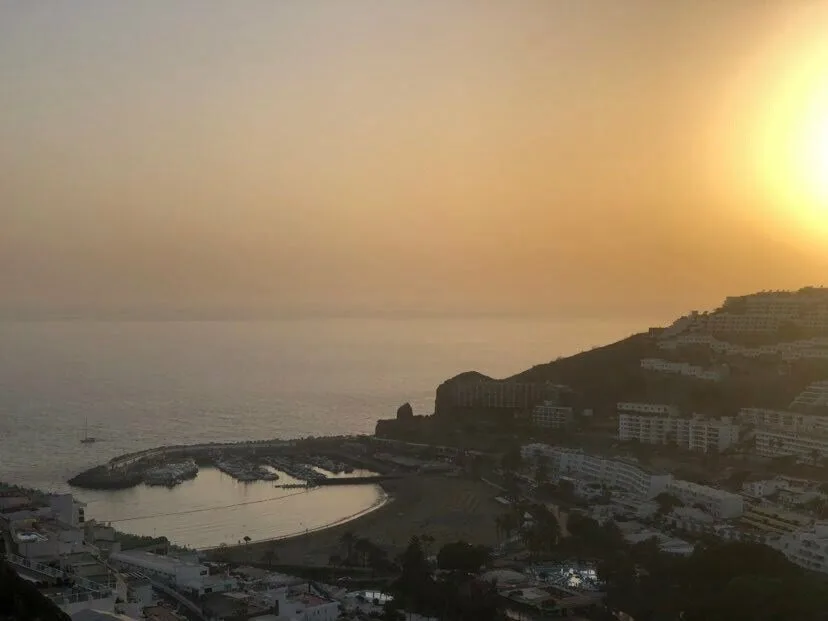
18º – 29ºC Puerto Rico de Gran Canaria
-

- Beaches – Amadores-Puerto Rico de Gran Canaria (Mogán)

-

- Beaches – Maspalomas-Playa del Inglés (SBT)

-
- Beaches – Las Canteras (Las Palmas de Gran Canaria)

-

- Beaches – Las Nieves (Agaete)
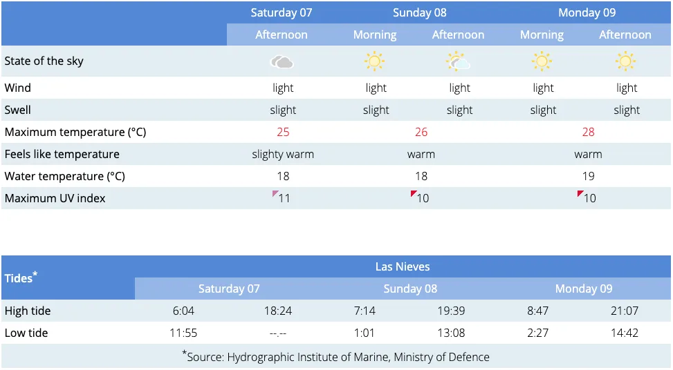

Image: Courtesy of Nasa’s Terra MODIS, taken this afternoon
The Saharan dust in suspension is expected to continue to spread across all the islands, as we move through the weekend. Temperatures will continue to climb, towards a predicted peak on Tuesday, as ever, on the south of Gran Canaria. All in all there is some splendid weather ahead, a touch on the hot side for some, with Calima expected to be light.
This Sunday the rising temperatures will be further accentuated in an upward trend, hitting 31ºC, in the shade, with few clouds, if any, and a fairly calm ocean around the entire archipelago, the early summertime weather looks set to continue as we head into a new week, exceeding 32ºC on Monday, giving rise to a yellow advisory warning for high temperatures, and forecast to hit 35º by Tuesday with high-pressure and blue skies set to remain, at least until the middle of the week, when a changing trend is expected. From Wednesday things should start to cool off once again throughout the archipelago, with the long-range forecast predicting a return to highs of around 30ºC by the end of the week.
Look after yourselves, and each other, and if you are out and partying this week, take extra care to avoid awkward situations in unknown places, should you happen to overindulge while enjoying the daytime and nighttime pleasures on offer.