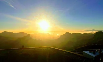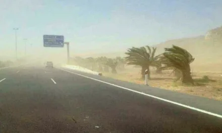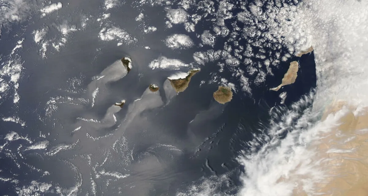
The stable blue skies and warm weather across the Canary Islands this weekend has given way to an incoming African desert calima expected from Tuesday, June 8. The desert sands and dust are to be accompanied by our first real heatwave of this season in the archipelago, according to forecasts from the Spanish State Meteorological Agency (AEMET), the effects of which will last several days starting to soften by the coming weekend, giving way to clearer blue skies once more. In the meantime expect maximum UV index exposure levels hitting 12 and 13 all week long.
|
----- Google provide a way for you to
|


 AEMET have activated a yellow advisory warning (denoting some risk) in the Canary Islands from Wednesday, June 9, with high temperatures expected to exceed 38ºC in the shade on the southwestern coasts of Gran Canaria, much hotter in direct sunlight, accompanied by rough seas along several coasts, though most of the winds are reduced to breezes in the lee of the island, in places like Puerto Rico de Gran Canaria.
It’s going to get very hot this week with maximums on Tenerife potentially reaching 34ºC, in Arona, and Gran Canaria’s Costa Mogán climbing towards 40ºC.
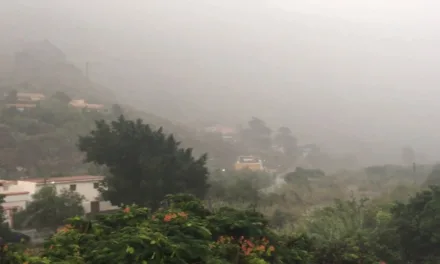
Cloudy skies on Tuesday with some medium and high cloud cover, along with some low cloud over the northern lowlands are expected during the first half of the day, then returning in the late hours. A higher altitude calima will directly affect summits. Rising temperatures, likely to be more noticeable in inland areas. Southern midland mountain areas could hit 34ºC locally. Northeast trade winds predominate all week, felt more strongly on southeast and northwest slopes, as well as down the western coasts, especially during the second half of the day when saharan dust is expected to start arriving, perhaps pushing some week rainfall ahead of it. At the summits, winds from the west tending to blow from the north with strong intervals. Occasionally blustery breezes on the north, south and southwest coasts.
Tuesday’s TEMPERATURES on Gran Canaria:
Las Palmas de Gran Canaria 19° night time to 25°C daytime in the shade
Puerto Rico de Gran Canaria 17º night time rising to 32ºC in the shade of daytime
Maspalomas/Playa del Inglés 16º night time rising to 33ºC in the shade of daytime
More cloudy skies persist into Wednesday with medium and high cloud cover, bunching up particularly on the north coasts, where intervals of low clouds are expected in the early and later hours of the day. Calima at height will start to become evident, mainly affecting mountain peaks. Temperatures rising, hitting maximums in coastal areas and minimums inland may be notable. Exceeding 34ºC on southern slopes, as well as the west and southeast, and in the northern midlands. Inland areas will see maximum’s in the shade of 37ºC and minimums not dropping below 26-27ºC. Northeasterly trade winds, will blow strongly from first thing on northwestern and southeastern peaks and slopes, and as the morning progresses strong intervals will most likely be restricted to the extreme southeast and northwest. Breezes will predominate on the north and southwest coasts.

Wednesday’s TEMPERATURES on Gran Canaria:
Las Palmas de Gran Canaria 22° night time to 28°C daytime in the shade
Puerto Rico de Gran Canaria 24º night time rising to 38ºC in the shade of daytime
Maspalomas/Playa del Inglés 22º night time rising to 37ºC in the shade of daytime
By Thursday medium and high cloudy intervals, more significant on the eastern isles, tending to decrease during the second half of the day. Minimum temperatures are expected to rise ever so slightly with maximum temperatures on the westernmost islands either maintained or declining slightly. Loose breezes to moderate north and northeast winds will continue.
Thursday’s TEMPERATURES on Gran Canaria:
Las Palmas de Gran Canaria 23° night time to 28°C daytime in the shade
Puerto Rico de Gran Canaria 26º night time rising to 37ºC in the shade of daytime
Maspalomas/Playa del Inglés 25º night time rising to 38ºC in the shade of daytime
Occasional cloudy intervals could well continue into Friday, particularly on the north face coasts and slopes. They day will tend toward cloudy intervals in the northern lowlands of the western isles by the end of the day. Temperatures continuing to decrease slowly from their peak. Northeast winds, with strong intervals in the extreme southeast and northwest.
Friday’s TEMPERATURES on Gran Canaria:
Las Palmas de Gran Canaria 23° night time to 28°C daytime in the shade
Puerto Rico de Gran Canaria 26º night time rising to 36ºC in the shade of daytime
Maspalomas/Playa del Inglés 24º night time rising to 36ºC in the shade of daytime
Temperatures starting to become more bearable as we head into the weekend, with skies clearing too it looks destined to be a hot one.