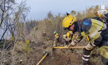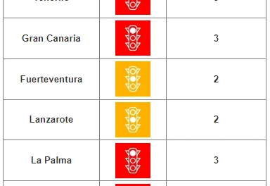
The Canary Islands General Directorate of Security and Emergencies declared a state of pre-alert yesterday in anticipation of Calima affecting Fuerteventura, Lanzarote, Gran Canaria, Tenerife and La Gomera. A yellow advisory was already in place for winds expected to gust to more than 70kmph for Thursday.
|
----- Google provide a way for you to
|
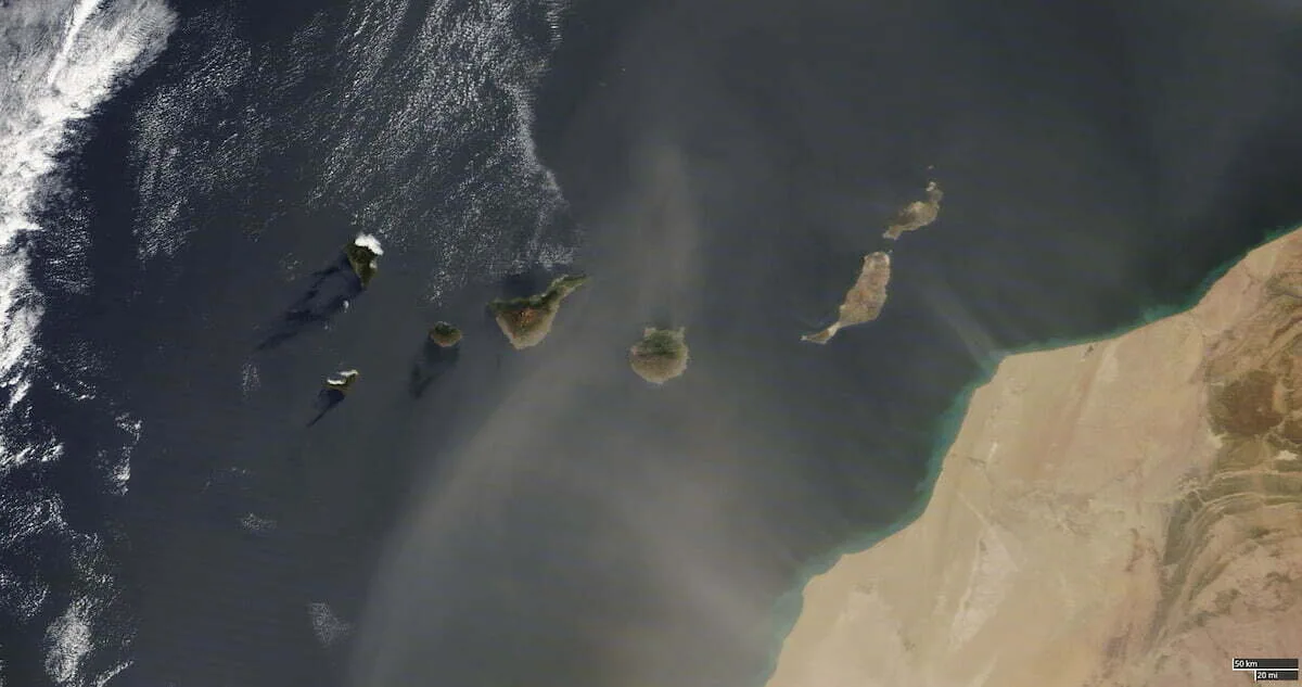
After a warm night of occasional howling winds, Gran Canaria awoke on Thursday morning to temperatures exceeding 28ºC in the shade, higher in direct sunlight, and Saharan dust suspended in the air, blanketing particularly the eastern islands and trapping warm air close to the ground, from the coasts to the summits. Gusts of very strong wind are expected throughout the day from the southeast, according to the prediction of Spain’s State Meteorological Agency AEMET. There will be intervals of high cloud. Temperatures rising slightly, across the archipelago.
-
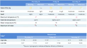
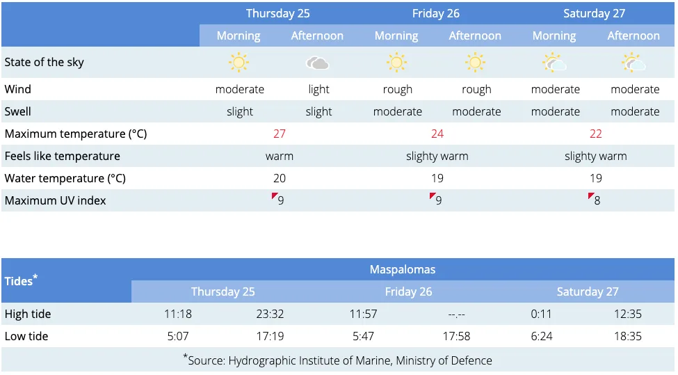
- Maspalomas Beach
-
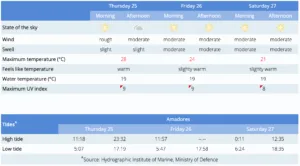
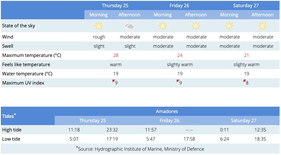
- Amadores Beach
Moderate southeasterly winds, with strong intervals, and occasionally very strong gusts, are expected on the summits and western slopes, though they should subside during the afternoon. By the end of the day, to the west a moderate northwesterly wind is expected.

At sea variable force 2 to 4 winds on Wednesday, mainly from the east and northeast, increased through the night to blow from the east and southeast by Thursday morning, likely to reach force 4 or 5. Swell increased during the night locally on the south coast and moving toward the northeast. Sea swell to the north is expected to reach around 1 metre.

Thursday is expected to remain relatively clear though the Calima will intensify during the afternoon and into the evening, significantly reducing visibility. Temperatures on the south west expected to remain above 28ºC in the shade until Friday. Moderate easterly and southeasterly winds, with strong intervals are expected along the west facing slopes (from Gáldar to Mogán) though decreasing through the day.
Friday will start with a little cloud, tending toward some drizzle in the southwest during the afternoon. Calima, is expected to be more dense during the early morning, significantly reducing visibility, but then should subside as the morning wears on. Temperatures will fall a little from Thrusday’s highs of more than 28ºC in the shade, particularly on the northwest. Moderate southwesterly winds will continue with strong intervals, more intensely felt on the southeast and northwest coasts during the middle of the day.

On Saturday cloudy skies with probable light rains will tend towards inland areas and on the mountains cloud bringing weak rains. Temperatures will stay similar to Friday’s or decrease slightly. Moderate winds from the west.
Sunday is looking cloudy with light to moderate rains inland, at the summits there is even the smallest possibility of some frosting at the very highest points, cloudy intervals with probable light rains elsewhere. Temperatures slightly decreasing. Breezes and moderate westerly winds expected.

By Monday as we start into next week the low pressure system that brought light weekend rain could be sustained over the Canary Islands if it doesn’t head north towards the Peninsula. So some mild instability to start the week on the Canary Islands, where rain to the north of the islands is still likely, although probably less intense than we are likely to have seen in the days preceding, with chance of small amounts of wet weather appearing elsewhere.