390 hectares affected. The perimeter is 13.5km long about 66% of which has been stabilised.
|
----- Google provide a way for you to
|
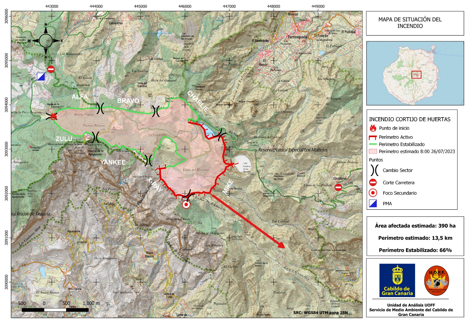 The fire is divided into sectors from head to tail, with their respective heads of sector and assigned units in:
👉 Left flank: 70% controlled
👉 Right flank: 80% controlled
👉 Head

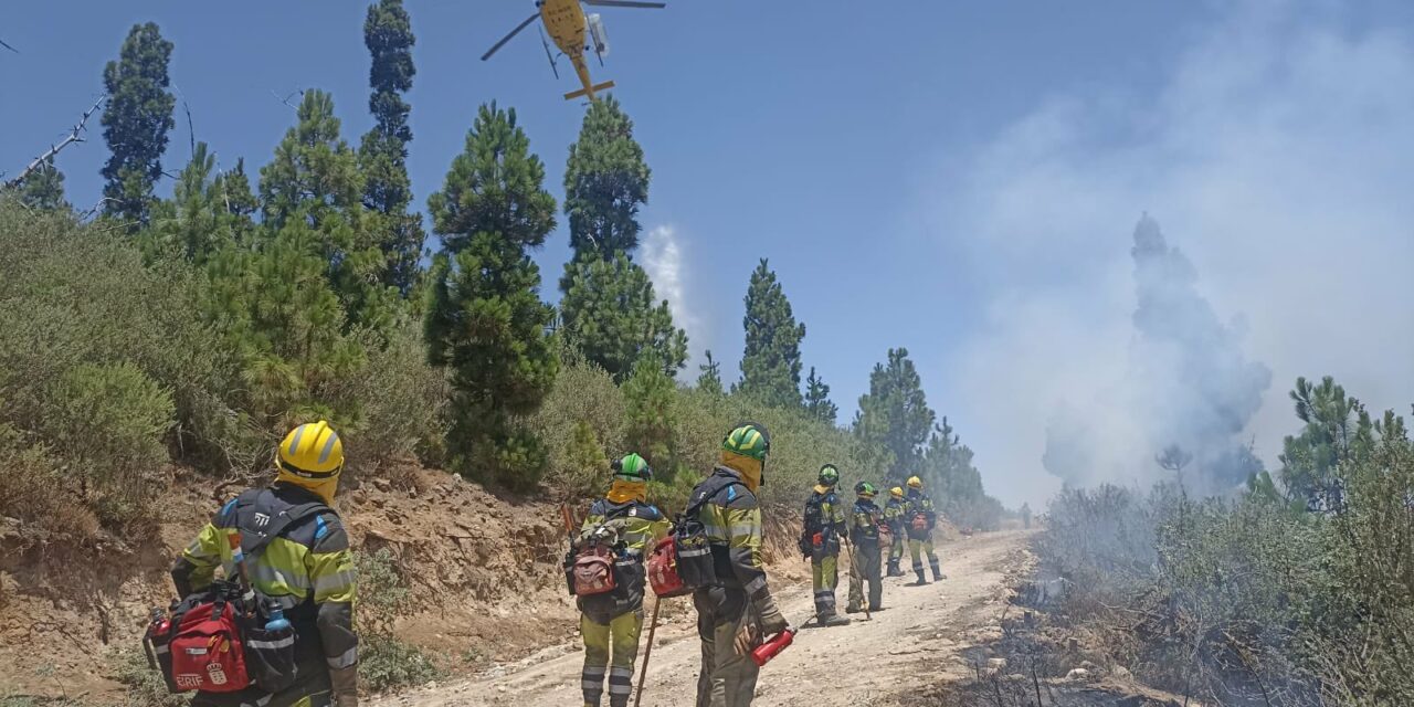
🔥 On the left flank with a head, the work last night has been concentrated, stopping the progression towards Valsequillo.
🔥 Containment work has been carried out at the head of the fire, so it has not evolved much. Anchoring manoeuvres are still being carried out there.
![]() The GC-600 (Cruz de Los Llanos-Llanos de La Pez has reopened. The GC-130 Cruz de Los Llanos-Cazadores, with its branches to Pico de Las Nieves, remains closed.
The GC-600 (Cruz de Los Llanos-Llanos de La Pez has reopened. The GC-130 Cruz de Los Llanos-Cazadores, with its branches to Pico de Las Nieves, remains closed.
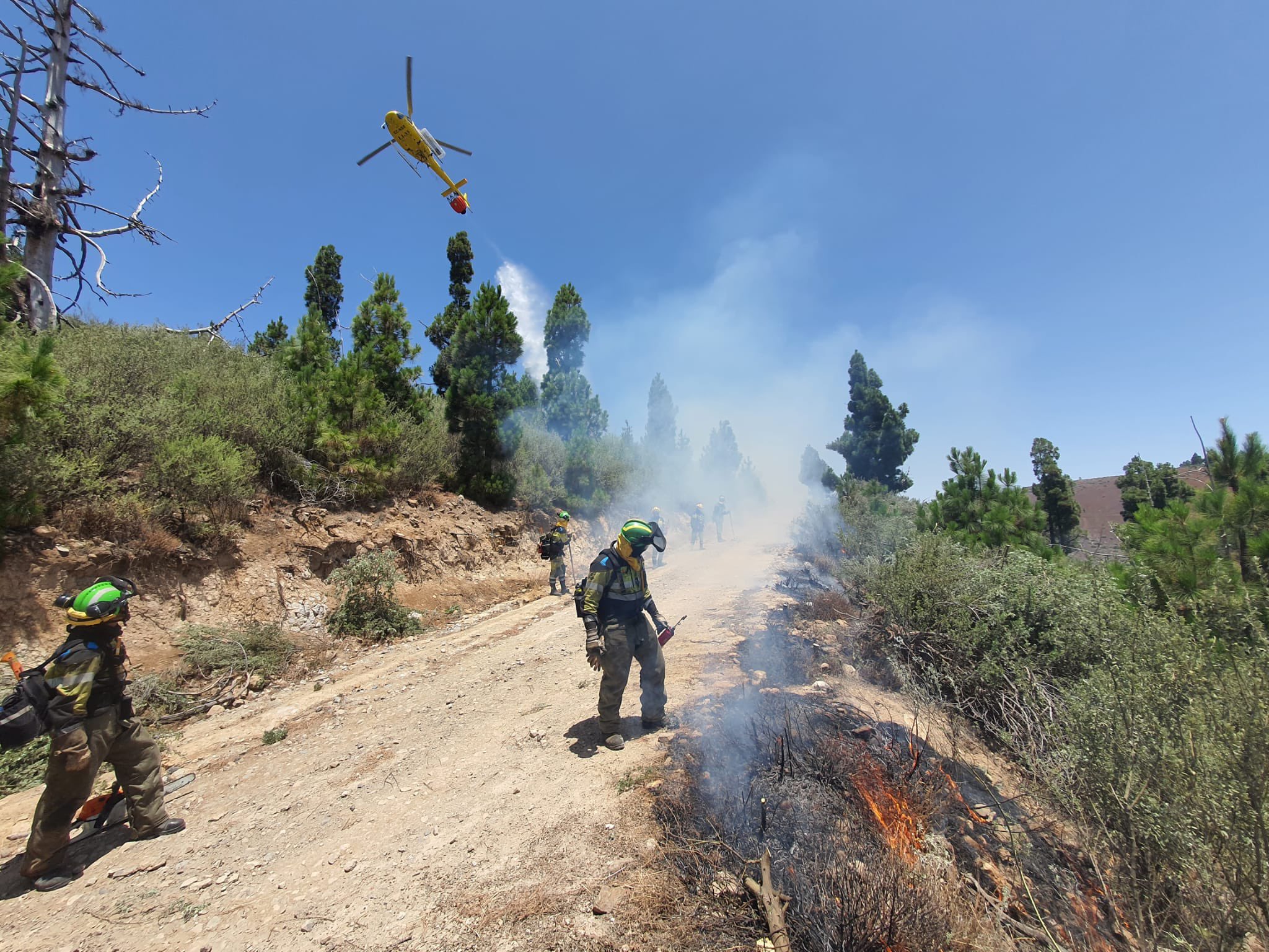
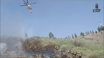
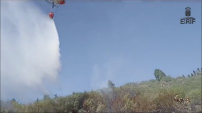
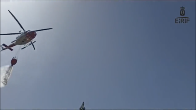
🔴 From 10 AM an #EIRIF coordinator together with teams from La Gomera and El Hierro, work in the area of the right flank of #IFTejeda towards the head of it, carrying out a control line in a dense scrub fuel model (model 4) supported by aerial means, and consolidating the perimeter.
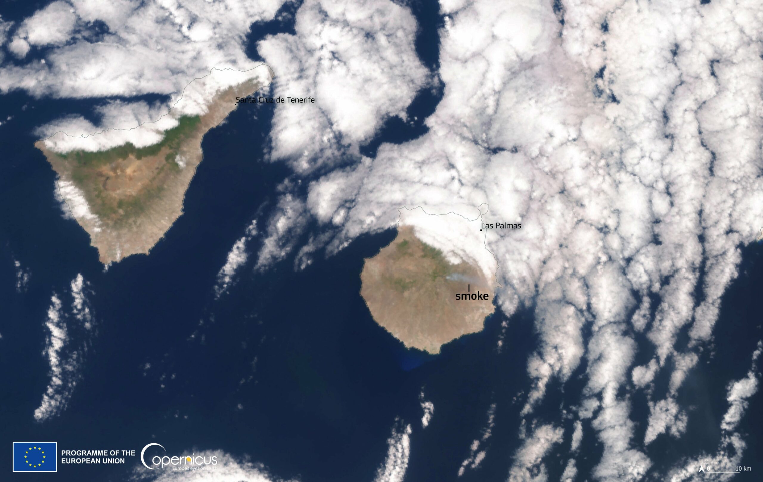
Copernicus monitoring #fires #incendios On Tuesday the wildfire dubbed #IFTejeda began on the island of #GranCanaria 🇮🇨🇪🇸 , advancing towards the highest point on the island, Pico de las Nieves, and forcing the evacuation of nearly 400 people at the summits, and affecting nearly 400 hectares of forest and scrublands. 👇#Copernicus #Sentinel3🇪🇺🛰️ captured the smoke from the fires in this image from today, July 26