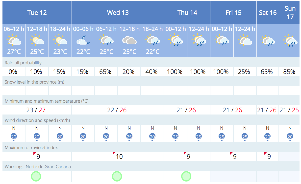
The weather outlook for the coming days on Gran Canaria suggests a predominance of cloud cover to the north, with light showers likely in the capital Las Palmas de Gran Canaria. The touristed beaches of south of the island will likely escape any wet weather, though there is always a chance at this time of year. The coastal waters around The Canary Islands have been unusually warm this year, which seems to have led to a few surprises for swimmers…


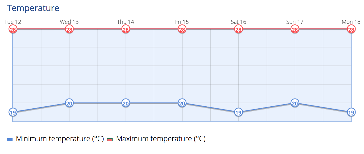
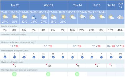
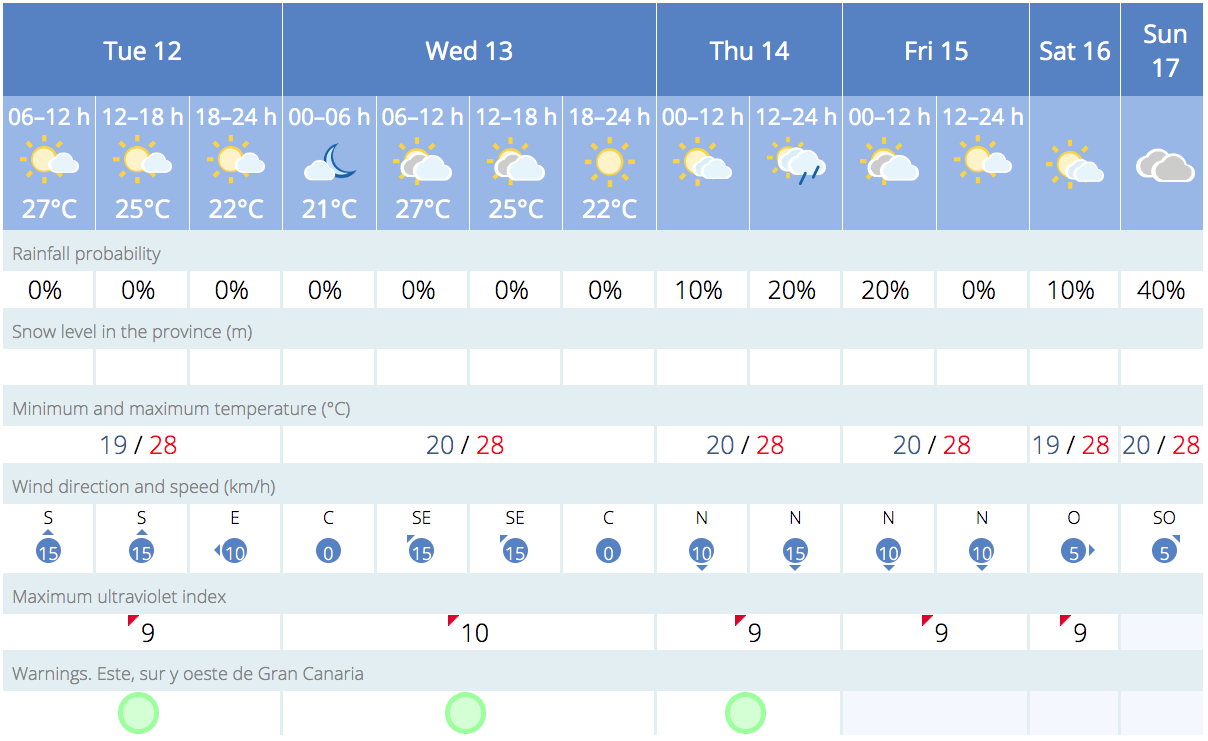
For Tuesday, the Spanish Meteorological Agency (AEMET) predicts occasional light rain mainly affecting the north and east slopes during the early morning and inland areas during the afternoon. The likelihood of rain is lower on the eastern islands of Lanzarote and Fuerteventura. Highs in the shade a fairly constant 28º all week, but much hotter in direct sunlight, with nighttime lows of around 19º-20ºC.
Moving into Wednesday and Thursday, the capital can expect continued showers, as can Tenerife, La Palma and El Hierro.
While there is some uncertainty, the weekend is expected to start with trade winds from the northeast, bringing partly cloudy skies and the possibility of light rains. Additionally, temperatures are expected to rise heading into Saturday and Sunday and the beginning of the following week.
-
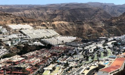
- Puerto Rico de Gran Canaria
-
- Las Palmas de Gran Canaria
It’s worth noting that the Canary Islands have been experiencing the impacts of a changing climate for several years, leading to phenomena such as increased calimas, record temperatures, prolonged heatwaves, and a scarcity of rainfall. Experts are concerned about the rising sea temperatures in the region, which could potentially support hurricanes of up to category 3.
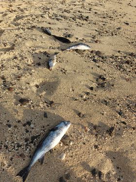
Dead Fish Off The Mogán Coast
Courtesy of Lukasz Szymanski
This last weekend dead fish were found all along the coasts of Mogán, washing up on tourist beaches from Puerto Rico to Amadores, Taurito and Playa de Mogán.
Although the local town hall has yet to offer any explanations for this, similar sightings have been occuring on the north of the island, in the captial Las Palmas.


Some suggested causes have ranged from suspicions that large amounts of untreated sewage being dumped just off the coast may lead to increased instances of microalgael blooms, which can affect some species of fish, particularly in the unusually high water temperatures this year, at some points during the summer water temperatures reached up to 24ºC, fully 5º higher than expected.
All of this has an effect on the marine eco system, and in this case it seems that one particular species of fish has been adversely affected, though the causes are far from clear, those in the know say that sewerage is unlikely to be the cause, in and of itself, though of course it may play a role.
Alex Bramwell from Gran Canaria Info says:
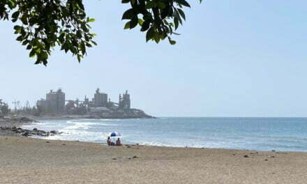
courtesy of Marta Kasprzyk
“These fish all appear to be Oceanic Puffers, they have been washing up on Las Canteras for weeks. They were very rare in these waters until around 2015 when shoals of them were spotted off the coast of El Hierro, and now it appears they have started to spawn around the archipelago.
Some of them appear to be suffering from some sort of parasite which suggests that they are not healthy. This year something has occurred which appears to only affect this species of fish, leading to the unusual situation of mass die offs in our waters.
Researchers are trying to figure it out.”

Ocean Temperatures and Hurricanes
Sea temperatures, on a larger scale, play a crucial role in the formation and development of storms and hurricanes in the Atlantic. These weather phenomena typically originate east of Cape Verde as tropical depressions and, as they move towards the Atlantic, they draw energy from warm waters. This often leads them to the Caribbean and occasionally causes devastation upon reaching the coasts, including the islands and the mainland of Florida in the United States.
 However, there has been a significant shift in the region. According to Dr. JJ González Alemán, a physicist and meteorologist, the displayed map represents the Maximum Potential Intensity, a measure quantifying the maximum energy a tropical cyclone could extract from the atmosphere and the ocean. In simpler terms, this measure indicates the maximum intensity a tropical cyclone could reach if it were to develop in the area. These unprecedented conditions have not been previously recorded in the region.
It’s important to note that even if a tropical cyclone were to form in this area, and conditions were favourable, such as low wind shear and a humid environment, it does not guarantee the actual formation of a category 3 hurricane in the region. It has just become more possible.
It should be remembered that in the last 150 years no major hurricane has ever made landfall in the archipelago, though there have been one or two near misses.


