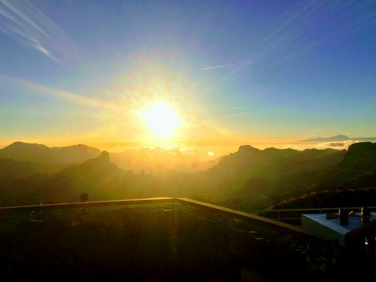
 The yellow advisory warning, for high temperatures, declared yesterday is expected to continue throughout Wednesday on Gran Canaria, with maximum highs in the shade expected to reach up to 34ºC at the island’s summits and in southern Gran Canaria, according to the Spanish State Meteorological Agency AEMET.
There will be some clouds at high altitude, with some intervals of low cloud on the north coast of the island during the early morning, with some probability of “calima” also bringing warm desert winds and dust to the island.
Temperatures will remain warm for the rest of the week, expected to reach the low to mid 30s, with lows of between 20-24ºC and winds primarily from the northeast.

 At sea there will be north or northeast winds of force 4 to 5, occasionally reaching ùp to force 6 to the west and southeast. Heavy swell with waves from the north of about one metre high. On the southwest coast, variable force 2 or 3 winds and “marejadilla” seas are expected, which is to say similar to storm surge, but without the large waves.

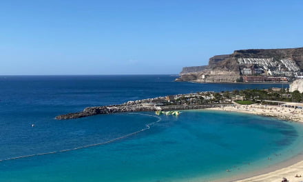
 Temperatures in Las Palmas de Gran Canaria it will range between 23º and 28º C while in Mogán temperatures will be a little higher, reaching up to 34ºC in the shade, gradually declining by one or two degrees as the week continues on.
All in all conditions should remain much as they were yesterday although perhaps with a small decrease in maximum temperatures especially at the Gran Canaria Summit. Therefore, fire warnings will remain active. No wet weather is expected.
Alert
The yellow warning was issued yesterday by the Government of the Canary Islands, due to an existing risk of forest fires, the alert situation is to be maintained throughout Wednesday, with all emergency and fire fighting resources on Gran Canaria on alert. Yesterday the emergency services had to respond quickly to a report at around 17.25 that turned out to be false. A report came in of a column of smoke having been sighted between Tamadaba and Tejeda, in the area known as Acusa Seca. Tejeda Firefighters immediately deployed to check the situation as did a helicopter from the Artenara base. However after repeated searches by land and air, they verified that there was no fire.
Temperatures were very high yesterday at the Summit with the potential for various fire-related incidents. In Tejeda, by two in the afternoon, temperature had reached 35ºC , with no wind and the sky completely clear. By around 19.20, some breeze had returned to the central rural area.
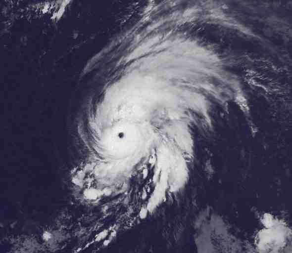
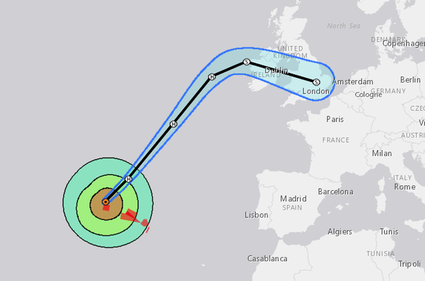
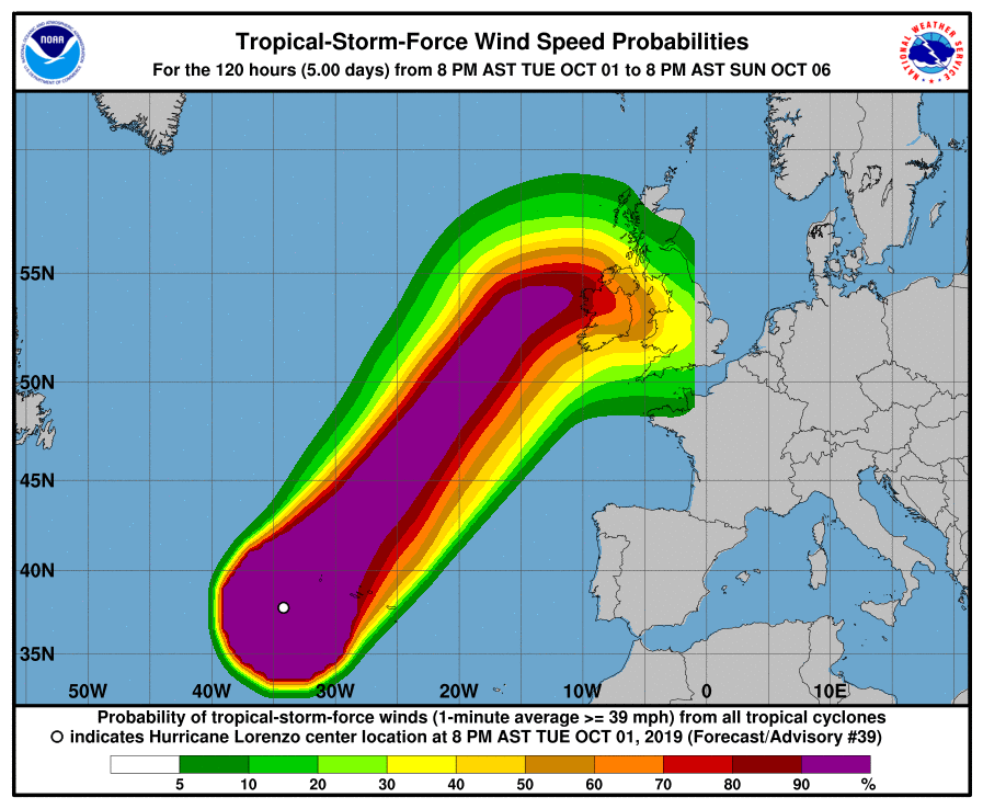
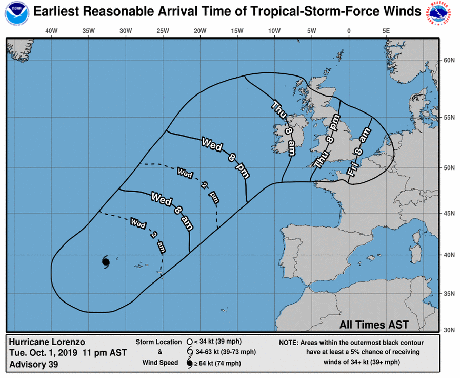
While Gran Canaria has been experiencing a heatwave, Hurricane Lorenzo, out in the north mid Atlantic has continued to weaken from a Category 5 storm. Today the storm system is expected to arrive in the Portuguese Azores Islands as a category 1 hurricane, according to Portugal’s climate service. Lorenzo looks set to pass near the western Azores with warnings focusing on the Flores, Corvo, Faial, Pico, San Jorge, Graciosa and Terceira islands. The forecast is that between tomorrow and Friday Lorenzo should reach the north of Europe, with some forecasts suggesting it may arrive in west Ireland by Thursday, with storm surges and heavy seas expected on the Peninsula.


